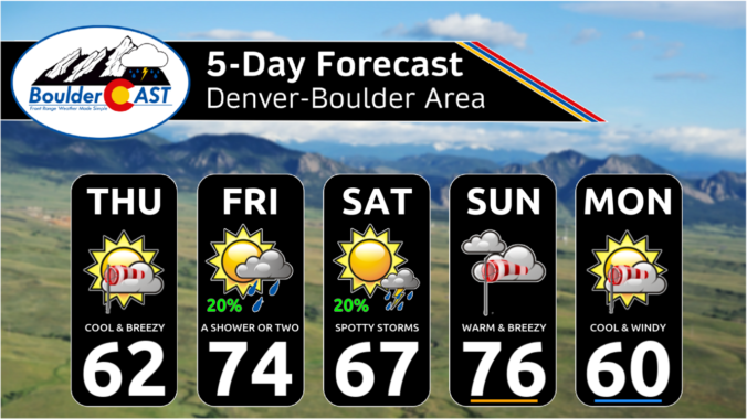
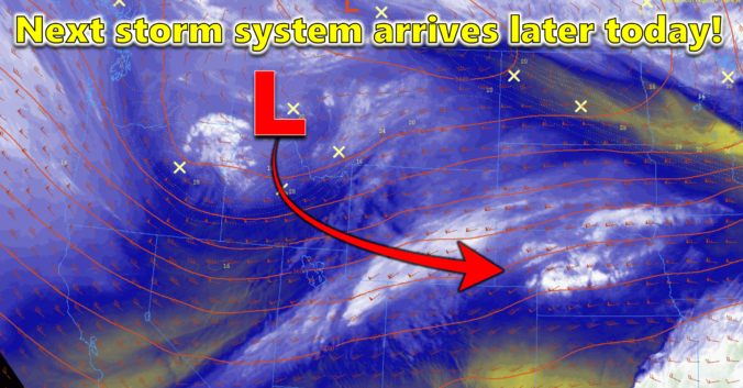
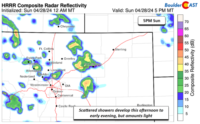
Ashortwave trough will penetrate eastward this evening to our north. Energy to the south of the axis will provide some forcing for ascent later this afternoon and evening across eastern Colorado. Accompanying the trough will be a surface cold front that will push through by early evening. Ahead of that, highs will reach the lower 70s, with some gusty WNW …
The extended forecast will remain unsettled for the Front Range as we head into the first weekend of May! The European ensemble 500mb height anomaly forecast animation below runs through Monday. In general, the theme for the next five days will be an active pattern across the West, but with all three storm systems in the mix passing north of …
Despite temperatures soaring comfortably into the lower 70s on Tuesday, the wind was sure feisty across the Front Range. Wind gusts of 30 to 50 MPH were frequent during the day across most of the area, with the strongest gusts in and near the Foothills. The NCAR Mesa (southwest of Boulder) reported dozens of gusts over 50 MPH, and at …
Aquick-moving shortwave disturbance is passing across Wyoming early this morning, with just a tad of energy trailing south into the Front Range. Skies are totally clear in the Metro area, but clouds and even a few snow showers are falling in the Mountains and Foothills to the west. Current radar shows where the fleeting precipitation echoes are this morning. A …
The rather unsettled weather we had yesterday with a mix of snow and mostly rain is long gone as the system pulls out and into the central/northern Plains. However, behind it, there is some tail-end energy sliding through later this afternoon and evening. As that comes across, steep mid-level lapse rates from the colder air aloft will spawn some scattered …
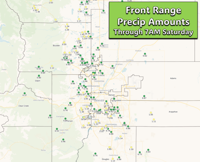
Showers and storms developed right on schedule Friday in the early evening hours, pummeling some areas with heavy rain, hail and lightning. Precipitation totals thus far generally range from 0.5" to 1.5" across the Front Range --- the higher of which were related to catching a thunderstorm or two with heavy rain Friday evening. A look at radar this morning …
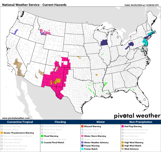
The first of two troughs will arrive to the Front Range this afternoon and evening with storm chances increasing alongside its arrival. This trough will bring bigtime fire, wind and blowing dust today to parts of southern Colorado and much of New Mexico (where I am currently located). Further north the Denver Metro area, though, the concern today will be …