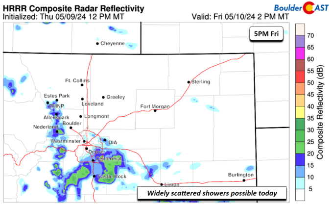
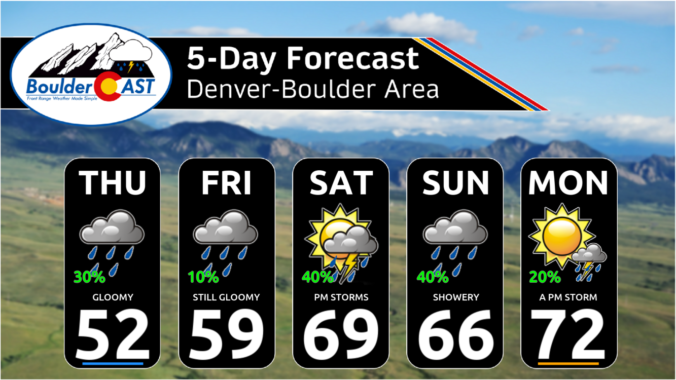
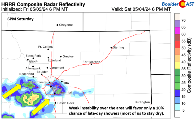
Aband of scattered showers and some embedded storms will develop later this afternoon and evening in response to a cutoff closed low that will move overtop the region into Sunday afternoon. Some weak instability will develop this afternoon and evening and fuel a few showers to produce some thunder/lightning, but we are not expecting any severe threat. The storm chance …
Achilly pattern will persist to end our work week. As you can see below, an area of low pressure continues to reside along the Utah/Arizona border. That spells out another day of light upslope flow on the Front Range and cool air advecting into the area. Along with the cool easterly flow, the atmosphere remains moist, with precipitable water anomalies …
Acomplex, though fairly weak, troughing pattern sits over the Rockies right now, including squarely across Colorado. This morning's GOES-East water vapor animation shows that the Front Range is still located south of the trough axis, evident by the fact we are still under southwest flow. Over the next several days, this trough won't move much, with a weak closed-low pressure …
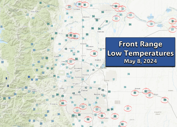
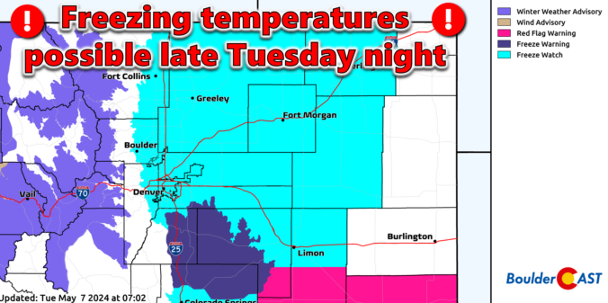
Fortunately models trended a tad warmer last night due to gusty winds sticking around through the night. As a result, the scary Freeze Watch was cancelled for the Metro area. Overnight temperatures have dropped into the 30s across most of the region (20s in the higher terrain), with some lower elevation spots (circled below) dropping to or under freezing. This isn't …
The broad upper-level low pressure has shifted northeastward over the last 24 hours, now sitting up across portions of South Dakota. After seeing significant wave cloud development yesterday and overnight, drier air has worked into the Front Range from the northwest leading to clearing skies. Winds aloft are still very strong however --- close to 80 MPH at mountain top …
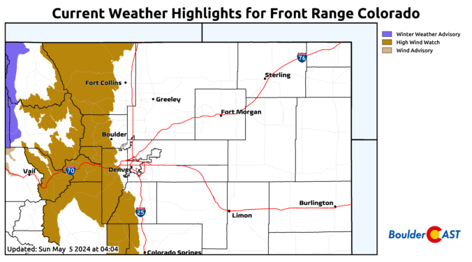
Astrong trough over Utah today will strengthen as it moves overhead this evening and overnight. Ahead of the trough, southerly flow will aid very warm temperatures in the upper 70s to low 80s, along with gusty downslope winds, especially tonight and into Monday morning. High Wind Watches are in effect for much of the Foothills and adjacent High Country with …
Ashortwave trough is rather large and present over the northwest part of California. This trough will bring broad southwest flow across the state. Embedded in the flow will be a few weak perturbations that will track from southwest to northeast across the region this early evening. The forcing will bring showers and some embedded thunder over the higher terrain. As …