After a hot and mostly dry Monday, the Front Range is in store for a wetter stretch midweek, with an uptick in monsoonal moisture and storm activity. A favorable upper-air pattern and midweek cold front will drive daily thunderstorm chances and potential flash flooding, especially Tuesday through Thursday. Conditions will trend hotter and drier into the weekend and next week, exacerbating the ongoing drought and fire risk in the High Country.
Category: Monsoon (Page 3 of 12)
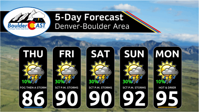
*Premium* This Weekend in Colorado Weather: Monsoon moisture keeps storm chances around as our temperatures inch upward
Monsoon season may have officially started earlier this month, but it’s off to a sluggish and lack-luster beginning across Colorado. Boulder has seen frequent storms—yet little meaningful rain—and wildfire smoke from the Western Slope and neighboring states is starting to pool to our west. A cold front arriving Tuesday night will bring cooler temps and a bump in thunderstorm chances for Wednesday, followed by a promising shift toward a more classic monsoonal setup Thursday through the weekend ahead with continued daily storms. This week, we’re tracking some heat, smoky haze, and hopefully, a few solid soakings of rain.
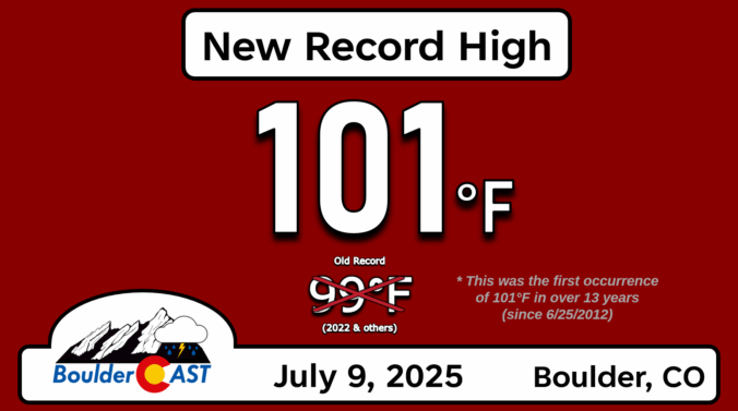
Forecast Update: Boulder hit 101° for the first time in 13 years yesterday, but (somewhat) cooler air and storms are moving in!
Wednesday brought historic heat across the Front Range, with Boulder hitting a record high of 101°F—the city’s hottest day in over a decade. A weak cold front has since cooled things off slightly, ushering in a good chance of storms the next few days as well. Sunday into Monday turn drier and hotter again as reverse monsoonal flow sets up, potentially stifling our typical summer storm pattern for a bit.
It’s going to be a scorcher across the Front Range this week—with temperatures climbing fast and flirting with triple digits by midweek. But just as the heat peaks, a pattern shift arrives that will bring cooler weather and a chance of storms again by Friday. Read on for all our full outlook of the weather week ahead.

Colorado Forecast Update: Hot with continued low-end chances for storms through the Fourth of July Weekend
A shifting weather pattern is on the way as we head into the holiday weekend along the Front Range. Thursday will bring the heat and mostly dry skies, but things could get a bit more unsettled as we head into the Fourth of July and the weekend. If you’ve got outdoor plans in the coming days, here’s what to keep an eye on.
Monsoon season kicks off right on time this week, bringing a steady stream of moisture from Mexico into the Southwest and central Rockies. While daily storm chances are on tap for the Front Range, coverage looks hit-or-miss, with Wednesday shaping up to be the warmest and driest day. Expect highs ranging from the 70s to mid-90s as the pattern evolves. We also need to keep an eye on the forecast heading into Fourth of July weekend as scattered storms will be in the mix.
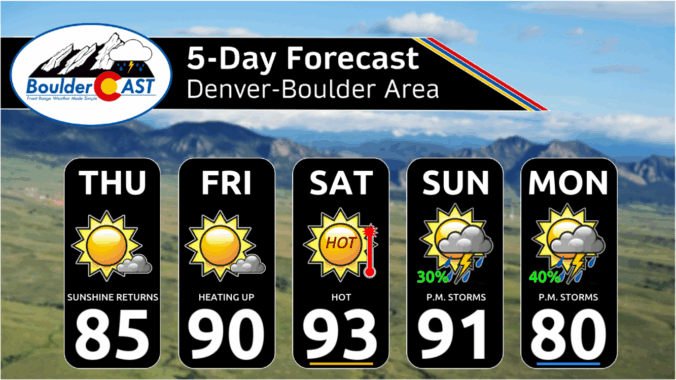
*Premium* This Weekend in Colorado Weather: A few hot & dry days before monsoon moisture begins to flow
© 2026 Front Range Weather, LLC

