After a definitively wet November in the Front Range, Mother Nature did a complete one-eighty with December landing one of the warmest and least snowy on record in many locations, topped off with our first rainy Christmas in 82 years! Here’s a quick and colorful graphical recap of our weather during December and how it relates to climatology.
Category: Forecasting 101 (Page 1 of 2)
January is typically our driest month of the year, but in 2025 it’s been anything but as another round of fluffy snow dumped on the Front Range Friday night into Saturday. We briefly review both the snow totals from this single storm and the seasonal ones.

*Premium* BoulderCAST Daily – Thu 01/01/25| A cool & sunny start to 2025, plus a look at last night’s rogue snow shower and viewable Northern Lights
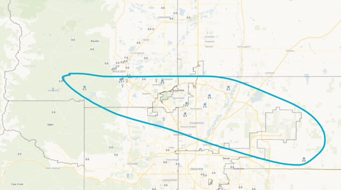
A short-lived period of light to moderate snowfall accompanied the passage of a quick-moving shortwave disturbance Monday evening, mostly impacting the southern and western Metro area. We briefly review the snowfall totals across the region.
Hint: All of the clues are related to Boulder, Denver, and/or Colorado weather. OK, well most of the clues…
This week’s weather quiz topic was snowfall forecasting. Read on for some background information, the quiz results, and a deep dive into the answer. Continue reading
Even with thick high-level clouds overhead, yesterday saw “Fair” weather conditions reported across the Metro area, but what does this actually mean? As it turns out, “Fair” weather can signify a lot of things, with one critical caveat.
We often include at least some discussion in our wintry forecasts about snow-to-liquid ratios. In this post, we explain what they are, why they matter, and examine the historical snow ratio record for Front Range Colorado.
© 2026 Front Range Weather, LLC


