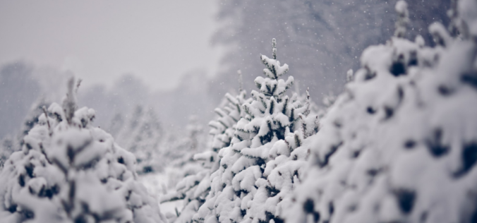
Are you tired of the warm and sunny spring weather? If so…you’re in luck! We’re seeing strong indication from all the weather models that winter will return in a hurry this weekend with very good chances of snow Saturday night through Sunday alongside near-record cold temperatures lingering into the upcoming week. Here’s our initial thoughts.
Category: Forecast (Page 95 of 169)
Temperatures 10 to 15 degrees above average will be the norm to start the first full week of April. Beyond this, we’re watching for a cool-down come Wednesday, along with a chance of unsettled weather for Thursday. A gradual chillier pattern looks to develop for the upcoming weekend.
Don’t be fooled by the warm temperatures Wednesday afternoon! A rapid transition back to winter-like conditions will begin Wednesday evening capped off with another round of light snow following on Thursday. In this forecast update, we discuss the BIG changes that will bring the coldest airmass since mid-February into the Denver Metro area and the expected snowfall amounts for the region.
PREMIUM STORM UPDATE (8:00 AM Thu 04/02/20): We do a quick check on how the overall forecast looks this morning as freezing drizzle falls across the area and bitter cold temperatures settled into the Front Range. Click HERE to read.
A wide range of weather and temperatures are expected this week as spring and winter continue to mingle. We’ll warm-up nicely through Wednesday into the 60’s, but another round of snowfall is taking aim on the Front Range for Thursday.
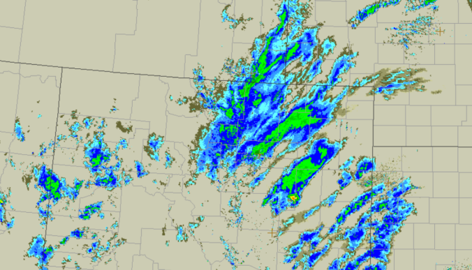
From freezing drizzle, to fog and rain, to thundersnow and blizzard conditions, Friday’s storm system had it all across northeast Colorado! Or did it? As expected, its quick progression and lack of cold air ultimately left us with rather unimpressive snow totals. We take a quick look back at how Friday’s winter event played out across the Denver Metro area.

Another late-week system will impact much of Colorado Friday morning through Friday night with light rain turning to snow across the Metro area. With an unfavorable track and limited cold air, snow accumulations will be minimal. We take a look at when the rain will arrive, when it will change to snow, and expected snowfall amounts.

Temperatures will be on the uptick over the next couple days, after which a downward trend takes over toward the latter part of the week. There are also hints of a late week rain and snow event. We’ll detail all of this and more in our week ahead.

Live View of Boulder

Current Conditions

Live Radar

Latest Smoke Forecast

Recent Premium Posts

This Weekend in Colorado Weather: Several More Scorching Days Ahead Before the Long‑Awaited Monsoon Pattern Arrives
☀️ Persistent heat continues — Low to mid‑90s through Saturday, spiking towards the …
BoulderCAST Daily – Wed 07/15/26 | The Ridge Rules the Rockies as Hot, Dry Pattern Holds Firm
🔥 Heat dome setup continues — A strong, stationary 500 mb ridge keeps …
BoulderCAST Daily – Tue 07/14/26 | The Front Range Continues to Bake Under Expansive Ridge
🔥 Heat streak continues — Boulder hit 97°F for the third time in …
3-Day Forecast

Trending Content

© 2026 Front Range Weather, LLC