
After a gorgeous weekend with temperatures across the Plains in the upper 50’s and lower 60’s, the week starts off rather uneventful with conditions similar to yesterday. However, things will be changing, mainly in the department of gusty downslope winds several days this week. This spells out continued above normal temperatures for the Plains, but upslope flow and snowfall for the High Country. Read on for our full weekly outlook of what to expect.
Category: Forecast (Page 144 of 169)
By the pace of the traffic tonight, many folks are not aware of the surrounding danger from freezing fog and mist that has already begun across much of the region. We give our thoughts on what is now our second ice event in the last seven days.
We begin the week under the protective influence of a mid-level ridge of high pressure. With this, the Front Range will be (mostly) dry and at times very warm through the week. Read on for our short and to-the-point weekly outlook.

2017 got off to a quick start with multiple snow storms dumping on parts of northeast Colorado and the Mountains. However, we’re seeing strong indication in the models that things are about to quiet down significantly for the foreseeable future.
As one would expect during the month of January, our driest month of the year, this week will be relatively quiet across the Front Range. We’re tracking continued Mountain snowfall early in the week, and with a large trough moving in, cooler temperatures will linger statewide through the weekend. Continue reading for our complete weekly outlook.
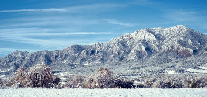
Snow that fell Sunday night into Monday continues to melt as warmer temperatures have taken hold the last few days across the Front Range. We review the totals from the event earlier in the week, check in on our Mountain snowpack, and detail what’s on-tap for Thursday night as another chance of snow arrives.
We start this week on the cold and snowy side with an area of low pressure off to our east in Kansas. However, a welcomed ridge of high pressure will take over through much of the remainder of the week and lead to a really nice warm-up. We’re also tracking the potential for a more active weather pattern towards the weekend. Read on for all the details of the weather week ahead.
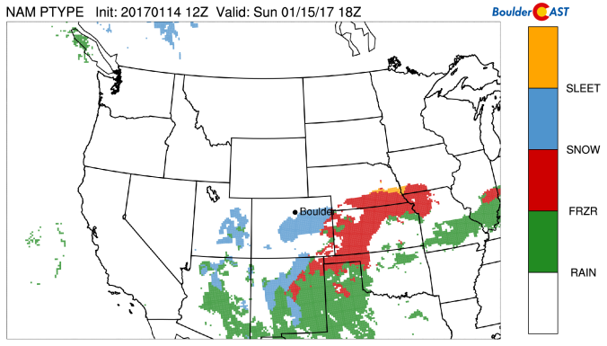
A storm currently located over the Baja Peninsula in Mexico will swing northeast during the day Sunday. Though the system’s track doesn’t exactly favor the Denver Metro area, some wintry weather will be possible Sunday into Monday. Read on for how much snow to expect and when it will fall.

Live View of Boulder

Current Conditions

Live Radar

Latest Smoke Forecast

Recent Premium Posts

BoulderCAST Daily – Sat 07/18/26 | Heat Advisory Issued Sunday and Monday for the Front Range
🥵 Heat Advisory Issued — Sunday through Monday for upper 90s to low …
BoulderCAST Daily – Fri 07/17/26 | Hot and dry continues through the weekend
🥵 Heat tightens its grip this weekend — Ridge strengthens slightly over the …
This Weekend in Colorado Weather: Several More Scorching Days Ahead Before the Long‑Awaited Monsoon Pattern Arrives
☀️ Persistent heat continues — Low to mid‑90s through Saturday, spiking towards the …
3-Day Forecast

Trending Content

© 2026 Front Range Weather, LLC