This content requires a subscription to BoulderCAST Premium.
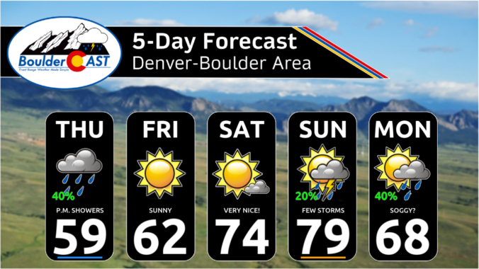
After a solid dump of springtime snow Sunday night, including widespread thundersnow, things will turn quiet for the week ahead with temperatures trending from downright chilly back to t-shirt weather by week’s end. We recap last night’s snowstorm, check the snowfall totals, and detail the Front Range forecast for the next seven days. Let’s dive in!
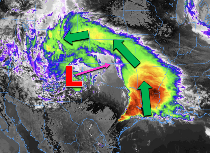
After a lengthy stretch of relatively quiet weather this past week as we officially transitioned from winter to spring, things are set to change on Sunday as a quick-moving storm system races into Colorado from the west with rain, hail, and thunder Sunday afternoon transitioning to heavy snow by Sunday evening. Several inches of accumulation will be possible with this storm, favoring the Palmer Divide and southern Foothills, but for the most part it’s moving too quickly to generate significant snow in our area. Winds will gust upwards of 45 MPH at times Sunday evening and night creating brief near-blizzard conditions in some locations. Read on as we discuss the latest forecast details, timing, and our projected snowfall amounts.
UPDATE (Sun 3/24/2024 8AM): Snowfall amounts were adjusted upwards an inch or two in some areas. Check our updated snowfall forecast map near the end of the post. Otherwise, the going forecast looks fine with afternoon thunderstorms quickly changing to snow after 6PM. Snow could be very heavy at times Sunday evening with 2″/hr snowfall rates. Gusty winds will create blowing snow and reduced visibility as well. Snow is still expected to end late Sunday night after midnight.
A quiet week is expected across the beautiful state of Colorado! The low pressure system which brought feet of snow to the Front Range just a few days ago will slowly begin to vacate the Desert Southwest in the coming days. The weakened storm will be shunted to our south by a ridge advancing into the area from the northwest. This ridge will slide east through the week, keeping our temperatures mild and our weather dry. We are watching a few backdoor cold fronts mid to late-week but we should still remain dry and fairly mild in spite of their passages. Read on for more details.
As promised, a well-advertised spring-like snowstorm delivered the goods to (almost) the entire Front Range this week with over four feet of snow falling in the Foothills and up to 2 feet across the lower elevations. We take a look back at this odd, moisture-infused winter storm, discussing how the difficult forecast evolved during the lead up and ultimately how much rain and snow pummeled the area.
After a round of rain and thunderstorms Wednesday, everyone changed over to heavy snow Wednesday night with a dense blanket of sludge now covering the entire area as of Thursday morning. Though there will be a slight lull in the action for a few hours here, moderate to heavy snow is expected to redevelop soon with snow continuing non-stop into Friday morning. We are only now at approximately the halfway point of the storm. We take a look at how much snow has fallen already and discuss how much more is still to come!
The overarching forecast remains on-track this morning as a significant and highly impactful snowstorm bears down on the Front Range. We review a wide gamut of the most recent model data, with trends suggesting a boom scenario is more likely than a bust. Travel will become extremely difficult (and in some areas of the Foothills, impossible) Wednesday night into Thursday night, with some power outages expected. We give our final thoughts on the impressive winter storm about to slam the Denver Metro area. Buckle up and stay safe!
© 2024 Front Range Weather, LLC