After weeks of spring-like warmth and quiet skies, the atmosphere is finally showing signs of waking up in the West. While drought continues to tighten its grip and Colorado’s snowpack sits at historic lows, things are beginning to stir, subtly at first, but with hints of something more promising on the horizon. This week brings our warmest day yet with Monday approaching 70 degrees, then a quick cooldown Tuesday, and finally the return of Mountain snow midweek courtesy of a weak atmospheric river. It’s not the pattern shift we need just yet, but it’s the most active stretch we’ve seen in a while… and it may be the first step toward rebuilding what winter has failed to deliver so far in the High Country. Let’s dig in.
Category: Forecast (Page 1 of 164)
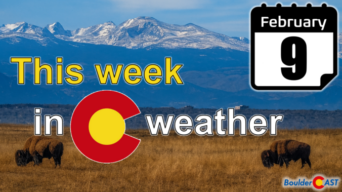
February isn’t wasting any time showing us who’s in charge along the Front Range—and spoiler alert, it’s not winter. As we roll into Groundhog Day and beyond, the pattern overhead keeps leaning warm, quiet, and stubbornly snow‑stingy. A weak system will try to shake things up Tuesday night, but the bigger story is how quickly we bounce back into springlike warmth and how the broader West continues to miss out on meaningful moisture. If you’re wondering where the real winter weather is hiding, or if Colorado has any chance of breaking its dry streak, read on for all the details.
A fleeting brush with winter may have swept across the Front Range this past weekend, but the atmosphere isn’t planning to stick with the theme for long. That sharp Arctic plunge—while refreshing for snow lovers—was more of a brief interruption than a true turning point. A closer look at the pattern ahead shows Colorado snapping right back into its now‑familiar routine of warm afternoons, bone‑dry air, and a statewide snowpack sitting at record‑low levels. Winter may have knocked on the door, but it certainly isn’t moving in.
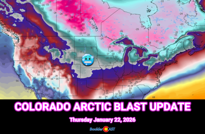
This weekend’s forecast looks nothing like the mild stretch we’ve been coasting through so far in 2026. A sharp pattern shake‑up is finally knocking on eastern Colorado’s door. An Arctic airmass is set to spill into the Front Range Thursday night, bringing the coldest temperatures of the season and eventually a round of light, fluffy snow. We break down the timing, impacts, and just how low those temperatures will go—plus why the rest of the country is gearing up for a far bigger and historic winter storm.
A quick round of overnight snow is already over and done with in the area as of Monday morning, but it’s just the opening act in a busy week of weather across the Front Range. Several cold fronts are lined up to keep temperatures bouncing around, including a late‑week Arctic surge that could deliver the coldest air of the season and a chance for additional snow. Read on as we break down the timing of at least three different cold fronts, the associated wind and fire‑weather concerns, and what to expect as that Arctic air barrels in later this week.
A stubborn weather pattern is settling in this week, and Colorado finds itself right in the middle of the action—or the lack of it. While the coasts deal with weather extremes, the Front Range gets a quieter blend of mild spells, a couple of cold fronts, and just enough uncertainty to keep things interesting. Read on for our full outlook of the next seven days to see if this translates into meaningful moisture or just more dry January days.

A tandem of low pressure systems — one warm and moisture‑rich, the other colder and more dynamic — teamed up just enough to deliver a surprisingly efficient burst of snowfall across the Front Range to end the week. We break down how this two‑part event unfolded, why the timing mattered so much, and where our forecast over‑ and under‑performed. Continue reading
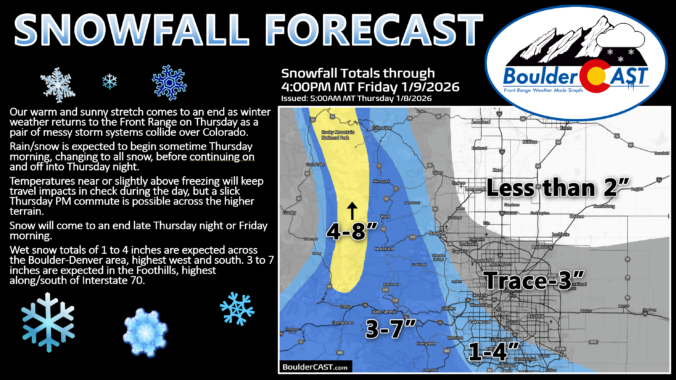
Winter is about to make a move again along the Front Range for the first time in 2026. After one last mild day Wednesday, a pair of storm systems will team up to bring moisture, colder air, and a decent shot at accumulating snow to finish the week. The setup is a little tricky, the timing isn’t perfect, and the details are still fuzzy due to some uncertainty—but there’s plenty to be hopeful for as this event plays out Thursday into Friday. We discuss the broader setup, how things may unfold and where the biggest impacts could land alongside heavy wet snow.
Update (Thu 1/8/26 5AM): Lower end scenarios now appear more likely with this tricky pair of storm systems not phasing together well. Based on latest guidance, we have reduced snow amounts by 1 or 2 inches across the board. Snow map and discussion of amounts are updated. Timing looks fine with rain/snow developing Thursday morning, snow on-and-off during the day into the evening, and snow coming to an end Thursday night or early Friday.

Live View of Boulder

Current Conditions

Live Radar

Recent Premium Posts

BoulderCAST Daily – Tue 02/10/26 | Much cooler for our Tuesday with rain/snow arriving into the Mountains by Wednesday morning
🌡️ After Monday’s 70° warmth, a late‑night cold front has brought an end …
BoulderCAST Daily – Sun 02/08/26 | Mild for Super Bowl Sunday
☀️ Mild through Monday: Highs in the mid 60s to low 70s through …
BoulderCAST Daily – Sat 02/07/26 | A few wave clouds today but still quite mild
☀️ Mild through the weekend: Highs in the mid 60s to low 70s …
3-Day Forecast

Trending Content

© 2026 Front Range Weather, LLC