


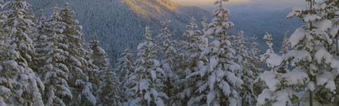
How is it even possible to snow this early in the season? What are we thinking for snowfall amounts for the early-season snowstorm bearing down on the Front Range? What could go wrong with the storm? Listen to find out!
Category: Fire Weather (Page 32 of 38)
The week will begin with near-record high temperatures continuing across the Front Range. However, we will see a gradual downward trend in temperatures thanks to increased clouds and scattered storms over the state. We are also tracking a few cold fronts on the horizon that look to finally breakdown that persistent ridge leading to much cooler temperatures next week.

The never-ending heat is back for another encore performance this week. Slight chances for rain will exist, but overall we’re in for another mainly dry week with scorching temperatures. Mid-level winds will usher in more smoke across the area as well. Read on for all the details.
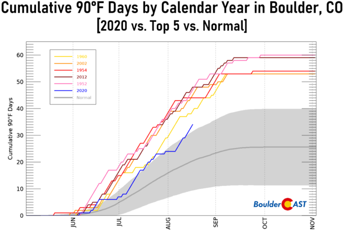
Tired of hearing about the 90’s? Too bad! Let’s talk a little bit about the summer’s heat so far in Boulder.

We continue the cool, monsoonal stretch with 80’s for the majority of the week. We are watching a weak system to affect northeast Colorado through Thursday, bringing our best chance of storms on Tuesday. Will the 90’s rear their ugly head for the first weekend in August? We discuss this and more in our weekly outlook.

Colorado Monsoon Update: Southern portion of the state in severe drought, the monsoon may be delayed
Have you noticed the drop in visibility across the Front Range over the last few weeks? This haziness is actually smoke from a handful of wildfires burning hundreds of miles to our southwest. This may only be a taste of things to come later this summer as parts of southern Colorado and the Intermountain West have recently shifted into the penultimate drought classification. We provide an update on the hydrological situation and explain why we believe the monsoon will arrive late to Colorado this summer.

The heat continues this week with lower to middle 90’s through Wednesday under warm southwest flow. This pattern will also favor the threat of wildfires across Colorado. Our chance of storms does not really materialize until the latter part of the week, accompanied by a cold front followed by northwest flow. Read on more to find out the full week ahead details.
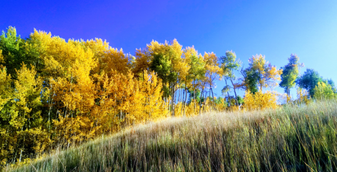
The week begins warm and sunny, but don’t be fooled as an autumn cold front is looming. Our coldest day in more than four months is developing for Tuesday alongside low clouds and drizzle. However, the end of the week will see above normal temperatures return.

Live View of Boulder

Current Conditions

Live Radar

Latest Smoke Forecast

Recent Premium Posts

This Weekend in Colorado Weather: Storm Chances Shrink While Heat Surges Into the Weekend
🌧️ Monsoon finally delivered Wednesday: Boulder and Denver both snagged a bout of …
BoulderCAST Daily – Wed 08/26/26 | Front Range Braces for a Few Severe Storms with Large Hail Today
🌩️ Severe storms possible — We’re still looking at scattered thunderstorms developing later …
BoulderCAST Daily – Tue 08/25/26 | Cooler with More Run-of-the-Mill Storms Today, But Big Hail Could Be an Issue Tomorrow
🌤️ Monsoon flow persists under a record-strong New Mexico ridge, keeping moisture aimed …
3-Day Forecast

Trending Content



© 2026 Front Range Weather, LLC