Category: BoulderCAST Daily (Page 93 of 465)

This page contains an index of our BoulderCAST Daily forecast updates. If you are NOT a Premium member, you will only see a tiny sample of this content below. Subscribe to BoulderCAST Premium to gain access to all of our daily forecasts which get published every morning.
Premium BoulderCAST Daily – Sat 08/31/24 | Warming up today for the start of the Labor Day weekend

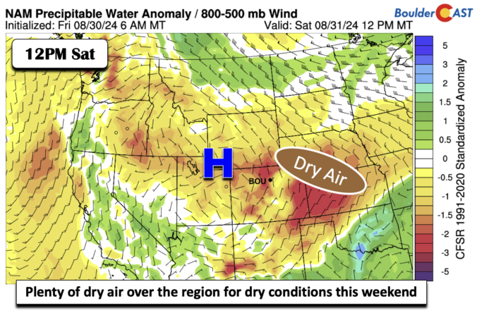
The Labor Day weekend starts off on the warm side with highs this afternoon in the upper 80s to lower 90s across the Denver Metro. Anomalously warm temperatures will extend from Colorado into the Pacific Northwest, as seen below from the GFS forecast. In addition, dry air will be in place across much of the intermountain West. This will favor …

Premium BoulderCAST Daily – Fri 08/30/24 | A quiet end to the week with middle 80s

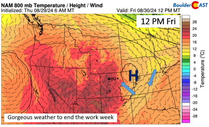
The week ends on a great note! High temperatures this afternoon will be nearly spot on with over average high for August 30th. Today's average high in Boulder is 85 degrees. The afternoon highs today will be within a degree or so of this. High pressure today will be over eastern Colorado and western Kansas. This is a cooler surface …

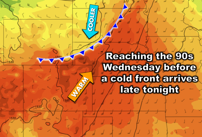
Premium BoulderCAST Daily – Wed 08/28/24 | A quick trip into the 90s before a weak cold front arrives tonight

Today will be the hottest day of the week as Colorado resides within an increasingly warm airmass under weak southwest flow aloft. Similar to the atmospheric setup we had on Monday, a potent closed-low pressure system resides to our north today along the Canadian Border. It won't draw any closer than northern Montana to us, so its broader influence on …

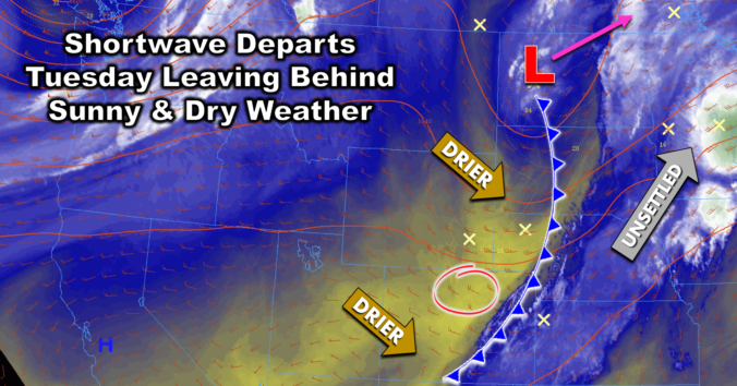
Premium BoulderCAST Daily – Tue 08/27/24 | A long dry stretch lies ahead for the Front Range beginning today with sunny skies & seasonal temperatures

Yesterday's shortwave disturbance, the one which brought overcast skies and a few raindrops to the Denver Metro area, has kicked off into the Dakotas overnight. As it exited, drier air has swept across Colorado from the northwest, beginning around 5PM yesterday for the Boulder area. This dry air will be in place today leading to a beautiful Tuesday for us …

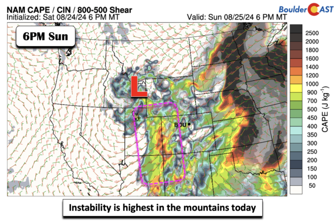
Premium BoulderCAST Daily – Sun 08/25/24 | Instability is greatest in the High Country, where storms will be more numerous

The instability axis today will be greatest across western sections of Colorado and over the High Country, as noted in the image below (box region). Even though the moist flow will be anomalous once again, it appears chances of storms today will be less on the Plains. Not that yesterday was all that wet, either, but it looks spotty again …

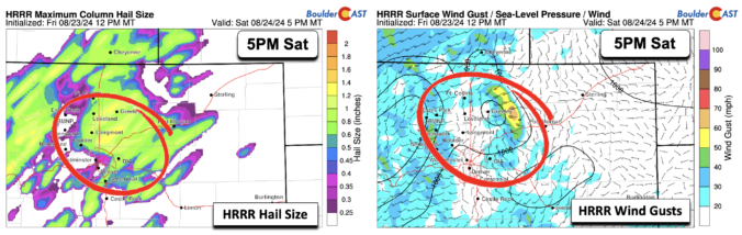
Premium BoulderCAST Daily – Sat 08/24/24 | Storms return with a risk of damaging winds and hail

The moist flow will become more favorable today and tonight. High pressure will be situated over Oklahoma and Texas, while a trough positions itself across the western United States. As a result, we'll see a more south-southwesterly flow, a tad more backed than Friday. As a result of that flow, we'll see storms initially firing over the southwest and south-central …

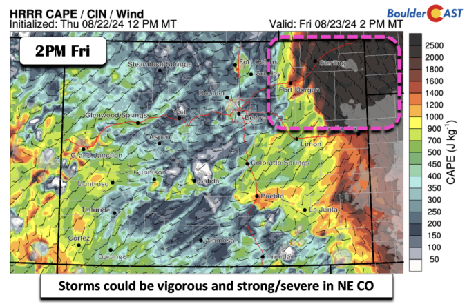
Premium BoulderCAST Daily – Fri 08/23/24 | Storms still in the forecast, but appearing more isolated today

The moist flow will continue today at mid-levels, with the ridge of high pressure to our southeast and a trough to our northwest. However, although storms are in the forecast again today, coverage and overall chances are more isolated and lessened than what we had on Thursday. One reason for that is the mid-level flow is ever so slightly out …

« Older posts Newer posts »