Category: BoulderCAST Daily (Page 91 of 465)

This page contains an index of our BoulderCAST Daily forecast updates. If you are NOT a Premium member, you will only see a tiny sample of this content below. Subscribe to BoulderCAST Premium to gain access to all of our daily forecasts which get published every morning.
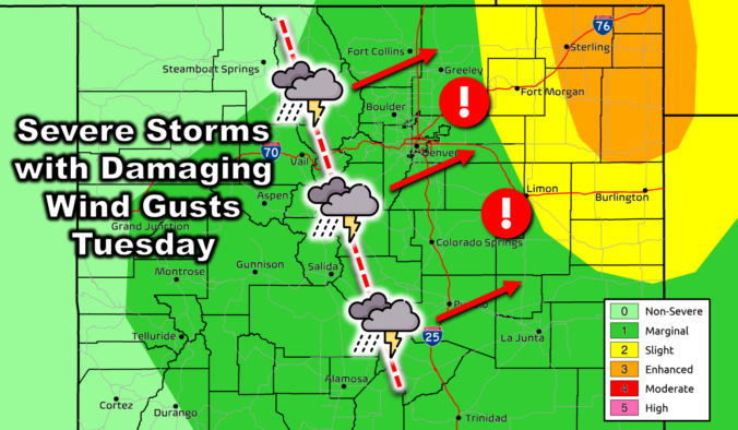
Premium BoulderCAST Daily – Tue 09/17/24 | Watch out for a line of strong to severe thunderstorms coming off the terrain this afternoon!

Today will be the most active and wettest day of the work-week across the Front Range, with the primary concern being a line of severe thunderstorms expected to blow through the entire area this afternoon. As of writing Tuesday morning, the potent closed-low pressure is located in northern Nevada. Over the next 24 hours, this system will scurry northeastward towards …

Premium BoulderCAST Daily – Sun 09/15/24 | Slight shot of storms and the tropics are active again

Amid-level impulse will track overhead this afternoon and evening to bring isolated showers and storms over the mountains and Plains. There is only one problem: instability is lacking. As indicated below, the instability plume is east of the Denver Metro area, and maximizes over far east Colorado into Nebraska and Kansas. As such, even with added moisture today, coverage of …

Premium BoulderCAST Daily – Sat 09/14/24 | Warming back up well above average

High pressure ridging will build east today, centered over the panhandle of Texas. Westerly flow aloft will persist as it did yesterday. That will again spell out a dry day. Temperature anomalies will start to trend well above average again after our short reprieve yesterday in the lower 80s in most locales. Today, high temperatures will get into the upper …

Premium BoulderCAST Daily – Fri 09/13/24 | Cooling off slightly with smoke in the air

Yesterday's mid-level trough has pushed into far northeast Montana and Wyoming. As a result, the trough axis has largely pushed through much of Colorado. Southwesterly flow persists, however, over the state, favoring continued downslope flow aloft. At the surface, the trough has brought a cold front through the eastern part of the state. Gusty winds from yesterday are long gone, …

Premium This Weekend in Colorado Weather: Critical fire conditions, record heat, and none of the rain we desperately need

As we've been discussing all week long, today will be hot, dry and breezy --- three weather conditions that when coincident with Moderate to Severe Drought will breed critical fire concerns across much of the state from late morning through sunset on this Thursday. Winds should increase from late morning into early afternoon, peaking as high as 35 MPH at …

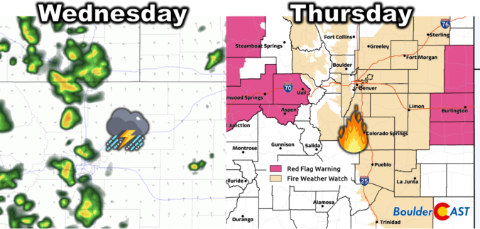
Premium BoulderCAST Daily – Wed 09/11/24 | Scattered PM storms today, hot & gusty with high fire danger Thursday

The mid-level trough in the Pacific Northwest is about to come ashore into Oregon this morning, as shown in the 500mb vorticity forecast animation below. Out ahead of the trough, southwest flow will slowly increase across Colorado today leading to some changes in our weather. Initially this southwest flow will contain above normal moisture content which will produce an uptick …

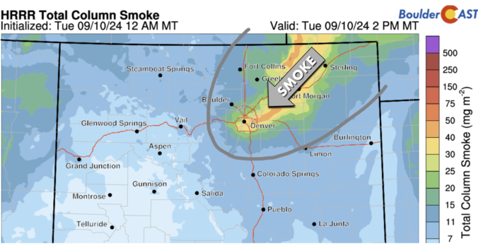
Premium BoulderCAST Daily – Tue 09/10/24 | Increasing clouds & smoke with a few isolated gusty showers around, a better chance of rain on Wednesday

Today's weather will be almost identical to Monday's with morning sunshine giving way to a few isolated high-based showers and storms later in the day. This morning's water vapor animation shows a belt of dry air draped across the southern half of the nation, but this doesn't include Colorado actually. In our neck of the woods, a weak shortwave disturbance …

« Older posts Newer posts »