Category: BoulderCAST Daily (Page 86 of 465)

This page contains an index of our BoulderCAST Daily forecast updates. If you are NOT a Premium member, you will only see a tiny sample of this content below. Subscribe to BoulderCAST Premium to gain access to all of our daily forecasts which get published every morning.
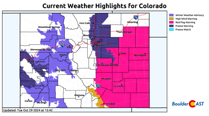
Premium Storm Update – Wed 10/30/24 8:00 AM | Dreary and cold with rain/snow showers around through the day, minor accumulations possible

All the ingredients are coming together this morning for a cold and dreary Wednesday in the Front Range. We discuss the latest on the approaching storm system and provide a few final details regarding the timing for what should be a widespread bout of light rain and snow today across the area followed by a hard freeze tonight.

Continue reading

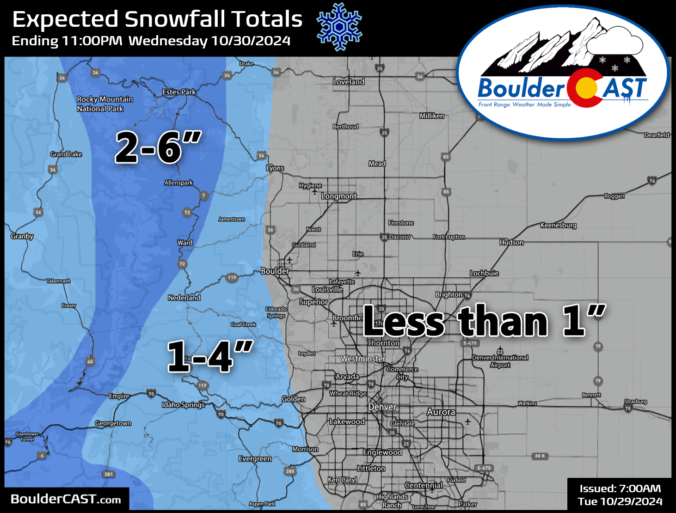
Premium BoulderCAST Daily – Tue 10/29/24 | Chilly & mostly dry today, but wet snow arrives Wednesday morning followed by a hard freeze Wednesday night!

The first of two pulses of energy associated with the approaching strong trough is impacting Colorado this morning and will be around into the evening hours today. This first shortwave will bring rain and mountain snow to much of Colorado through the day, but just a few spotty rain showers at best to the Metro area. Our better chance of …

Premium BoulderCAST Daily – Sun 10/27/24 | Continued warmth and watching a Tuesday system

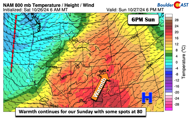
We continue the warmth for our Sunday. High pressure at the surface resides over the southern Plains, while troughing is present off the Pacific Northwest and over the Gulf of Alaska. The result is a nice fetch of warm southerly flow over the Front Range. Highs today will reach the mid to upper 70s, though a few spots could briefly …

Premium BoulderCAST Daily – Sat 10/26/24 | Warming up through the weekend

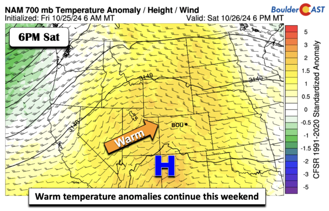
Warm temperature anomalies remain the story these next several days through the weekend. The low-level airmass is characterized by some 2+ standard deviations above normal for late October. Where is the snow?? We could have something early next week but that's still uncertain. But not today. Temperatures this afternoon will get into the low to mid 70s, warmest in the …

Premium BoulderCAST Daily – Fri 10/25/24 | Pleasant in the lower 60s with some wave clouds

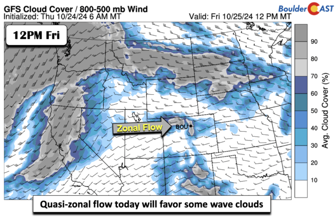
Quasi-zonal flow will be in place today across Colorado. That west to east flow will be nearly perpendicular to the mountain range and will likely favor, at times, some wave clouds this morning into early afternoon. These are not expected to be prolonged, if any, such that we should still see good amounts of sunshine. Below shows the GFS forecast …

Premium This Weekend in Colorado Weather: Gusty winds, critical fire danger, patchy frost and unseasonable warmth. Yep, it’s October!

Our main weather concern today are the gusty winds that will accompany a dry frontal boundary blasting southward through the Front Range during the daytime hours. The animation below shows the surface wind vectors and speed forecast for today from the HRRR model. Winds will be gusty through much of the daylight hours from the northwest and eventually the northeast …

Premium BoulderCAST Daily – Wed 10/23/24 | Completely dry through at least Sunday, but is snow brewing for next week?

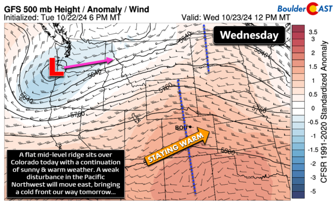
Arelatively flat mid-level ridge will be passing across Colorado today which will facilitate the continuation of warm, quiet, sunny, and dry weather in the Front Range. However, up in the Pacific Northwest, a weak disturbance is coming  ashore today which will race eastward and across Montana by tonight into early Thursday. This system will become a slight factor for us …

« Older posts Newer posts »