Category: BoulderCAST Daily (Page 65 of 465)

This page contains an index of our BoulderCAST Daily forecast updates. If you are NOT a Premium member, you will only see a tiny sample of this content below. Subscribe to BoulderCAST Premium to gain access to all of our daily forecasts which get published every morning.

Premium BoulderCAST Daily – Sat 05/03/25 | Another picture perfect day but unsettled weather is on the way

We have beautiful weather for the start of our weekend, and, in fact, at least through most of Sunday too. High pressure ridging will continue today, extending into the area from Wyoming and stretching up into Montana. This will keep our weather sunny and quiet with highs some 15 degrees warmer in the middle 70s. Tomorrow, the ridge will start …

Premium BoulderCAST Daily – Fri 05/02/25 | A pleasant end to the week

Agorgeous day is in store to close out the work week. Colorado today is sandwiched between high pressure ridging building in from the northwest and troughing over the central Plains. All this spells out gorgeous weather and lots of sunshine for our Friday. Near the surface, a cold front is to our east and this cooler and pleasant weather also …

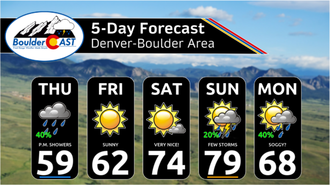
Premium This Weekend in Colorado Weather: A delightful weekend ahead of a soggy pattern next week

Widespread rain fell across the area overnight along the passage of and behind a cold front. Most areas saw their allocated rainfall of 0.2 to 0.5", though some of northwestern Boulder came in just below this range. As promised, there was indeed a little bit of white stuff in the highest Foothills. This is the snowy view from Eldora this …

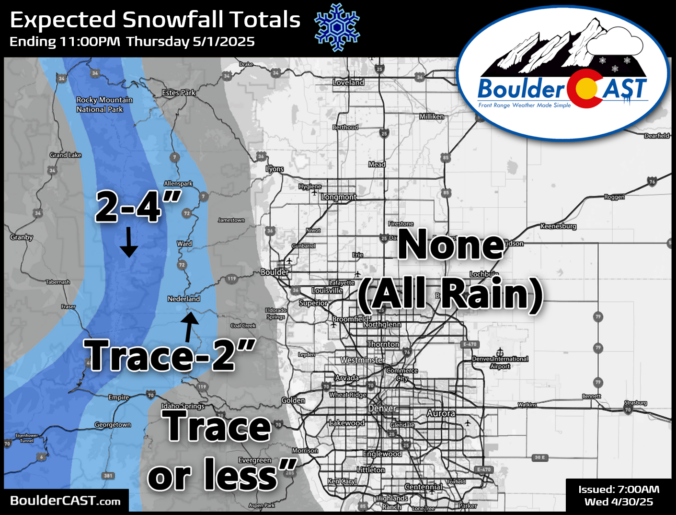
Premium BoulderCAST Daily – Wed 04/30/25 | A beautiful morning, but showers, storms and (Foothills) snow develop later

The final day of April will begin quite pleasant across the area, with sunshine this morning and temperatures pushing towards 70° by early afternoon. However, this tranquility will not last! A cold front will approach from the north and northwest later today. The front is currently located up across central Wyoming and will be heading towards Boulder and Denver for …

Premium BoulderCAST Daily – Tue 04/29/25 | A few late-day thundershowers, but a better chance of rain (high Foothills snow) developing Wednesday evening

Astalled trough continues to sit across the Four Corners region this morning, with the center of a pseudo-closed low located along the Utah-Arizona Border and slowly digging southward. Across the Front Range, we're just downstream from this trough with somewhat mild southwest flow aloft. This trough will funnel in additional energy and moisture northward through the day into our area, …

Premium BoulderCAST Daily – Sun 04/27/25 | Fire Danger Today with limited shower chances

Astrong and deep trough of low pressure will be tracking east and northeast tonight from Utah into Wyoming by early Monday. Ahead of the system, it will bring strong and gusty surface winds, along with very low RH levels, as low as 10%, and very warm weather in the lower 80s. HRRR guidance suggests relative humidity levels could dip as …

Premium BoulderCAST Daily – Sat 04/26/25 | Warmer with isolated afternoon storms

Awarm front will lift north today and spell out much warmer temperatures. But that is not before we have some fog that will slowly lift out this morning in the stalled wedge of cooler air. But our afternoon should be lots better. A few isolated showers or storms will develop later this afternoon and evening in the southwest flow, but …

« Older posts Newer posts »