Category: BoulderCAST Daily (Page 38 of 465)

This page contains an index of our BoulderCAST Daily forecast updates. If you are NOT a Premium member, you will only see a tiny sample of this content below. Subscribe to BoulderCAST Premium to gain access to all of our daily forecasts which get published every morning.

Premium BoulderCAST Daily – Wed 12/31/25 | A calm and mild finish to 2025, with more of the same heading into 2026

Our recent taste of winter is nothing but a distant memory already with warm weather set to return today and last through the upcoming weekend. A sluggish ridge of high pressure is spreading over the Rockies, and it’s already nudging us toward another day that feels more like early spring than late December. Expect highs in the upper 50s to near …

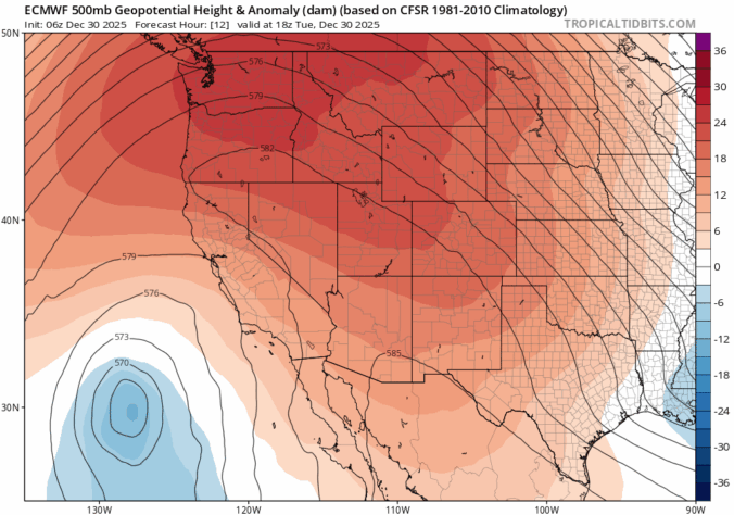
Premium BoulderCAST Daily – Tue 12/30/25 | Sunshine continues as temperatures trend up

We’re heading into our second straight sunny, seasonable day along the Front Range as we sit in a quiet gap between storm systems. A ridge of high pressure parked along the West Coast is steering dry northwest flow into Colorado, keeping conditions calm and stable for now. A few clouds are spinning over the top of the ridge across Montana …

Premium BoulderCAST Daily – Sun 12/28/25 | Snow has ended but it’s definitely colder

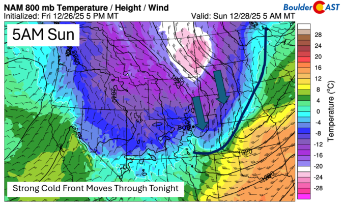
Well the snow has largely come to an end, but much colder air has become entrenched across the Front Range. A strong cold front plowed through late last night and is presently over the Central Plains. In its wake, temperatures this morning started out in the mid to upper teens to some low 20s. Snowfall reports are starting to come …

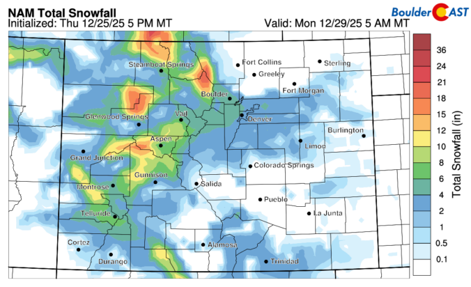
Premium BoulderCAST Daily – Sat 12/27/25 | Snow comes in late tonight but perhaps not as much as previously thought

We have one last day of some mild temperatures. A strong Arctic cold front will move through tonight, roughly between 9 and 11 pm. Behind the front, winds will turn upslope from the north and northeast, with temperatures falling into the 20s and only near 30 for highs on Sunday. Today, though, we should manage to get into the middle …

Premium BoulderCAST Daily – Fri 12/26/25 | Continued mild before wintry weather returns Saturday night and Sunday

Warmth continues today across the Front Range. Downslope flow will yet again favor some mild temperatures for late December. We hope you all had a great Christmas overall! Today's highs should top out in the middle 60s under a mix of clouds and sun. The weather makes a change late Saturday. Our warmth comes to an end late Saturday night …

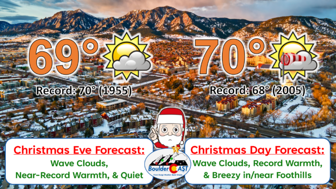
Premium BoulderCAST Daily – Thu 12/25/25 | Soaring towards record highs for Christmas Day, but wintry weather returns Saturday night!

Boulder set a new daily record high temperature yesterday on Christmas Eve reaching 71°F, besting the old record of 70° set in the notoriously observationally warm-biased 1950s (1955). No surprise here: the scorching airmass hasn’t budged at all today. A big, warm blob remains parked over the heart of the country, keeping Colorado locked into unseasonable warmth. Nearly the entire …

Premium BoulderCAST Daily – Wed 12/24/25 | Record warmth sticks around through Christmas Day before a cooldown this weekend (and maybe some snow)

Astrong ridge of high pressure parked over the south‑central U.S. will stay in charge through Christmas before finally easing eastward Friday into the weekend. For now, that ridge is trapping unusually warm air across the Front Range. Near‑record highs are expected both today and tomorrow, though thick wave clouds drifting overhead could be the only thing keeping us from smashing …

« Older posts Newer posts »