Category: BoulderCAST Daily (Page 36 of 465)

This page contains an index of our BoulderCAST Daily forecast updates. If you are NOT a Premium member, you will only see a tiny sample of this content below. Subscribe to BoulderCAST Premium to gain access to all of our daily forecasts which get published every morning.
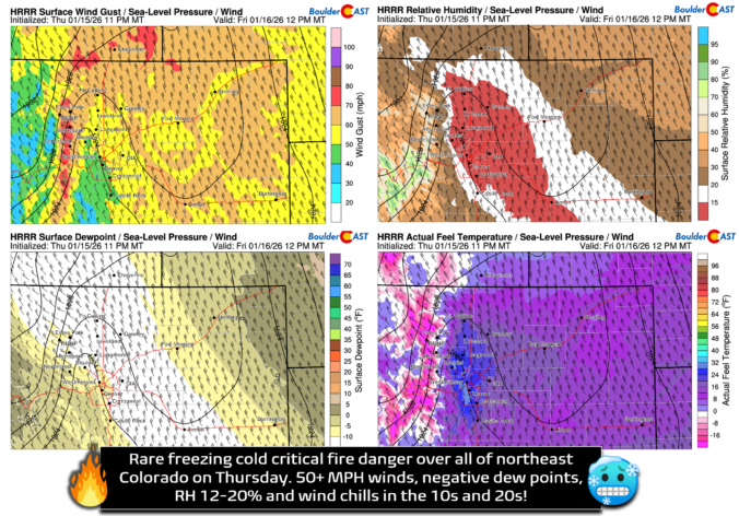
Premium BoulderCAST Daily – Fri 01/16/26 | High wind event gives northeast Colorado a rare day with critical fire danger AND cold temperatures–stay weather aware!

The latest temperature‑timeline graph out of Boulder tells the story loud and clear: last night’s cold front didn’t just arrive—it punched its way through around 8:30 PM, dropping temperatures nearly 20 degrees in just minutes. A true “blink and suddenly you need a jacket” kind of front. In the wake of that abrupt boundary, today is shaping up to be …

Premium BoulderCAST Daily – Thu 01/15/26 | Fire Danger Today Before a Cold Front Tonight

Fire concerns are real today with the combination of gusty winds, low relative humidity, and warm temperatures in the lower 60s. A Red Flag Warning has been issued for areas north and east of Denver, from Ft. Collins to Fort Morgan to Limon to Burlington and Sterling. These conditions are expected to last until early this evening, prior to a …

Premium BoulderCAST Daily – Wed 01/14/26 | A gorgeous Wednesday ahead of increasing fire danger & a stronger cold front tomorrow

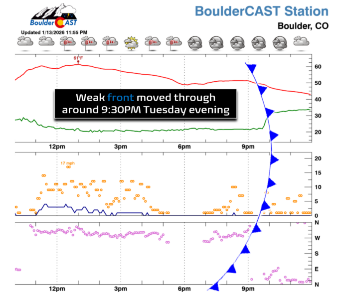
Last night’s weak cold front slipped through right around 9:30 PM—it was nothing crazy, just a subtle dip in temperatures, a bump in dew points, and a shift of the winds around to the northeast direction. As expected, a few light rain showers are hanging out east of Denver this morning. They’re already looking pretty flimsy on radar and aren’t …

Premium BoulderCAST Daily – Tue 01/13/26 | A thick blanket of high clouds won’t stop us from reaching the 60s again

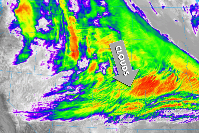
Moisture is streaming overhead this morning like a quiet conveyor belt, and it’s doing a fine job painting a broad shield of mid‑ and upper‑level clouds across all of Colorado. GOES‑East imagery shows the whole thing unfolding in real time—an impressive, almost uninterrupted swath of clouds stretching in from upstream. The infrared channels are lighting up thanks to those bright, …

Premium BoulderCAST Daily – Sun 01/11/26 | A mild Sunday with readings reaching the 50s

Sunday is shaping up to be a calm, pleasant day across the Front Range—quiet weather, light winds, and a slow warm‑up underway. The only real forecast wrinkle this morning is the lingering snowpack, now mostly confined to Boulder proper where a few inches still blanket the ground. Yesterday’s temperatures underperformed a bit thanks to that snowpack greedily absorbing the sun’s …

Premium BoulderCAST Daily – Sat 01/10/26| Widespread sunshine and moderating temperatures this weekend as our recent snow melts off

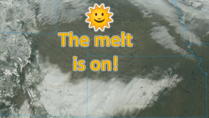
Saturday is shaping up to be a calm, almost serene day along the Front Range—an abrupt change of pace after the back‑to‑back storm systems that delivered our Thursday–Friday snowfall. Those storms are now well off into the Plains, but their signature remains etched across the landscape. GOES‑East imagery this morning shows a striking “white scar” draped across southeast Colorado and …

Premium BoulderCAST Daily – Fri 01/09/26| Snow ends quickly this morning with a quieter weekend in store

After Thursday’s bout of wet, slushy snow—more nuisance than accumulation for most—the atmosphere found just enough instability overnight to squeeze out a surprise encore. A secondary push of colder upslope arrived after midnight, sharpening the lift along the Front Range and allowing narrow but intense snow bands to blossom before dawn. These bands have been drifting across the region through …

« Older posts Newer posts »