Category: BoulderCAST Daily (Page 32 of 465)

This page contains an index of our BoulderCAST Daily forecast updates. If you are NOT a Premium member, you will only see a tiny sample of this content below. Subscribe to BoulderCAST Premium to gain access to all of our daily forecasts which get published every morning.

Premium BoulderCAST Daily – Fri 02/20/26 | Cloudy with some passing light snow this afternoon

Arelatively moderate shortwave at mid-levels will track from west to east across Colorado today into this evening before moving into the Central Plains of the U.S. As that happens, uplift along the higher terrain west of the Denver Metro will bring another period of mountain snow. A smattering of 3 to 6 inches of additional snow will be possible in …

Premium This Weekend in Colorado Weather: Light snow Friday ahead of a peaceful weekend, but a renewed stretch of wind and fire risk looms next week

We had early indications last evening that the forecast was beginning to unravel. Frontal snow bands—initially expected to remain well north of the Denver/Boulder corridor—were instead pushing as far south as Loveland, Lyons, and even Niwot as the compact shortwave disturbance crossed northern Colorado. This southward displacement was the first sign that the system’s track was shifting. Ultimately, the disturbance …

Premium BoulderCAST Daily – Wed 02/18/26 | Mountain snow continues today while Boulder braces for a downslope windstorm tonight

Colorado is gearing up for several more days of active, unsettled weather as a broad longwave trough continues to hang over the western United States. The main axis of this system has now pushed onshore, stretching from Washington down through southern California. Out ahead of this trough, a deep plume of moisture and a cluster of small disturbances are streaming …

Premium BoulderCAST Daily – Tue 02/17/26 | A high impact day of weather throughout Colorado with heavy Mountain snow, strong winds, blizzard conditions, and critical fire danger!

Today marks the beginning of what will be an active, high‑impact stretch of weather across all of Colorado—heavy Mountain snowfall, strong winds, and elevated fire danger depending on which side of the Divide you call home. Our storm system is assembling nicely this morning across the western U.S., with a broad longwave trough and parent low still anchored just offshore …

Premium BoulderCAST Daily – Sun 02/15/26 | A quiet Sunday but a Potentially Dangerous Fire Weather Situation early this week

The weather is quiet and mild again for our Sunday. In contrast to Saturday, we'll see some mid and high clouds stream in from time to time but it won't be enough to keep us from reaching the mid and upper 60s in most locales of Denver and Boulder. All eyes and focus are on a very strong west coast …

Premium BoulderCAST Daily – Sat 02/14/26 | Warming up this weekend

The area of low pressure that brought us rain yesterday is on its way east. Today it will be over Texas, and by Sunday, it will be bringing rainfall to the southeast and Carolinas. In it's wake, we'll see high pressure ridging taking over with sunny skies and warming back up above normal. Highs today top out in the middle …

Premium BoulderCAST Daily – Fri 02/13/26 | Rain later today, then mild and sunny this weekend

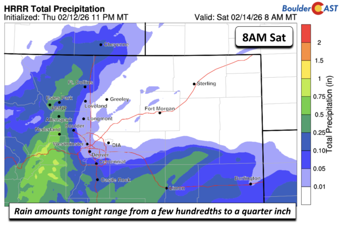
It is pretty rare for us to receive non-frozen, or liquid, precipitation in the winter season. Nevertheless, that is what we'll see for us in the Front Range later today and tonight. An area of low pressure to our south will bring just enough moisture into the area to give us some rain showers starting this evening and tapering off …

« Older posts Newer posts »