Category: BoulderCAST Daily (Page 274 of 465)

This page contains an index of our BoulderCAST Daily forecast updates. If you are NOT a Premium member, you will only see a tiny sample of this content below. Subscribe to BoulderCAST Premium to gain access to all of our daily forecasts which get published every morning.
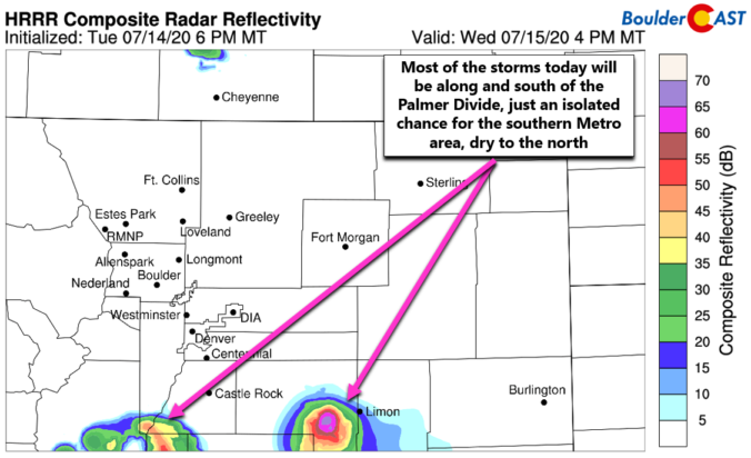
BoulderCAST Daily – Wed 07/15/20 | Continued cool with isolated storms, mainly south of Denver

ADetailed Forecast Discussion second "cool" day will unfold as the cooler airmass still resides over eastern Colorado. Another surge of cool and moist air has backed into the Front Range this morning with low stratus and even fog possible in some areas during the morning hours. There are a few showers showing up on radar with this push, but these …

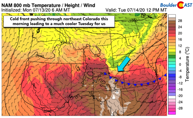
BoulderCAST Daily – Tue 07/14/20 | Pushing pause on the heatwave

IDetailed Forecast Discussion t's that amazing day you've been anticipating for more than a week now! Yes, today high temperatures will NOT make it into the 90's as a cold front is dropping southward across northeast Colorado this morning. Behind the front, a welcomed change in airmass is taking place with cooler Canadian air replacing the mostly dry and hot …

BoulderCAST Daily – Sun 07/12/20 | The heat returns…along with storms

Detailed Forecast Discussion Increased moisture has developed across the state and will continue to do so as we go into the afternoon and evening hours. With the ridge of high pressure to our south and weak troughs of low pressure to our north, this has fueled south-southwesterly flow from Baja California. This will bring above average moisture across much of …

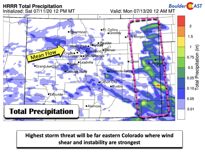
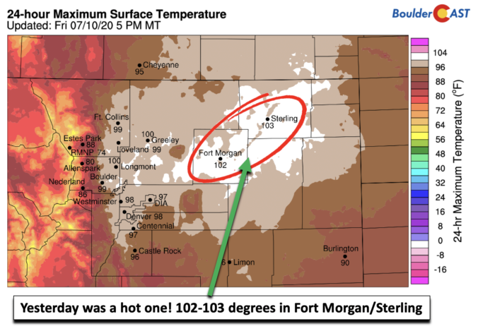
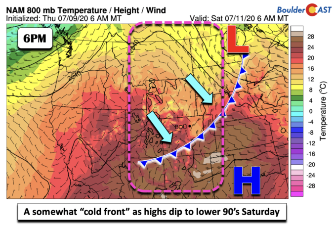
BoulderCAST Daily – Sat 07/11/20 | “Cooler” by relative standards

Detailed Forecast Discussion You don't need me to tell you that yesterday was quite the hot one. Highs across the Front Range were in the upper 90's to lower 100's. The two locations that were the highest were Fort Morgan and Sterling with highs of 102 and 103 degrees (below). But there is a welcomed cooling today, but in relative …

BoulderCAST Daily – Fri 07/10/20 | Hottest day of the week!

Detailed Forecast Discussion It has been all about the heat this week and it is no surprise that it continues to end the work week. Highs will top out in the upper 90's to lower 100's today with the ridge still to our south (below). A fast moving area of low pressure will race from Montana into North and South …

BoulderCAST Daily – Thu 07/09/20 | Lower 90’s as the monsoon is now officially “late”

TDetailed Forecast Discussion he heat is on again today with highs in the lower 90's. It will be slightly cooler following the influx of moist, rain-cooled air overnight from storms well out across the eastern Plains. The ridge of high pressure will really begin to intensify today into tomorrow with 500mb heights reaching near 6000 meters across New Mexico by …

« Older posts Newer posts »