Category: BoulderCAST Daily (Page 271 of 465)

This page contains an index of our BoulderCAST Daily forecast updates. If you are NOT a Premium member, you will only see a tiny sample of this content below. Subscribe to BoulderCAST Premium to gain access to all of our daily forecasts which get published every morning.

BoulderCAST Daily – Sat 08/08/20 | Continued heat…cooler Monday

Detailed Forecast Discussion It was a hot one yesterday! Given virtually little change in the atmospheric setup, with high pressure at mid-levels over Texas (below) and southwest flow across Colorado, the airmass has only increased slightly in terms of its temperature. Thus, highs should reach the upper 90's across most areas of the Front Range given full sunshine. Be sure …

BoulderCAST Daily – Fri 08/07/20 | Middle 90’s and bone dry

Detailed Forecast Discussion As mentioned in yesterday's forecast, we are seeing a large amount of dry air moving into the region, which started yesterday. The satellite image on the below left figure shows this dry air intrusion quite well, working in from southern California in the southwest flow from yesterday. Moist air started to push to the east into the …

BoulderCAST Daily – Thu 08/06/20 | Drier air enters the picture, weak storms possible

TDetailed Forecast Discussion he threat of severe weather for the week is now (mostly) behind us with a ridge axis shifting through Colorado today. Drier and warmer southwest flow has taken hold across the Front Range. With this, storms will be weaker and much more sparse compared to the last few days. While we aren't concerned about any hail in …

BoulderCAST Daily – Wed 08/05/20 | An encore of severe storms, but hot & dry weather on the horizon

TDetailed Forecast Discussion he severe threat finally materialized with widespread reports of mainly large hail across much of eastern Colorado on Tuesday. While the heavy rain and hailstones largely eluded the Boulder/Denver area (big surprise, right?), severe thunderstorms did impact Erie, Firestone and Greeley. This was the scene yesterday afternoon south of Greeley following a hail-producing storm. Quite impressive! https://twitter.com/Dan_Fitts/status/1290774543171231744 …

BoulderCAST Daily – Tue 08/04/20 | Brief shot at severe storms this afternoon

TDetailed Forecast Discussion he severe weather threat that has been with us the last handful of days has been rather disappointing thus far, mainly due to a lack of large-scale forcing. The stalled frontal boundary over the area just hasn't been enough. Furthermore, the sheared-out anvils from early afternoon storms forming across the higher terrain has been putting a lid …

BoulderCAST Daily – Sun 08/02/20 | More numerous thunderstorms today…some marginally severe

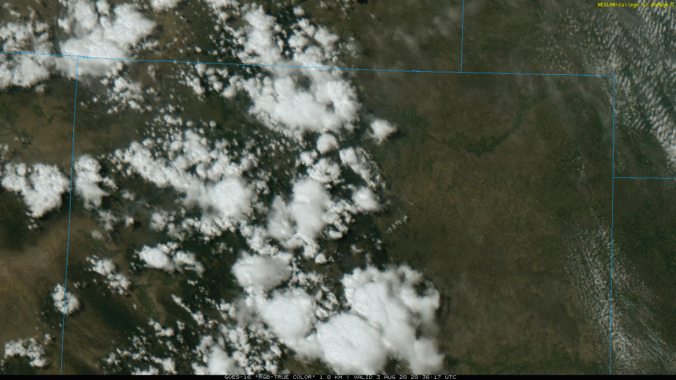
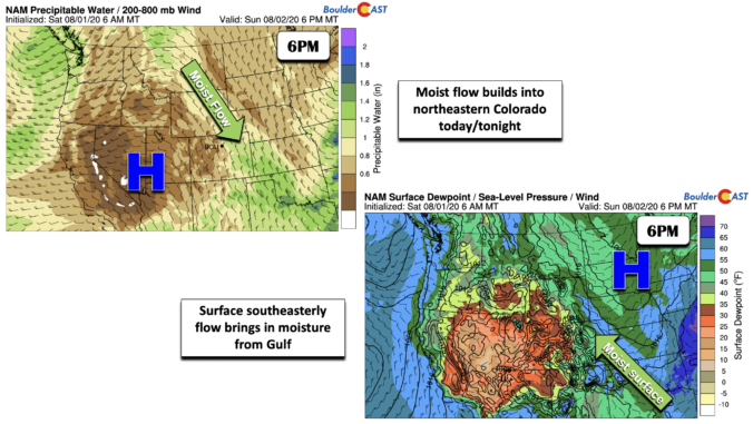
Detailed Forecast Discussion As we discussed yesterday, we are seeing a nice pattern unfold today with more numerous showers and storms expected in the late afternoon/evening hours. The ridge of high pressure remains to our west, with general trouging across the upper Midwest. This setup is keeping northwest flow across Colorado (below left). The moist flow over northeast Colorado today …

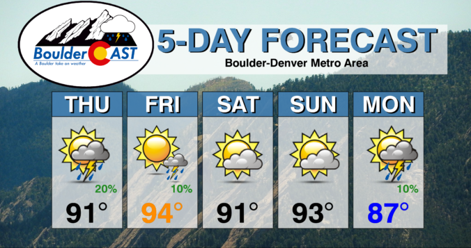
BoulderCAST Daily – Sat 08/01/20 | Highs near 90 on this first day in August

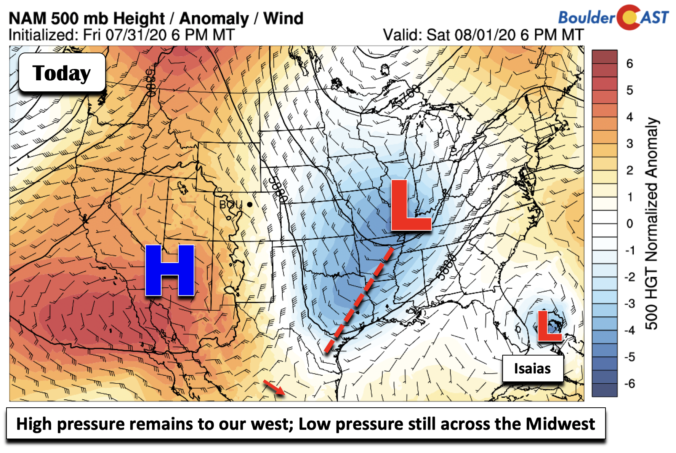
Detailed Forecast Discussion High pressure continues to remain to our southwest in Arizona, thanks to that trough of low pressure in the mid-section of the country (below). Meanwhile, Hurricane Isaias churns near Florida and is expected to move northward toward the Carolinas early this coming week. The high pressure remaining to our west will keep the extreme heat west of …

« Older posts Newer posts »