Category: BoulderCAST Daily (Page 272 of 465)

This page contains an index of our BoulderCAST Daily forecast updates. If you are NOT a Premium member, you will only see a tiny sample of this content below. Subscribe to BoulderCAST Premium to gain access to all of our daily forecasts which get published every morning.
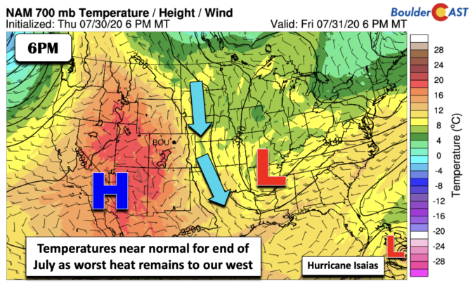
BoulderCAST Daily – Fri 07/31/20 | Ending the week still on cool side

Detailed Forecast Discussion The area of low pressure that has influenced our weather pattern this week has finally moved out into Arkansas/Missouri today (below). However, northerly flow continues to reside across Colorado into the Midwest. Hot high pressure remains situated across the desert southwest of Arizona and California. This pattern of northerly winds will continue the stretch of 80-degree temperatures …

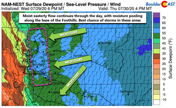
BoulderCAST Daily – Thu 07/30/20 | Cooler with a few storms along the base of the Foothills

TDetailed Forecast Discussion hat pesky low pressure to our east is still the main discussion point in today's forecast. The center of the low is located in far eastern Nebraska and Kansas this morning and it will slowly sag further south and east through the day. On its western edge, a weak trough axis is oriented westward into Colorado with …

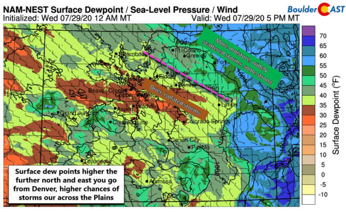
BoulderCAST Daily – Wed 07/29/20 | Is the monsoon dead already?

TDetailed Forecast Discussion he shortwave trough axis that brought scattered showers and storms to the area yesterday has pushed off to the east into Kansas and Nebraska. The actual low pressure still resides further north and west back across Wyoming. GOES-East infrared satellite imagery this mornings shows the setup well. We see the spinning low in Wyoming, the line of …

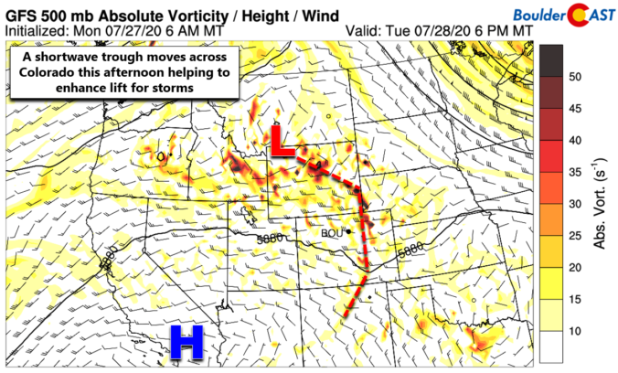
BoulderCAST Daily – Tue 07/28/20 | Widespread storms pushing off the higher terrain

TDetailed Forecast Discussion oday will offer up our best chance of rain for the week as a shortwave trough is passing across the northern Rockies. The timing during the afternoon will work well with solar heating to produce scattered to widespread showers and storms. Convection and storms will pop-up first in the Mountains by early afternoon and then spread eastward …

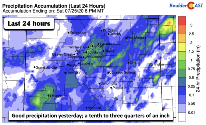
BoulderCAST Daily – Sun 07/26/20 | We finally got some rain! More on the way

Detailed Forecast Discussion We finally got some rainfall across much of the state in the last 24 hours. Portions of Colorado picked up a tenth to three quarters of an inch across the Front Range. A nice addition for your lawn if it has dried up! Also good news for the High Country as they also picked up some much …

BoulderCAST Daily – Sat 07/25/20 | Wetter than the work week

Detailed Forecast Discussion Likely showers and thunderstorms will exist later today and this evening with a more favorable mid-level pattern. As we saw yesterday, we continue to have a jet streak oriented southwest to northeast from Utah into Wyoming (below). The jet streak is actually a little further south than Friday and could provide some marginal added lift for the …

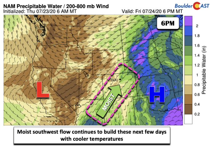
BoulderCAST Daily – Fri 07/24/20 | Moist flow penetrates into Colorado

Detailed Forecast Discussion A good moist flow into Colorado today and the weekend is setting up. A nice southwest to northeast oriented jet stream between Utah and Montana (below) is squeezed between an area of high pressure over Oklahoma and a trough over the Pacific Northwest. Both of these systems on either side of the jet are bringing in a …

« Older posts Newer posts »