Category: BoulderCAST Daily (Page 266 of 465)

This page contains an index of our BoulderCAST Daily forecast updates. If you are NOT a Premium member, you will only see a tiny sample of this content below. Subscribe to BoulderCAST Premium to gain access to all of our daily forecasts which get published every morning.
BoulderCAST Daily – Fri 09/18/20 | Hazy, warm, and dry

Detailed Forecast Discussion: We end the work week still on the mild and dry side of things. The smoke and haze will continue to be a problem, hence the Air Quality alert that has been issued over the Front Range. Try to avoid prolonged time outdoors to avoid having respiratory problems. Highs today will rise to the mid to upper …

BoulderCAST Daily – Thu 09/17/20 | Warm and mostly dry the next five days

RDetailed Forecast Discussion: idging aloft is still with us again today. The two centers of the high pressure are located to our south and west with a ridge axis extending up the spine of the Rockies into western Canada. This is shown in the GFS 500mb height anomaly forecast map below for mid-day today. This "ridgy" set-up will be present …

BoulderCAST Daily – Wed 09/16/20 | Thick low-level smoke behind a cool front

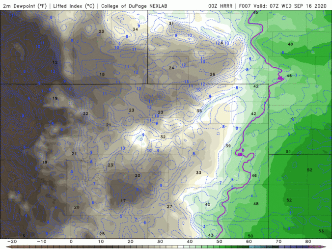
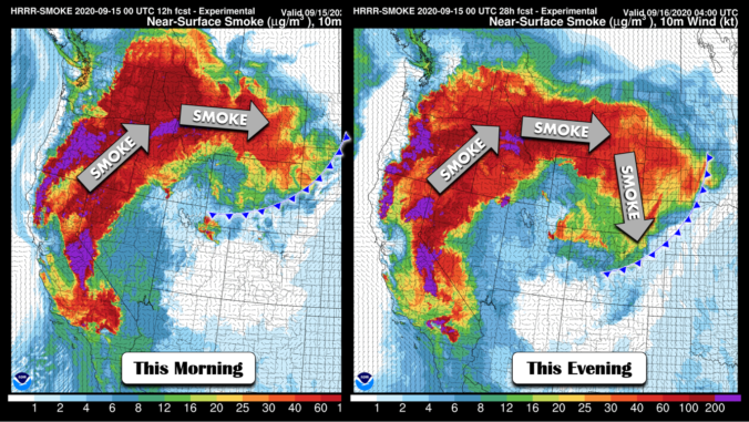
IDetailed Forecast Discussion: f you thought the smoke and air quality were bad yesterday, you're really not going to like today's forecast... A cool front is pushing through the area this morning with low-level winds turning northeasterly across the lower elevations. The front is so shallow and weak that it's hard to pick out in the models or even surface …

BoulderCAST Daily – Tue 09/15/20 | Simply sunny, but increasing smoke

TDetailed Forecast Discussion: he typical high in Boulder on the Ides of September is 75°F. We will be considerably warmer than this today under a dominant ridge of high pressure and sunny skies. The large-scale pattern across the United States today is shown in the graphic below. Outside of Hurricane Sally, high pressure controls most of the continental United States, …

BoulderCAST Daily – Sun 09/13/20 | Middle 80’s with no cloud in sight

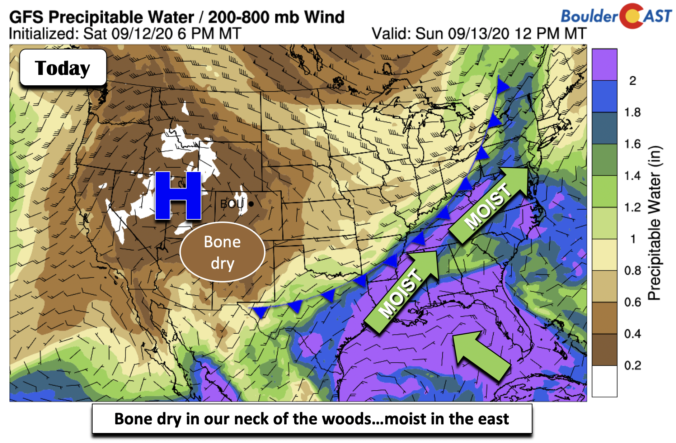
Detailed Forecast Discussion We are bone dry in Colorado and portions to the west of us (below). This is due to us being under the ridge of high pressure. However, a different picture is seen to the east over the Ohio Valley and the East Coast. High moisture there is tied to an approaching cold front and tropical cyclone Sally …

BoulderCAST Daily – Sat 09/12/20 | Beautiful weather takes hold

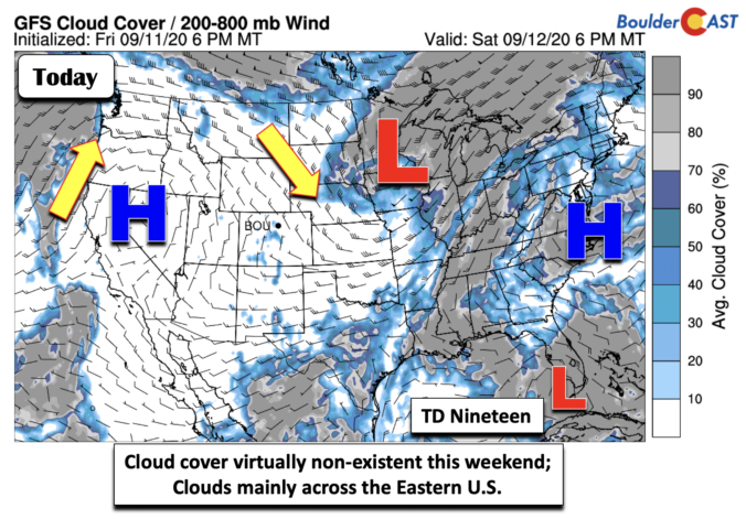
Detailed Forecast Discussion A gorgeous weekend is setting up across the state and over the Plains today and tomorrow. With the exit of the low pressure into the Midwest (below), high pressure will take over both days and lead to continued moderating temperatures. No extreme heat is expected as well, just your typical fall season weather. Tropical Depression Nineteen has …

BoulderCAST Daily – Fri 09/11/20 | Low pressure finally moving out…great weekend ahead

Detailed Forecast Discussion That pesky remnant area of low pressure, which has been with us this entire week, bringing snow to unsettled cloudy weather, will finally make its way out of the state later tonight and especially tomorrow. This morning, the center of circulation was across far northeastern Colorado and western Nebraska. Expect some clouds around for the first part …

« Older posts Newer posts »