Category: BoulderCAST Daily (Page 265 of 465)

This page contains an index of our BoulderCAST Daily forecast updates. If you are NOT a Premium member, you will only see a tiny sample of this content below. Subscribe to BoulderCAST Premium to gain access to all of our daily forecasts which get published every morning.
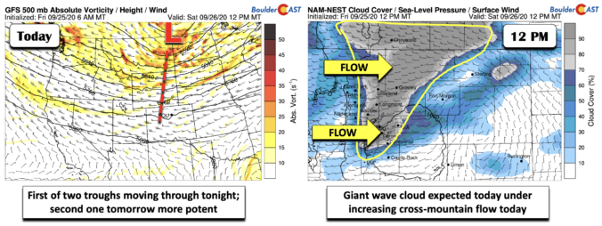
BoulderCAST Daily – Sat 09/26/20 | One more day of warmth ahead of cold front

Detailed Forecast Discussion: Trough number one of a total of two will pass through tonight. It's position as of this evening will be along the Montana/North Dakota border (below left), with the trough axis stretching southward into central Colorado. Increasing westerly flow today, both at the surface and at mid-levels, will aid uplift along the higher terrain this afternoon. As …

BoulderCAST Daily – Fri 09/25/20 | Potential record warmth next few days before cooler weather Sunday

Detailed Forecast Discussion: A very subtle but noticeable weak cool front has moved through the Front Range earlier this morning. The surface boundary is shown below in blue. A weak small-scale high pressure has set up just northeast of Greeley. As a result, surface winds today will be out of the east-southeast, giving us a slight upslope component. While there …

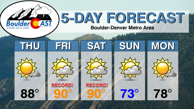
BoulderCAST Daily – Thu 09/24/20 | Record heat likely in the coming days

YDetailed Forecast Discussion: esterday's high temperature was 84°F at BoulderCAST Station. We'll be a few degrees warmer than this today as 700mb temperatures edge even higher. There is a notable tilted ridge axis sliding across Colorado today (shown below). It stretches from the Desert Southwest into central Canada. Once this axis passes around mid-day, warm air advection under southwesterly flow …

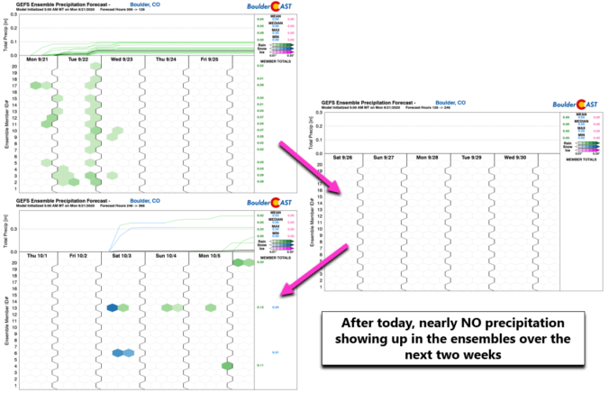
BoulderCAST Daily – Wed 09/23/20 | The beginning of a long dry stretch

LDetailed Forecast Discussion: ittle change is expected in our weather for the first full day of autumn. Relatively warm and dry west-northwesterly flow is situated across Colorado. Meanwhile, a strong Pacific storm system is coming ashore into the Pacific Northwest. This system will move eastward and could bring a dry cold front through our area sometime Saturday leading to a …

BoulderCAST Daily – Tue 09/22/20 | A summer-like start to autumn

TDetailed Forecast Discussion: he first (half) day of autumn will feel like anything but as large-scale high pressure continues to control our weather. Unseasonably warm temperatures will be the story again with highs in the middle 80's, similar to yesterday. Also not unlike a typical summer day, there will be a slight chance of afternoon and evening showers spreading eastward …

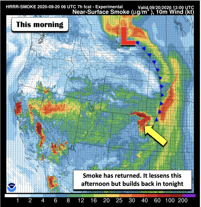
BoulderCAST Daily – Sun 09/20/20 | Surface smoke returns

Detailed Forecast Discussion: Earlier this morning, a very weak cool front and surface boundary pushed through, barely brushing northern sections of Colorado and the Front Range. This has led to a lowering of visibility and increase in surface smoke during the morning today (below; courtesy of NOAA). There should be some improvement by the afternoon as southerly winds develop and …

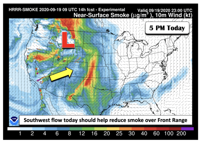
BoulderCAST Daily – Sat 09/19/20 | An improvement in surface visibility

Detailed Forecast Discussion: A decent area of low pressure will be skirting to our north later this afternoon and evening, tracking up into Montana by 6 PM (below). Southwest flow south of the system in our neck of the woods will bring in areas of mid and high clouds from time to time this afternoon and evening. Temperatures today will …

« Older posts Newer posts »