


Category: BoulderCAST Daily (Page 264 of 465)

This page contains an index of our BoulderCAST Daily forecast updates. If you are NOT a Premium member, you will only see a tiny sample of this content below. Subscribe to BoulderCAST Premium to gain access to all of our daily forecasts which get published every morning.
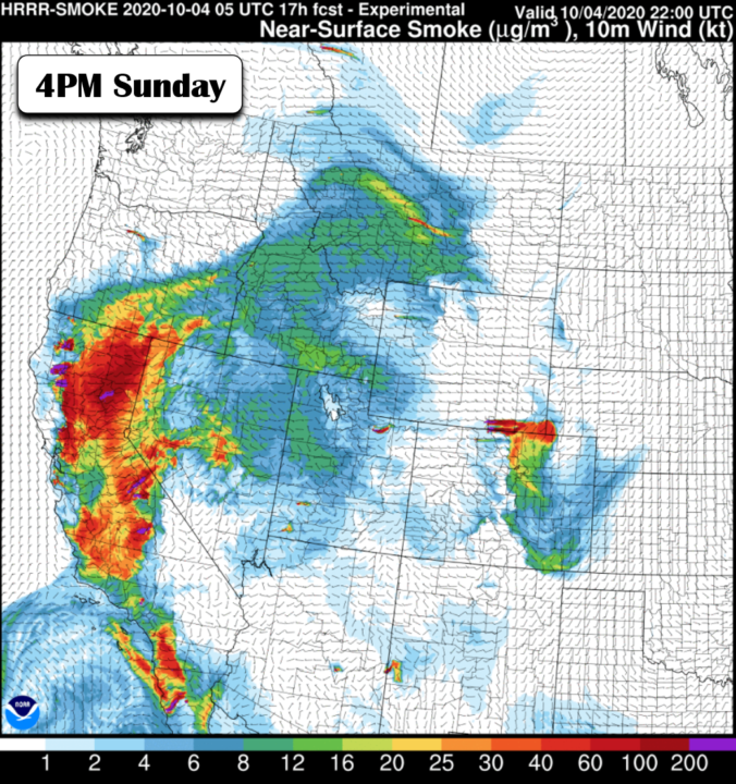
BoulderCAST Daily – Sun 10/04/20 | Let the warming commence

MDetailed Forecast Discussion: ostly sunny and dry weather will continue for the next several days across the Front Range. You know the story; it's been told many times all summer long and now again in early autumn. A strong dual-lobed ridge of high pressure continues to sit across the Four Corners and West Coast regions, with a trough in the …

BoulderCAST Daily – Sat 10/03/20 | Cool and pleasant

Detailed Forecast Discussion: Very nice satellite image earlier this morning as of 4 AM, showing the cold front approaching the Front Range, along with its associated mid-level clouds (below). The front will have already been through by the time you read this. The northeasterly winds today behind the front will create very pleasant weather for us in the middle to …

BoulderCAST Daily – Fri 10/02/20 | Another swing in temperatures ahead of another cold front

Detailed Forecast Discussion: Mid and upper-level clouds have started to stream into the state from the west and northwest earlier this morning (below left; shaded colors), in advance of another cold front slated to move through the Front Range around 11 PM to midnight tonight (below right). These clouds should diminish a tad as we go into the afternoon with …

BoulderCAST Daily – Thu 10/01/20 | Sunny with increasing smoke, no precip in the pipeline

MDetailed Forecast Discussion: ore sunshine is expected today as mid-level ridging holds across the West Coast. Another weak cold front clipped the area overnight. As we've been reiterating all week, the current large-scale weather pattern across North America is quite favorable for these frequent cold fronts. They have all been fairly tame so far, with most of the cold air …

BoulderCAST Daily – Wed 09/30/20 | Sunny & just a tad cooler

ODetailed Forecast Discussion: n this last day of September, dry and sunny weather will continue as a persistent and dominant ridge of high pressure aloft remains across the western third of the country. There are actually two high pressure centers embedded in this ridge (shown below): one in the Pacific Northwest and a second in northern Mexico. Since we are …

BoulderCAST Daily – Tue 09/29/20 | Back to above normal temperatures

FDetailed Forecast Discussion: ollowing the brief cooldown we saw over the last two days, we get right back to above normal temperatures as northeasterly flow turns towards a warmer northwesterly direction across the area today. This quick shift in temperatures is the result of the pronounced dipole pattern across North America which we foreshadowed last week. Colorado lies right in …

BoulderCAST Daily – Sun 09/27/20 | Much cooler and breezy

Detailed Forecast Discussion: The cold front as of 7 AM this morning was positioned along the Colorado/Wyoming border, with temperatures in the middle 40's behind it near Cheyenne. Later this morning, around 9 AM, the front will be knocking on our doorstep (below left), passing Loveland at that time and nearing Longmont. We should see a brief warmup into the …

« Older posts Newer posts »
