Category: BoulderCAST Daily (Page 208 of 465)

This page contains an index of our BoulderCAST Daily forecast updates. If you are NOT a Premium member, you will only see a tiny sample of this content below. Subscribe to BoulderCAST Premium to gain access to all of our daily forecasts which get published every morning.

BoulderCAST Daily – Wed 01/05/22 | The bitter cold & snow arrive late afternoon into evening, snow amounts still uncertain

Avery tricky forecast unfortunately remains for today as models failed to come into better agreement overnight on how exactly the wintry event later on will play out. The main forecasting challenge lies in the fact that nearly every high-resolution model shows weak banding with this event and thus lower-end snow totals --- 1/2 to 3" from Denver to Fort Collins. …

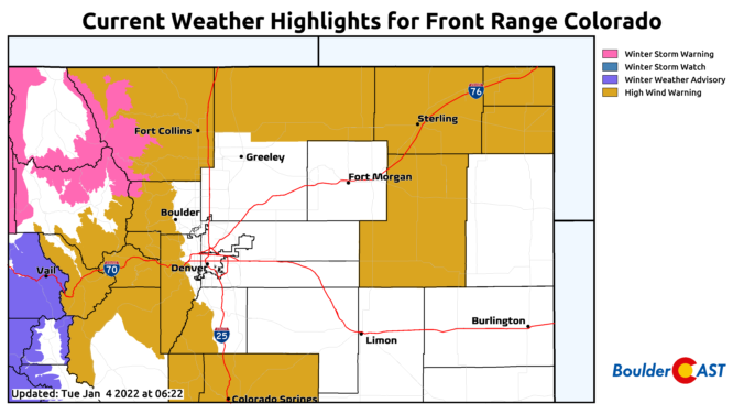
BoulderCAST Daily – Tue 01/04/22 | High winds today gusting up to 70 MPH, brief heavy snow tomorrow

The nose of a strong jet streak is projected to be directly over the Front Range today and tomorrow with a favorable setup developing for high winds across the Mountains and Foothills, with potent winds also possible across the bulk of the Denver Metro area as well. Further north along the Wyoming border, more of a classic bora-type wind event …

BoulderCAST Daily – Sun 01/02/22 | Downslope warming helps melt snow today

ADetailed Forecast Discussion: nice ridge of high pressure will build in today, ushering in lots of sunshine and rising temperatures. Below shows a nice ridge stretching from California into western Texas. The ridge will allow nice downslope warming to take effect across the Front Range this afternoon and help melt some of the snow. With the fresh snow, highs will …

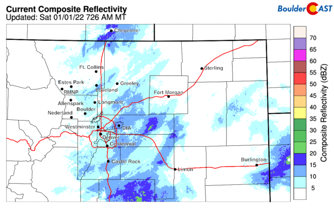
BoulderCAST Daily – Sat 01/01/22 | Snow tapering off this afternoon on this first day of 2022

ADetailed Forecast Discussion: cold morning and afternoon across the Front Range today. Temperatures earlier this morning were in the single digits across the area. There will be little diurnal rise in those values with highs only in the upper single digits to lower teens with all the fresh snow cover on the ground and the cold airmass in place. The …

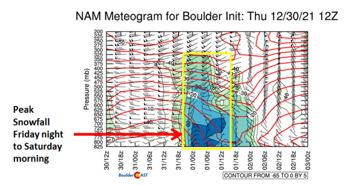
BoulderCAST Daily – Fri 12/31/21 | Snow arrives this New Year’s Eve

NDetailed Forecast Discussion: othing has changed in our snowfall forecast, but here are some specifics on today and the start and end time for the snow for the Front Range. A strong trough will approah later today and tonight, as well as a secondary strong arctic cold front later this afternoon. The arrival of these two features will favor the …

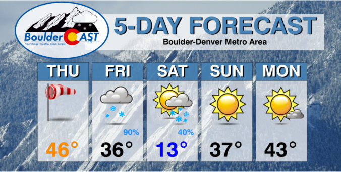
Weekend Weather Snapshot: December 30, 2021

IDetailed Forecast Discussion: n addition to warmer temperatures, high winds are expected to develop through the morning and continue into the evening for areas in and near the Foothills. High-resolution models agree well on this facet, but it continues to be a bit of a mystery forecast since the usual wind ingredients are not necessarily fully in-play. However, with such …

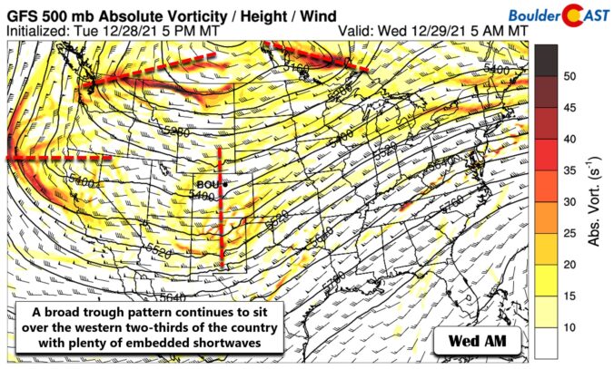
BoulderCAST Daily – Wed 12/29/21 | Sunny & cool today, windy with elevated fire danger tomorrow, & a NYE snow update

⦁❶⦁ Falling and blowing snow will continue at various intensities in the Mountains through the rest of the week causing travel impacts

⦁❷⦁ Very quiet today across the Denver Metro area with highs in the 30’s under partly cloudy skies

⦁❸⦁ Warmer tomorrow, but high winds are possible in and near the Foothills — this will create elevated fire danger

⦁❹⦁ New Year’s Eve snowfall is all but guaranteed (woo!), but models still disagree on how much snow will fall

Continue reading

« Older posts Newer posts »