Category: BoulderCAST Daily (Page 204 of 465)

This page contains an index of our BoulderCAST Daily forecast updates. If you are NOT a Premium member, you will only see a tiny sample of this content below. Subscribe to BoulderCAST Premium to gain access to all of our daily forecasts which get published every morning.
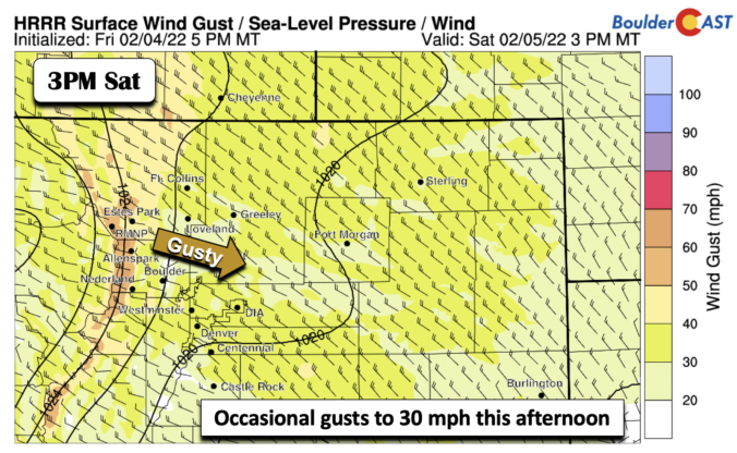
BoulderCAST Daily – Sat 02/05/22 | A tad breezy with highs in the middle 40s

It is National Weatherperson's day! Be sure to thank a fellow meteorologist you know, if you get the chance. A mid-level area of low pressure is situated off to our northeast in northwest North Dakota today. It will be tracking largely east-southeast and remain mostly to our north today, with the bulk of the lift remaining over the upper Midwest. …

BoulderCAST Daily – Fri 02/04/22 | A nice snow melt today

Anice ridge of high pressure builds in today, bringing in higher heights aloft and warmer weather, thanks to some appreciable downslope flow on the Plains. There is one system over the Pacific Northwest today that will track into the upper Midwest by tomorrow, which may bring a weak cold front through the area later tomorrow. We are already some 15-20 …

Weekend Weather Snapshot: February 3, 2022

After more than 30 continuous hours, snowfall finally came to an end last evening across the entire area. We'll post the final storm totals later this morning so keep a look out if you are interested for that. Overnight skies have mostly cleared across the area, though there are still some low clouds lingering in spots. The microphysics cloud animation …

BoulderCAST Daily – Wed 02/02/22 | Intermittent light snow lingers into the evening followed by below zero temperatures late tonight

Reported snowfall totals indicate that most areas saw between 6 and 10" of snow so far. We just measured close to 8" at BoulderCAST Station. The major outlier, as expected, was Denver International Airport which has seen a measly 2.1" so far! The map below contains all the co-op reports that have come in so far at this early morning …

Premium Storm Update – Tue 02/01/22 7:00 AM | Snow begins this afternoon, higher-end snow totals appear more likely

In case you missed it, we provided an updated forecast and our snowfall map last evening. Below is what we came up with. Upslope is expected to focus the heavier snowfall into the western suburbs, with the most snow likely to fall in Boulder and the Foothills just to the west below 8500 feet. The upslope is somewhat shallow this …

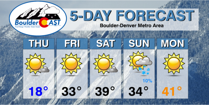
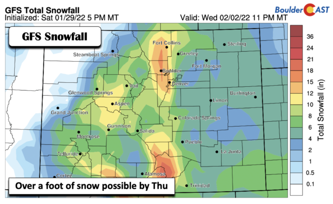
BoulderCAST Daily – Sun 01/30/22 | Another mild day but snow on the way late Tue-Wed

The weather today again remains quiet as the area remains in between systems today, with the cutoff low pressure system still to our south, but now in New Mexico. The jet stream is to our north with an area of low pressure moving onshore in the Pacific Northwest tonight. Highs will stay mild today under sunny skies in the lower …

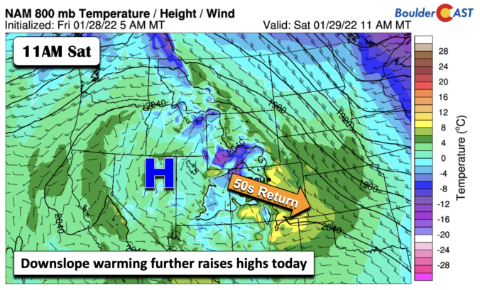
BoulderCAST Daily – Sat 01/29/22 | Warmth continues with highs in the 50s

Aridge of high pressure remains in place across the state today. We will be sandwiched between the northwest flow to our northeast over the upper Midwest and Great Lakes, and a cut-off area of low pressure over southern California. The high pressure will spell out another warm and sunny day. The downslope warming east of the Foothills will continue to …

« Older posts Newer posts »