Category: BoulderCAST Daily (Page 20 of 465)

This page contains an index of our BoulderCAST Daily forecast updates. If you are NOT a Premium member, you will only see a tiny sample of this content below. Subscribe to BoulderCAST Premium to gain access to all of our daily forecasts which get published every morning.
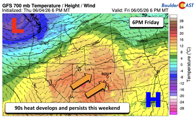
Premium BoulderCAST Daily – Fri 06/05/26 | A streak of 90s set in through the weekend

Astreak of the 90s will take over to end our week and start the weekend as temperatures soar to near 90 today and the lower to middle 90s this weekend into early next week. The temperature airmass aloft will be some 2-3 standard deviations above normal. As mentioned, we'll top out basically near 90 this afternoon. Most of the day …

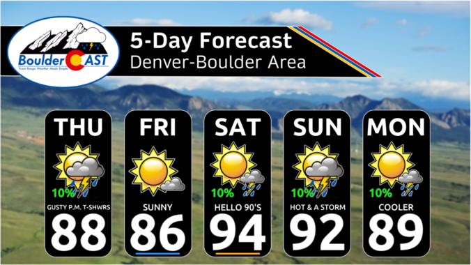
Premium This Weekend in Colorado Weather: Early-Season Heat Ramps Up — First 90s of the Year on the Horizon

Awarming and drying trend locks in for the rest of the week as mid‑level ridging expands northeast out of the Desert Southwest. On Thursday we sit ahead of the ridge under west–northwest flow, which still supports some modest afternoon convection. By Friday, the ridge axis shifts directly overhead, actively suppressing vertical motion and shutting down meaningful thunderstorm development. Over the …

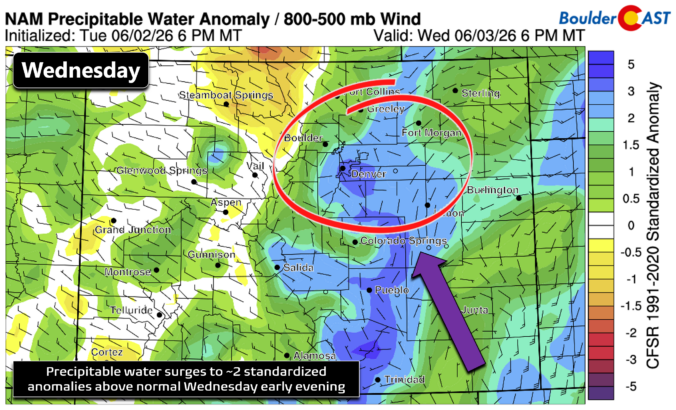
Premium BoulderCAST Daily – Wed 06/03/26 | Scattered P.M. storms again as moisture peaks for the week

Relatively weak westerly flow stays locked over northern Colorado today, with 500 mb winds only 10–20 MPH as the larger‑scale pattern keeps all meaningful dynamics well away from the state. The one feature of note is a weak disturbance lifting out of Texas, which should help boost thunderstorm coverage across far southeast Colorado later today and tonight. Across the Front …

Premium BoulderCAST Daily – Tue 06/02/26 | Storms Reload This Afternoon, But With Noticeably Less Bite

An impressive severe‑weather outbreak hammered northeast Colorado on Monday, with parts of Denver briefly looking like winter as hail piled up several inches deep. The dominant hail‑producing supercell tracked almost perfectly along I‑70 through the afternoon, clipping downtown Denver, rolling through Aurora, and then unloading across the eastern Plains. Widespread severe hail reports came in, especially from the Denver storm …

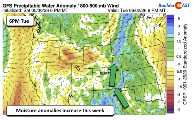
Premium BoulderCAST Daily – Sun 05/31/26 | Dry and warm today but rain chances increase this week

The Front Range is largely dry today as westerly downslope flow sets up across the state. However, we cannot rule out a widely isolated shower, though that will be quite hard to find. The best chance would be over the High Country and Foothills. That dry and sunny weather is going to promote warm temperatures this afternoon in the lower …

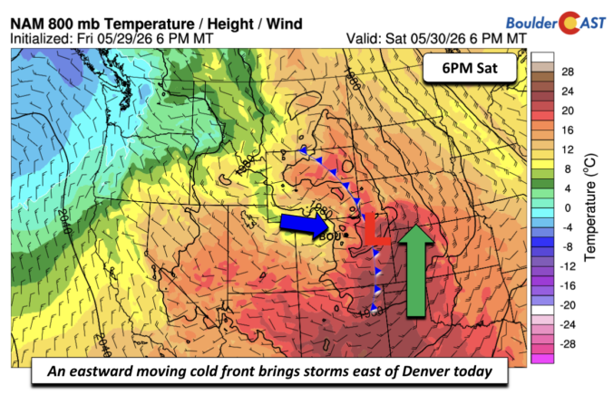
Premium BoulderCAST Daily – Sat 05/30/26 | A stray shower today as most activity resides well east of Denver

Astrong cold front will advance through later today and tonight. Aloft, a mid-level low pressure system will set up shop over northeastern Colorado, effectively robbing Denver from seeing the storms. All the lift and focus will stay over eastern Colorado and Kansas, where moisture is plentiful. This is not to say that we cannot rule out a few afternoon isolated …

Premium BoulderCAST Daily – Fri 05/29/26 | A Marginal Risk of Severe Isolated Storms

An area of low pressure tracks into Utah and Wyoming over the next 24-48 hours, along and to the west of Colorado. As that happens, it will bring the threat of some isolated to scattered afternoon to early evening showers or storms. Today, that isolated storm threat will largely be focused in the Noon to 4PM timeframe as the HRRR …

« Older posts Newer posts »