Category: BoulderCAST Daily (Page 155 of 465)

This page contains an index of our BoulderCAST Daily forecast updates. If you are NOT a Premium member, you will only see a tiny sample of this content below. Subscribe to BoulderCAST Premium to gain access to all of our daily forecasts which get published every morning.
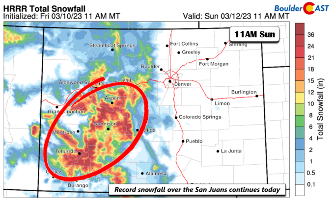
BoulderCAST Daily – Sat 03/11/23 | Record snowfall for the San Juans; near 50 on the Plains behind a cold front

Acold front moved through earlier this morning. A surface low is present across northwestern North Dakota. Behind the front, upslope flow will be over the Plains with cooler temperatures close to 50 degrees. Some upper 40s may be present as well as partly to mostly cloudy skies persist under an atmospheric river still slowly weakening. The surface low to our …

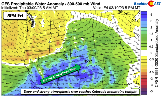
BoulderCAST Daily – Fri 03/10/23 | Strong Atmospheric River engulfs Colorado tonight for high country snowfall; warm and gusty on the Plains

Astrong storm system currently over the Pacific Northwest over Washington and Oregon this afternoon will continue to pummel California and the west coast of the US today. Increasing clouds will spread into Colorado today as moisture from the system approaches. The storm system will race into eastern Montana by Saturday morning, at which point a cold front will move through …

Colorado Weekend Weather Outlook: March 9, 2023

The main shortwave trough axis has passed to the east of Denver early this morning bringing just a few snow showers to the Mountains and the far eastern part of the state. Dry and subsident northwest flow in the trough's wake is already starting to rapidly carve away the deck of stratus clouds across the Metro area from northwest to …

BoulderCAST Daily – Wed 03/08/23 | Overcast and cold today, strong winds take hold tomorrow

Southeasterly upslope flow and cooling temperatures overnight have once again forced low clouds and patchy freezing mist upon the area, but for the most part this has been confined to Larimer and Weld Counties. Surface visibility observations early this morning show that the primary trouble spots are indeed up along the Wyoming Border region. There could be a few slightly …

BoulderCAST Daily – Tue 03/07/23 | Gloomy, foggy, freezy & misty

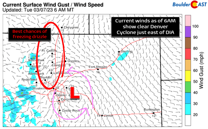
Upslope and low-level moisture have intensified overnight across eastern Colorado with low clouds, fog and freezing drizzle/mist developing across much of the Front Range. GOES-East satellite shows that almost everywhere east of the Continental Divide is socked into the stratus deck this morning, up to around 9000 feet elevation or so (white shading below is beneath the upper-level clouds). Current …

BoulderCAST Daily – Sun 03/05/23 | Red Flag Warning in effect under warm, dry, and breezy conditions
Astrong 150-mph west-east oriented jet streak stretches from central California into Kansas today. The strong winds tied to the jet are from California into central Colorado. The flow is largely perpendicular to the mountain range, promoting strong downslope flow over the Plains east of the Divide. The storm system tied to the jet is over the northern Great Plains. Both …

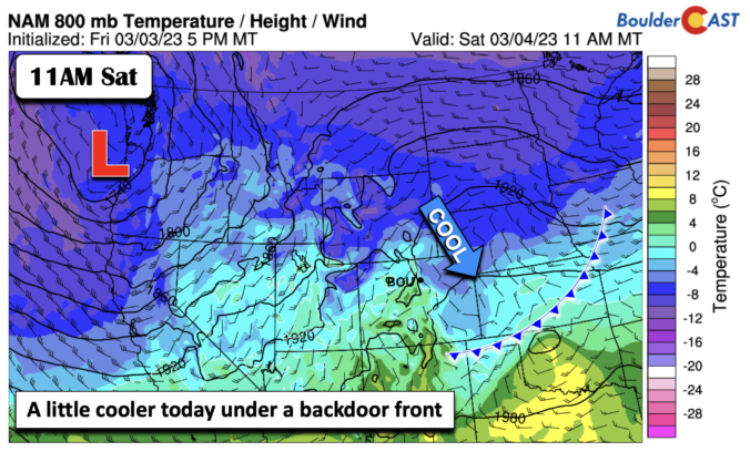
BoulderCAST Daily – Sat 03/04/23 | Temperatures in the low to middle 40s

Abackdoor cold front slid through earlier this morning from the north. The front is currently situated over Kansas and Texas. In response, the Front Range is in a east-southeast upslope flow. This along with increasing clouds later this afternoon, should keep temperatures on the lower side today relative to Friday in the low to middle 40s. Some gusty winds may …

« Older posts Newer posts »