Category: BoulderCAST Daily (Page 102 of 465)

This page contains an index of our BoulderCAST Daily forecast updates. If you are NOT a Premium member, you will only see a tiny sample of this content below. Subscribe to BoulderCAST Premium to gain access to all of our daily forecasts which get published every morning.
Premium BoulderCAST Daily – Sat 06/15/24 | Hot and dry weather returns this weekend

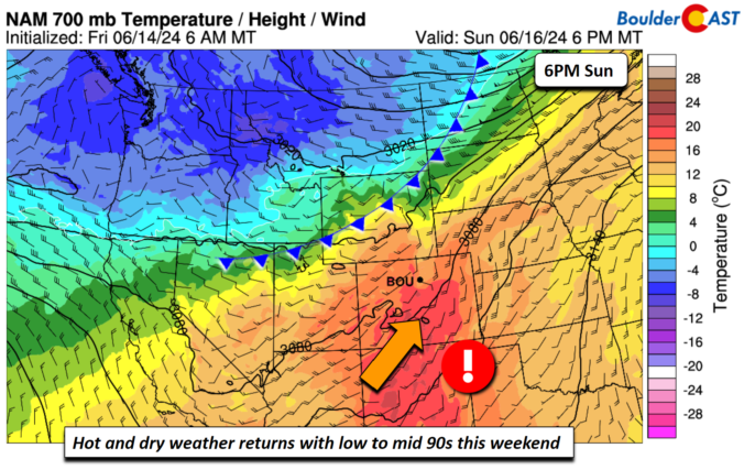
Hot and dry weather returns this weekend as dry west to southwesterly flow takes over. Today, ridging exists over the southeastern U.S., while troughing exists across the Pacific Northwest. Sandwiched in between is a trough/shear axis over the central Plains to Midwest. Over us, we'll see that downslope flow, spelling out largely dry conditions and warmer weather in the lower …

Premium BoulderCAST Daily – Fri 06/14/24 | Widespread showers and storms, some being severe

Deep and anomalous moisture will spread northward as a mid-level cut-off low moves overhead from Arizona this afternoon and evening. Precipitable water values will exceed some 3 standard deviations above normal for this time of year. Temperatures will be cooler due to increasing rain chances and and cloud cover, with highs in the low to mid 80s. Showers and thunderstorms …

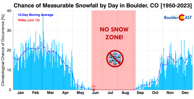
Premium BoulderCAST Daily – Wed 06/12/24 | Back into the scorching 90s today & tomorrow, but climatologically snow may be closer than you think!

Lots of dry (and also hot) air is present over the southwestern United States today, as seen from GOES-East water vapor imagery. The mid-latitude jet stream is well north across Canada, while the subtropical jet is well to the south. In between, we have largely quiet conditions across most of the West right now and most of northern Mexico. This …

Premium BoulderCAST Daily – Tue 06/11/24 | Mostly dry with seasonal temperatures, but brace for a push deep into the 90s the next couple days

The shortwave disturbance which brought a wave of weak showers and storms to the area yesterday has exited off to our south and east, just barely clinging to the far southeast corner of Colorado as of early this morning. Behind this system, a fetch of drier air is working into the region from the northwest and this will lead to …

Premium BoulderCAST Daily – Sun 06/09/24 | Anomalous moisture brings the threat of heavy rainfall and severe storms

Ahighly anomalous moist atmosphere will build into the Front Range this afternoon and evening from the eastern part of the state. With high pressure to our east and low pressure in the desert southwest, a moist south-southeasterly flow will advect into the region precipitable water values upwards of 1.2 to 1.4 inches, about 4 or so standard deviations above normal! …

Premium BoulderCAST Daily – Sat 06/08/24 | Severe thunderstorms capable of wind and large hail today
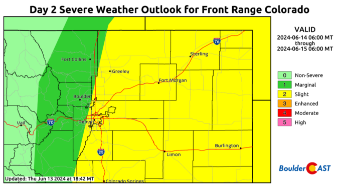
Amarginal to enhanced risk of severe storms is in place today, with the greatest severe risk east of Denver from Fort Morgan to Limon to Burlington, as shown below. A mid-level shortwave trough over Utah/Wyoming will track ESE into north-central Colorado this afternoon before reaching Nebraska and Kansas later today and tonight. At the surface, a cold front pushed through …

Premium BoulderCAST Daily – Fri 06/07/24 | Heat and showers/storms to end the work week and start the weekend

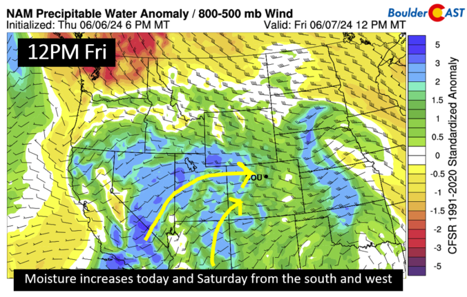
Moisture in the mid and upper levels of the atmosphere will be on the rise today and into the weekend as a south and west flow dominates. A trough to our north and closed low near Baja will favor moisture increasing from the Pacific region. This along with a southward moving cold front this evening will increase our chances of …

« Older posts Newer posts »