Category: Climatology (Page 29 of 63)
These posts contain information about the long-term weather patterns of Boulder County. Potential topics may include 30-day weather outlooks, El Nino/La Nina, and seasonal forecasts. You will find less about the day-to-day weather, with more focus on longer trends and patterns.
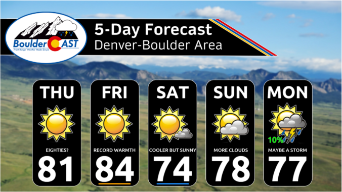
The week ahead will usher in persistent unseasonable warmth and sunshine to Front Range Colorado. There’s a better chance of setting record high temperatures this week than there will be to see any kind of precipitation. We are watching a couple of cold fronts, but they will be the dry variety with temperatures not even dropping below normal on their backside. Upper-level ridging will continue to push in from the West Coast for the weekend keeping things pleasant and dry through at least Sunday for our area. As you might imagine, there’s no chance of snow or additional sub-freezing temperatures in the pipeline.
Key Messages:
- The Colorado Buffaloes football game Friday night in Boulder begins at 8PM — there will be nice weather but cold with temperatures in the 30s throughout the game under clear skies
- The first hard freeze of the season is possible but is now looking less likely for the Metro area Friday night as high clouds will move in overnight
- The same clouds will be be around early Saturday morning, possibly impacting the view of the annular solar eclipse
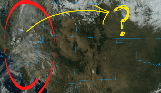
The first real storm of the season is heading towards Colorado, but unfortunately it will track too far north limiting the overall impacts to the Denver Metro area. While the Mountains are poised to receive plenty of snow from this system, the lower elevations will see just a little bit of rain alongside gusty downslope winds. In the wake of the storm, temperatures are expected to drop below freezing Friday night bringing an end to the growing season for many plants. Let’s take a look at the latest timing of the rain and snow and discuss the drastic change in temperatures headed our way!
Continue reading
All is quiet to kick off the week in the Front Range with high pressure in place across the Rockies. Temperatures will start out close to 80 degrees Monday and Tuesday but that won’t last long. All eyes are on a potent autumn storm system moving in from the Pacific Northwest later this week. Model uncertainty is somewhat high in regards to the storm’s track, but consensus currently would indicate a decent chance of rain in the Denver Metro area with snow possible along the Wyoming border and in our nearby Mountains. Things could certainly change as we get closer though. Either way, it will be a colder end to the week with the first freeze of the season possible Friday and/or Saturday mornings.
September 2023 was an overall warm and dry month in Boulder, but technically we did finish with above normal precipitation. Almost all of that came on a single day as a result of a locally heavy thunderstorm. We’re yet to see a real autumn storm in the Front Range and as a result it hasn’t snowed yet outside of the Mountains, which is fairly normal with our average first snowfall not coming until mid October. Here’s a quick and colorful graphical recap of our weather during September and how it relates to climatology.
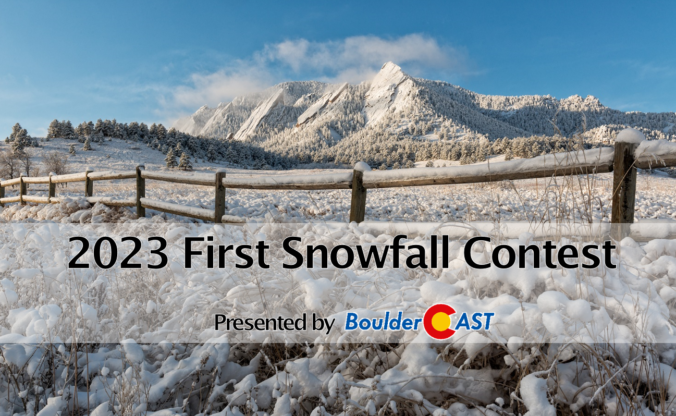
9th Annual BoulderCAST First Snowfall Contest
Are you eager for the first snow of the season? Have you already waxed your skis and purchased your Epic Pass? Our first big snow could be right around the corner! Mother Nature has been throwing wrenches into this annual contest the last few years making an accurate prediction for our first snowfall a monumental challenge! What’s in store for 2023? We provide a brief overview of Boulder’s first snowfall climatology and then pose a question…“When will Boulder’s first measurable snow occur this year?” Submit your guess for a chance to win an assortment of prizes. Those who get closest to the date and amount of our first snow win..
BOULDERCAST 2023 FIRST SNOW CONTEST ENTRY FORM
*Sorry but this contest is now closed to entries*


Live View of Boulder

Current Conditions

Live Radar

Recent Premium Posts

This Weekend in Colorado Weather: Red Flag Conditions Thursday, a cooler weekend ahead, and chances increase for a record late first snowfall
🔥 Windy with fire danger Thursday: Gusts of 20–30 MPH across the Metro …
October 2025 Graphical Weather Review: A warm & dry month that prolonged the growing season, delayed our first snow
October 2025 was definitively warm and dry throughout the Front Range with the …
BoulderCAST Daily – Wed 11/05/25 | Relatively cooler today, but far from cool by November standards
🌡️ Cooler but still mild today: A weak cold front has pushed south, …
3-Day Forecast

LATEST SMOKE FORECAST

Trending Content


© 2025 Front Range Weather, LLC