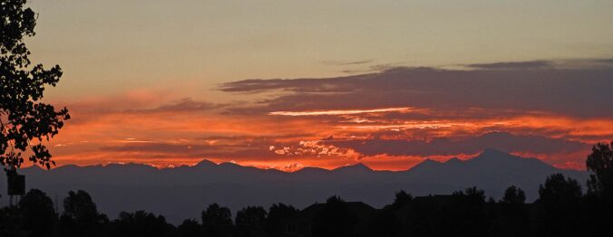
September 2023 was an overall warm and dry month in Boulder, but technically we did finish with above normal precipitation. Almost all of that came on a single day as a result of a locally heavy thunderstorm. We’re yet to see a real autumn storm in the Front Range and as a result it hasn’t snowed yet outside of the Mountains, which is fairly normal with our average first snowfall not coming until mid October. Here’s a quick and colorful graphical recap of our weather during September and how it relates to climatology.
Author: BoulderCAST Team (Page 13 of 45)
This post had major contributions from at least two members of our team. The more meteorologists the better, right?
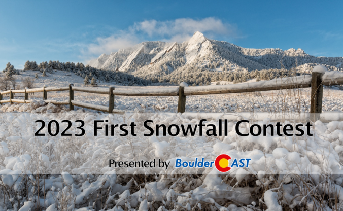
9th Annual BoulderCAST First Snowfall Contest
Are you eager for the first snow of the season? Have you already waxed your skis and purchased your Epic Pass? Our first big snow could be right around the corner! Mother Nature has been throwing wrenches into this annual contest the last few years making an accurate prediction for our first snowfall a monumental challenge! What’s in store for 2023? We provide a brief overview of Boulder’s first snowfall climatology and then pose a question…“When will Boulder’s first measurable snow occur this year?” Submit your guess for a chance to win an assortment of prizes. Those who get closest to the date and amount of our first snow win..
BOULDERCAST 2023 FIRST SNOW CONTEST ENTRY FORM
*Sorry but this contest is now closed to entries*
August 2023 ended up warmer and wetter than normal in Boulder — an uncommon pair of outcomes indeed. The summer monsoon failed to produce consistent precipitation across the state throughout the whole month (woefully dry in the middle), but most areas made out alright with drought still thankfully absent from eastern Colorado. The month had 14 90-degree days bringing the total count to 30 days year-to-date. Elsewhere, a DVD-sized hailstone that fell in far eastern Colorado was confirmed to be a new state record. Here’s a quick and colorful graphical recap of our weather during August and how it relates to climatology.
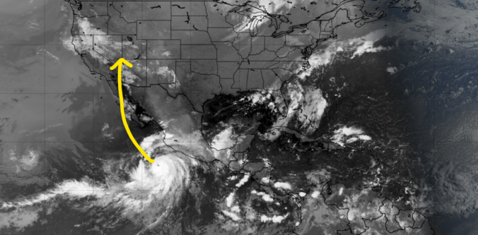
A ridge of high pressure will remain in control of Colorado through the extended and even intensifies this weekend keeping us mostly dry and hot. The best chance of rain in the pipeline comes on Friday, but only limited rainfall is expected from storms due to a lack of moisture. Additionally, the remnants of major Hurricane Hilary in the Eastern Pacific will arrive to the USA this weekend but stay well to the west of Colorado unfortunately (boo!). Things dry out further this weekend into early next week as temperatures once again make a run towards triple digits in the Denver Metro area.
Temperatures and precipitation ended up about as close to normal as possible for July in Boulder. The month began active with numerous severe weather outbreaks, some of which produced landspout tornadoes in parts of Denver. The last few weeks turned up the heat with a total of fifteen 90-degree days during the month. Here’s a quick and colorful graphical recap of our weather during July and how it relates to climatology.
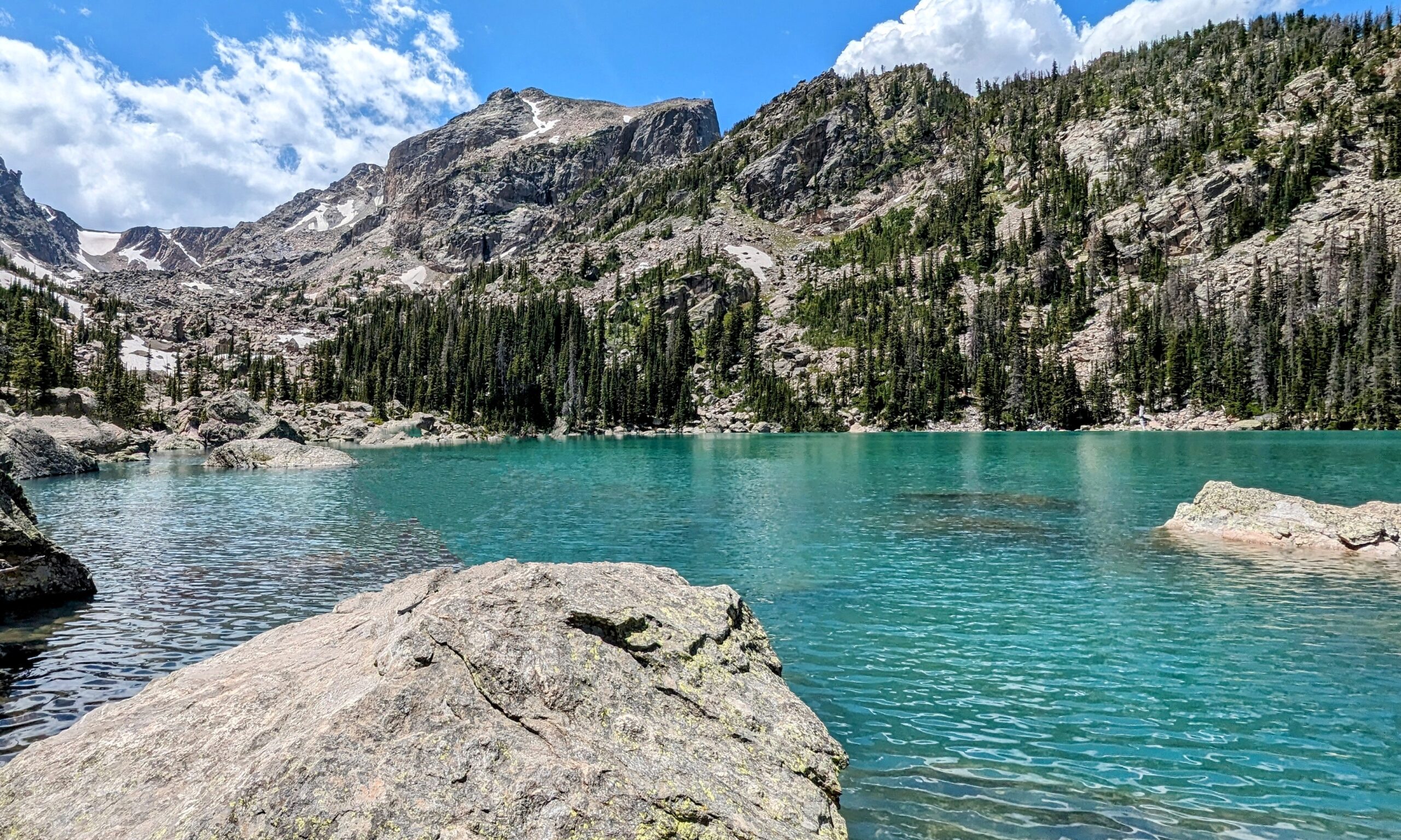
May 2023 dumped more than five inches of rain on Boulder and concluded as the 11th wettest May since the late 1800s. Though there were no exceptionally warm days, the month did see an above normal mean temperature, breaking a streak of cold months stretching back to November. Other monthly headlines included multiple severe weather outbreaks and of course the thick wildfire smoke from Canada which created days of degraded air quality. Here’s a quick and colorful graphical recap of our weather during May and how it relates to climatology.
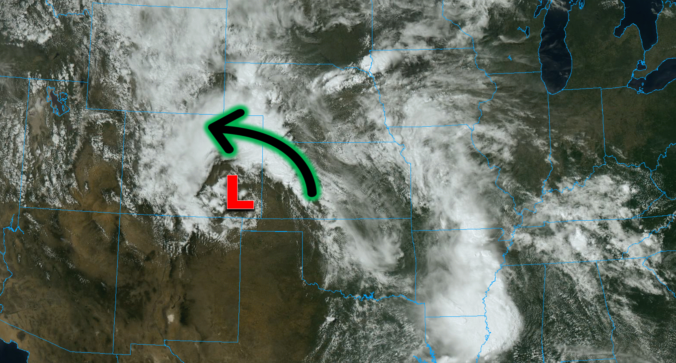
This was undoubtedly a wild week in Front Range weather — but one which resulted in multiple good outcomes. The extreme severe weather outbreak planned for midweek got partially busted by low clouds and fog which may have ultimately saved it from becoming the costliest hailstorm in state history. Further, the deluge of rain that dumped to close out the week will go a long way towards eradicating much of the ongoing drought in the eastern half of the state. Let’s take a look back at this crazy week in Colorado weather!
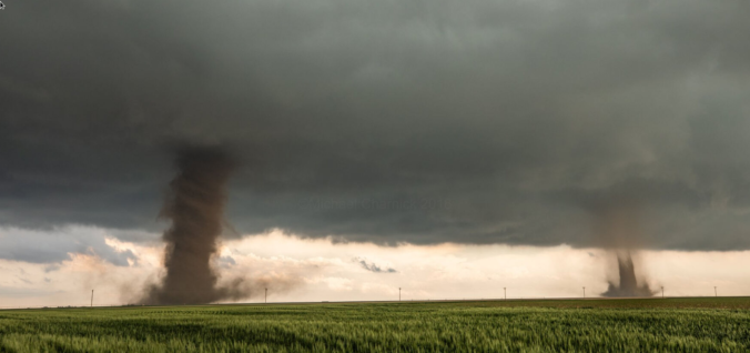
One of the most widespread Front Range severe weather outbreaks in recent memory is taking shape on Wednesday, though we still have some concerns. Two-inch hail, damaging winds and a few tornadoes are likely across eastern Colorado on Wednesday. Before that however, there will be another more uncertain bout of severe weather Tuesday night for the northern Front Range with big hail the main concern. Let’s get into this two-folded complex forecast!

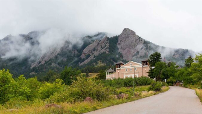
Live View of Boulder

Current Conditions

Live Radar

Recent Premium Posts

BoulderCAST Daily – Sun 01/11/26 | A mild Sunday with readings reaching the 50s
🌤️ Mild & Melty Sunday: Light winds and patchy clouds, with lingering snowpack …
BoulderCAST Daily – Sat 01/10/26| Widespread sunshine and moderating temperatures this weekend as our recent snow melts off
🌤️ Calm Saturday: Winter storm systems have departed the state, leaving behind a …
BoulderCAST Daily – Fri 01/09/26| Snow ends quickly this morning with a quieter weekend in store
❄️ Overnight snow bands: A second push of upslope after midnight sparked narrow …
3-Day Forecast

Trending Content

© 2026 Front Range Weather, LLC