Author: Ben Castellani (Page 88 of 301)
Ben grew up in southwestern Pennsylvania and holds both a bachelor's and a master's degree in Meteorology, the latter being from CU Boulder. His hometown received nearly three feet of snow from the Storm of the Century back in March of 1993, sparking his initial interest in impactful weather. Ben currently works on remote sensing and data analysis software at NV5 Geospatial Software in Boulder.
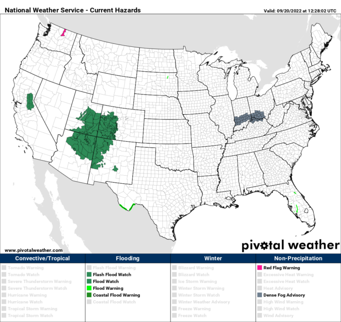
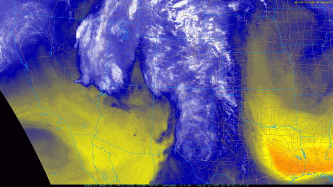
⦁❶⦁ Remnant tropical moisture from once-Hurricane Kay is fully-entrenched across the state today
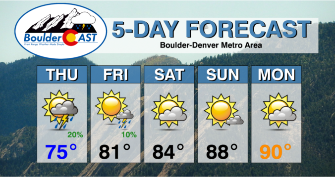
⦁❷⦁ Widely scattered afternoon and evening showers and storms expected with highs around 80 degrees
⦁❸⦁ The moisture lingers through Friday and so too will the (slight) rainfall chances
⦁❹⦁ A deep trough develops along the West Coast this weekend but it may never reach Colorado
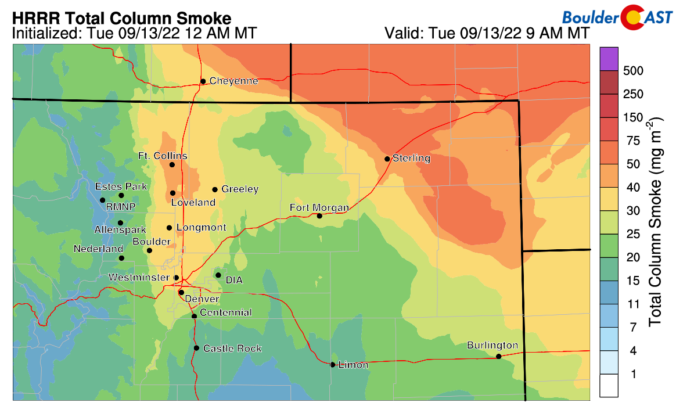
After setting multiple record high temperatures during the heatwave last week followed by a pleasantly cooler weekend, this week our temperatures will stay mostly above normal with some chances for rain mixed in as the remnants of Hurricane Kay pass across the Rockies. The week will end warm and mostly dry with that same trend continuing through the upcoming weekend. Let’s take a look at the weather week ahead for the Front Range.
The extreme heatwave unfolding across the West continues in full-force for one more day in Colorado. Unfortunately, the hottest temperatures thus far still lie ahead on Thursday alongside elevated fire danger. The end is in sight though — two cold fronts bring a taste of autumn this weekend. We discuss how hot it will get Thursday, the timing of the big changes, and just how chilly it will be this weekend.

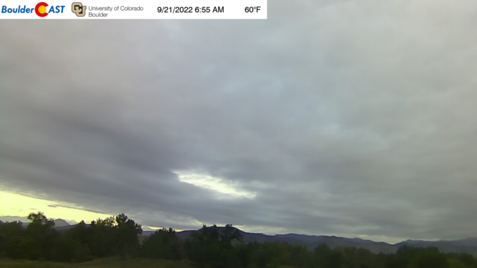
Live View of Boulder

Current Conditions

Live Radar

Recent Premium Posts

BoulderCAST Daily – Tue 04/28/26 | Staying cool with a couple showers, the late-week storm is still the main event despite trending south
🌧️ Morning wave = main show, with light rain showers and Foothills wet …
BoulderCAST Daily – Sun 04/26/26 | Showers and some storms later today and this evening
🌧️ A wet afternoon and early evening, with showers and a few rumbles …
BoulderCAST Daily – Sat 04/25/26 | Cooler today and wet Sunday into early next week
🌧️ A wet latter part of the weekend, with showers and a few …
3-Day Forecast

Trending Content

© 2026 Front Range Weather, LLC