Author: Ben Castellani (Page 68 of 303)
Ben grew up in southwestern Pennsylvania and holds both a bachelor's and a master's degree in Meteorology, the latter being from CU Boulder. His hometown received nearly three feet of snow from the Storm of the Century back in March of 1993, sparking his initial interest in impactful weather. Ben currently works on remote sensing and data analysis software at NV5 Geospatial Software in Boulder.
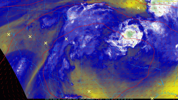
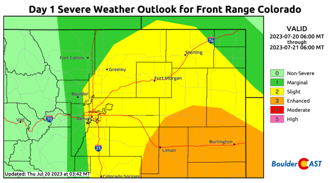

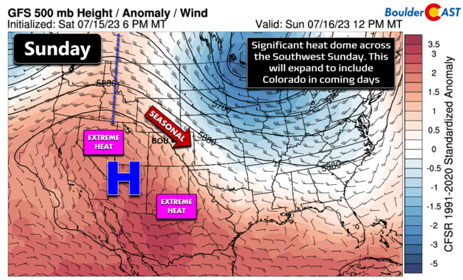
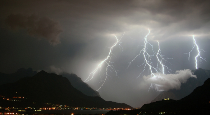
The weather this week in the Front Range will have two contrasting primary themes. A heat dome cooking beneath a large ridge of high pressure off to our southwest will push temperatures towards record highs Monday and Tuesday. However, the rest of the week will exhibit a cooling trend with increasing chances for late-day thunderstorms as several backdoor cold fronts team up with increasing monsoonal moisture. Yes, the famed monsoon season is about to commence! In typical fashion though, there will also be a risk of some severe weather mixed in. Let’s take a look at what should be yet another interesting weather week…
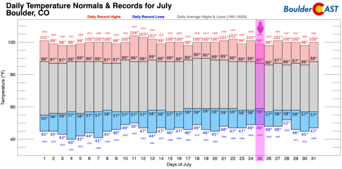
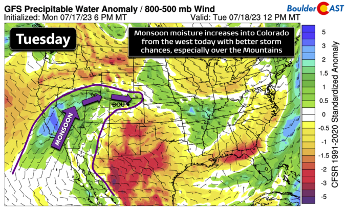
The Front Range has managed to ink out a cool and wet summer so far, but that wasn’t at all due to the monsoon. We discuss what has been causing the cool/wet weather of late and look ahead to when monsoon season may actually commence in Colorado. Spoiler alert: it’s sooner than you might think, but there’s a bit of a catch!

Live View of Boulder

Current Conditions

Live Radar

Recent Premium Posts

BoulderCAST Daily – Sun 05/31/26 | Dry and warm today but rain chances increase this week
🌦️ Overall dry and warm Sunday, though cannot rule out a very widely …
BoulderCAST Daily – Sat 05/30/26 | A stray shower today as most activity resides well east of Denver
🌦️ Spotty showers today, mainly well east of the Denver Metro area, where …
BoulderCAST Daily – Fri 05/29/26 | A Marginal Risk of Severe Isolated Storms
🌦️ Spotty showers this afternoon, mainly noon and 4 PM, with highs in …
3-Day Forecast

Trending Content

© 2026 Front Range Weather, LLC