

Author: Ben Castellani (Page 61 of 358)

Ben grew up in southwestern Pennsylvania and holds both a bachelor's and a master's degree in Meteorology, the latter being from CU Boulder. His hometown received nearly three feet of snow from the Storm of the Century back in March of 1993, sparking his initial interest in impactful weather. Ben currently works on remote sensing and data analysis software at NV5 Geospatial Software in Boulder.
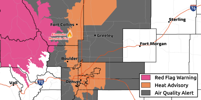
Premium BoulderCAST Daily – Wed 07/31/24 | The heatwave rages for at least another week as more wildfires ignite in the Front Range and smoke piles up

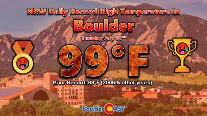
Boulder set a new daily record high temperature on Tuesday soaring to a cozy 99°F during the early afternoon hours. The prior record was 98°F last set in 2006. Denver hit 100° (again!) but this was not a record for the date. Fortunately Tuesday was the only day this week that we were really concerned about record heat. The overnight …

Premium BoulderCAST Daily – Tue 07/30/24 | Near-record heat once again before thick smoke from California arrives late tonight behind a “cold” front

Today's weather in the Front Range will be almost identical to Monday's with completely sunny skies and near-record highs possible as our heatwave marches on --- it's not stopping for anyone. A large swath of exceptionally dry air remains over most of Colorado today, blowing in with the west-southwest aloft. This is shown by the yellow shading in the GOES-East …

Premium This Weekend in Colorado Weather: Canadian smoke finally vacates the area on Friday! Unfortunately prolonged extreme heat will be its replacement…

The amplified mid-level ridge of high pressure across the West will continue to funnel smoke into Colorado today. Notice how the flow aloft is coming directly from the Canadian prairies southward into the Front Range. However, there is a closed-low pressure coming out of the Pacific Northwest along the Canadian border. This low pressure is ultimately what will cut-off the …

Premium BoulderCAST Daily – Wed 07/24/24 | Air quality improves slightly in the days to come, but worsening heat will keep things uncomfortable

We're happy to report that the end of the thick smoke is in sight across the Front Range. We should see some slight improvement today compared to Tuesday (which looks to have been the worst day of the week), with further improvement expected tomorrow before even more drastic clearing Friday into the weekend. The latest ground-level smoke forecast from the …

Premium BoulderCAST Daily – Fri 07/19/24 | PM thunderstorms today and tomorrow with highs in the 80s, choking Canadian smoke arrives late in the weekend

High pressure is currently located across Arizona with north-northwest flow residing over the Front Range. This is seen in the morning GOES-East water vapor loop below. Note that despite the big high pressure, a fair amount of monsoon moisture is trapped inside the ridge. This will provide the fuel for storms today (and throughout the upcoming weekend). Furthermore, a shortwave …

Premium This Weekend in Colorado Weather: Below normal temperatures, smoky skies & continued rainfall chances will accompany atypical due northerly flow through the weekend

Following yesterday's disappointing rain output, skies are mostly clear this morning across Colorado as seen from the GOES-East's visible satellite animation: Mostly clear is not entirely accurate, though, as there is plenty of smoke filling our skies. Check out the latest view from the Alpine Visitor Center in Rocky Mountain National Park below. Yuck! Thick smoke from wildfires in the …

« Older posts Newer posts »