Author: Ben Castellani (Page 60 of 358)

Ben grew up in southwestern Pennsylvania and holds both a bachelor's and a master's degree in Meteorology, the latter being from CU Boulder. His hometown received nearly three feet of snow from the Storm of the Century back in March of 1993, sparking his initial interest in impactful weather. Ben currently works on remote sensing and data analysis software at NV5 Geospatial Software in Boulder.
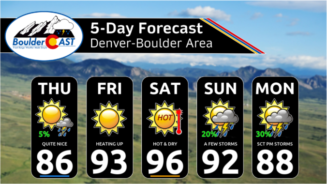
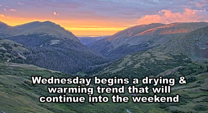
Premium This Weekend in Colorado Weather: The monsoon rains are over (for now) with hotter & drier weather in-store for the weekend

After several wet outings in a row, we will dry out for a few days with high pressure and drier air building to Colorado from the southwest. GOES-East water vapor imagery this morning shows the swath of dry air over the Four Corners associated with the approaching high pressure. Several disturbances are noted riding around the northern periphery of the …

Premium BoulderCAST Daily – Wed 08/14/24 | Scattered late-day storms stick around today before drier weather ensues for the days ahead

Tuesday's promised explosion of monsoon thunderstorms, flooding, and severe weather developed right on schedule during the afternoon and evening hours. Despite widespread storms, most areas picked up less than 0.5" of moisture yesterday, save for a few locations that got hammered by heavy rain for more than 30 minutes. The 0.3" of rain that fell in Boulder brings us above …

Premium BoulderCAST Daily – Tue 08/13/24 | Monsoon will be in full-force today with widespread PM storms, some producing flash flooding, hail & damaging winds

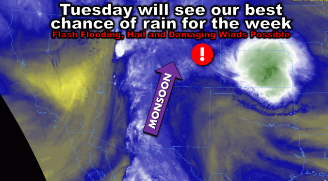
Today will offer up the best chance of rain for the week --- with storms that form capable of producing flash flooding, large hail, and damaging winds across the area. This morning's GOES-East water vapor animation below shows a continued strong flow of monsoon moisture northward into Colorado. This will set the stage for the significant rain chance today with …

Premium This Weekend in Colorado Weather: The nineties are a thing of the past with showery & cool weather the next few days!

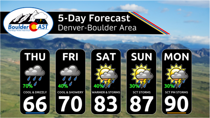
Just before sunrise, low clouds arrived to the Front Range with a moist surge of easterly upslope flow early this morning. The current scene in Boulder is a gloomy one: You can see this development in the GOES-East nighttime microphysics animation below, with stratus clouds engulfing Boulder and Denver between 4 and 5AM (white shading). There are some pockets of …

Premium BoulderCAST Daily – Wed 08/07/24 | Temperatures quickly soar into the 90s before rain & a cold front arrive! We’ll be ~30° colder tomorrow!

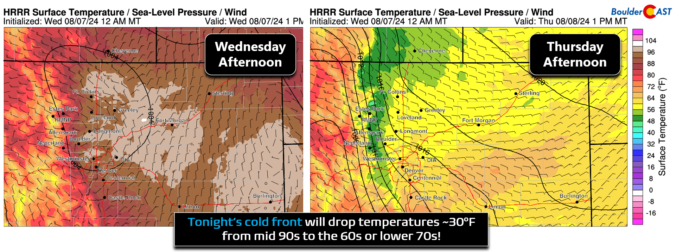
Happy Wednesday, folks! Today's the day we've all been waiting about two weeks for --- the final day of the ongoing and prolonged heatwave as a significant cooldown arrives behind a cold front tonight. Unlike most of our recent fronts, this one is the REAL deal! We will have another hot day with a round of scattered afternoon and evening …

Premium BoulderCAST Daily – Tue 08/06/24 | Two more hot days with thunderstorms before cooler (and smokier) air arrives Thursday

Yesterday saw the development of showers and thunderstorms across the Denver Metro, aided by the evening arrival of a weak shortwave from the west. Some areas saw more than a half inch of rainfall (south of Denver). Most locations generally picked up less than a quarter inch, though. Water is water though! A flattened ridge of high pressure still resides …

This Week in Colorado Weather: August 5, 2024

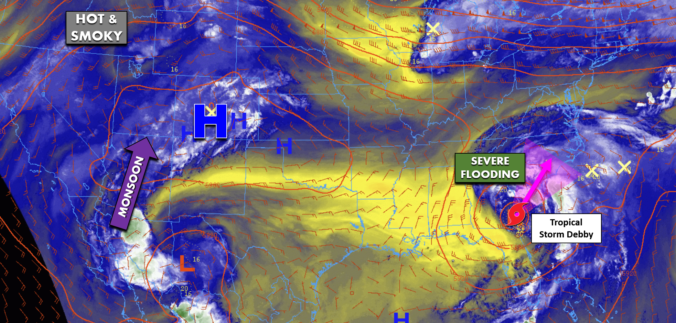
Our scorching hot, two-week-long heatwave will finally come to an end later this week, but not before we endure a few more days. A cold front is slated to arrive into the Denver area late Wednesday finally knocking us out of the 90s. This front will also come with an enhanced chance of rainfall, though monsoon moisture is still largely lacking. Despite daily chances for rain this week, our existing fires will continue to smolder and the risk of new fire ignitions remains uncomfortably high.

Continue reading

« Older posts Newer posts »