A short review of the tiny snow totals from Monday night into Tuesday morning.
Author: Ben Castellani (Page 159 of 301)
Ben grew up in southwestern Pennsylvania and holds both a bachelor's and a master's degree in Meteorology, the latter being from CU Boulder. His hometown received nearly three feet of snow from the Storm of the Century back in March of 1993, sparking his initial interest in impactful weather. Ben currently works on remote sensing and data analysis software at NV5 Geospatial Software in Boulder.

A continued flow of weak weather systems into Colorado this week will lead to a duet of light snow chances and unseasonably cold temperatures through mid-week. However, things take a much warmer turn heading into the weekend.
Update (Mon 2/17/20 3:00 PM): Added our official snowfall forecast map for light snow falling Monday evening and night.
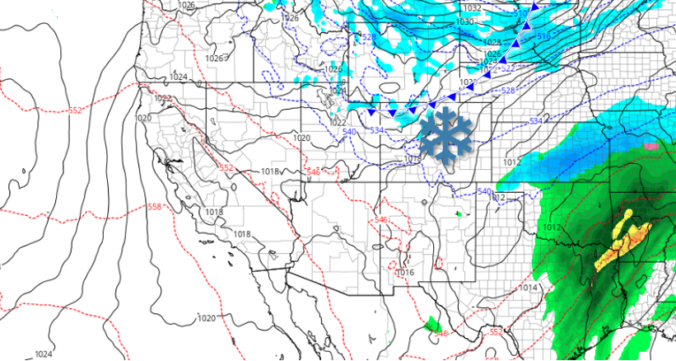
Models finally came into a snowy agreement last evening and unfortunately this means we have another round of snow to deal with Wednesday afternoon and evening, one which may turn out quite similar to what transpired on Monday. Read on for our full forecast, including when the snow will start and how much to expect in your area.

Live View of Boulder

Current Conditions

Live Radar

Recent Premium Posts

BoulderCAST Daily – Sun 05/03/26 | Beautiful weather will transition to late-spring snow by Tuesday!
☀️ Warm Start: Expect a quiet and pleasant start to the week, with …
BoulderCAST Daily – Sat 05/02/26 | A pleasant and warm first weekend in May
☀️Warming up for the first weekend in May, with upper 60s to near …
BoulderCAST Daily – Fri 05/01/26 | Warming up this weekend
🌡️ Warming up this weekend, from the upper 50s-60 today to the upper …
3-Day Forecast

Trending Content

© 2026 Front Range Weather, LLC