Author: Ben Castellani (Page 158 of 358)

Ben grew up in southwestern Pennsylvania and holds both a bachelor's and a master's degree in Meteorology, the latter being from CU Boulder. His hometown received nearly three feet of snow from the Storm of the Century back in March of 1993, sparking his initial interest in impactful weather. Ben currently works on remote sensing and data analysis software at NV5 Geospatial Software in Boulder.

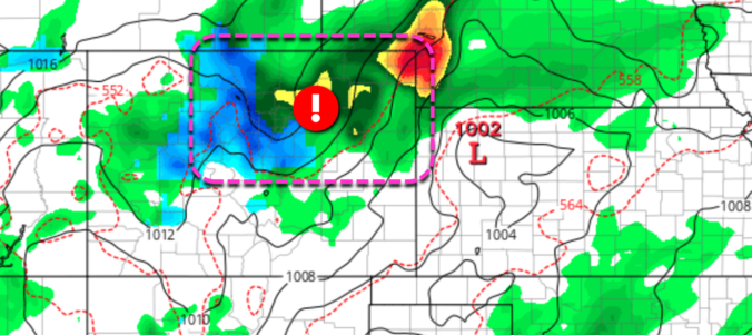
Forecast Update: Severe thunderstorms possible Sunday afternoon, soaking rain and Foothills snow Sunday night into Monday

After our first real taste of summer the last few days, the weather will revert to more seasonal conditions Sunday into Monday. For Front Range Colorado in early May, that means severe weather, soaking rainfall and snow in the higher terrain. Let’s take a look at the latest on the stormy, soggy and snowy weather about to unfold!

Continue reading

BoulderCAST Daily – Fri 04/30/21 | Sunny & 80 today, watching a soggy/snowy system late in the weekend

HDetailed Forecast Discussion: igh pressure continues to dominate the weather for the western half of the country today. As you can see in the GOES-East satellite animation from this morning, Colorado and Arizona are the only two cloud-free states right now! The cloudless trend will continue through the day with high temperatures warming to near 80 degrees. A few high …

BoulderCAST Daily – Thu 04/29/21 | Warming up significantly as high pressure builds

BDetailed Forecast Discussion: eneficial moisture dumped across all of northeast Colorado this week, with a huge area seeing more than 1" of moisture and localized spots picking up in excess of 3" of rain from slow-moving thunderstorms on Tuesday. As you can see in the precipitation analysis below, the bullseye was well northeast of our area. We still did quite …

BoulderCAST Daily – Wed 04/28/21 | Morning showers with a cool day to follow

RDetailed Forecast Discussion: ain fell through the entire night in many areas, with snow generally remaining above 6000 feet. At BoulderCAST Station (5550 feet elevation), we got down to 37°F under a band of moderate rain around 4:00AM, but didn't note any snowflakes mixing in at all. A look around regional webcams shows a good bit of accumulation in the …

Forecast Update: Thunderstorms, soaking rain, and heavy Foothills snow over the next 36 hours

Change is happening NOW! After a few days close to 80 degrees in Boulder and Denver, temperatures will tumble today into the 50’s with widespread precipitation developing through the day Tuesday and lingering well into Wednesday. The initial threat will be thunderstorms Tuesday afternoon, but that concern will shift to heavy snow in the Foothills Tuesday evening and night. Let’s take a quick look at the forecast for this spring storm!

Continue reading

BoulderCAST Daily – Tue 04/27/21 | Scattered thunderstorms transitioning to widespread chilly rain tonight, heavy snow in the Foothills

TDetailed Forecast Discussion: here is a lot to talk about today so let's get right into it! We've got a broad cut-off low and associated deep trough to our west located in Nevada this morning. GOES-East infrared satellite imagery shows that significant Pacific moisture is streaming into Colorado from the southwest. This low pressure will drop into Arizona by tonight …

BoulderCAST Daily – Thu 04/22/21 | A little warmer with isolated rain/snow showers

UDetailed Forecast Discussion: nsettled weather will continue across the western United States and Colorado for two more days before a major warming and drying trend takes hold this weekend. There are three separate (but equally weak) disturbances present in the West, with a very cold trough nudging eastward into New England (that was our snow-maker on Monday). The same system …

« Older posts Newer posts »