Author: Ben Castellani (Page 157 of 358)

Ben grew up in southwestern Pennsylvania and holds both a bachelor's and a master's degree in Meteorology, the latter being from CU Boulder. His hometown received nearly three feet of snow from the Storm of the Century back in March of 1993, sparking his initial interest in impactful weather. Ben currently works on remote sensing and data analysis software at NV5 Geospatial Software in Boulder.

BoulderCAST Daily – Wed 05/12/21 | 60 degrees & mostly sunny, an extended rainy pattern on the horizon

WDetailed Forecast Discussion: e've got patchy shallow fog across some of the area this morning as you can see in the current visibility observations below. The worst of the fog appears to be north of Longmont to the Wyoming Border with better less foggy conditions in general around Boulder and Denver. Lingering areas of patchy fog will dissipate quickly this …

BoulderCAST Daily – Tue 05/11/21 | Rain/snow will redevelop later today, highs only around 40 degrees

MDetailed Forecast Discussion: ost areas saw some snow overnight as temperatures cooled into the low to middle 30's. It looks like just a trace to a dusting here in Boulder, but reports of 1 to 3" are already coming out of portions of Denver from Westminster, to Aurora, to Parker where snow was a little more persistent overnight. As you …

Forecast Update: Another wet spring storm is knocking on the door, some snow likely at the tail-end

For the third time in less than two weeks a significant spring storm will spread a hefty helping of precipitation to the Front Range in the coming days. Initially it will be all rain across the Plains Sunday and during the day Monday, but we are concerned about a change-over to snow Monday night into early Tuesday for the lower elevations. Let’s take a look at the storm timeline and how much May snow everyone can expect!
Continue reading

BoulderCAST Daily – Thu 05/06/21 | Low 70’s with sunny skies, but another soaking storm in the pipeline!

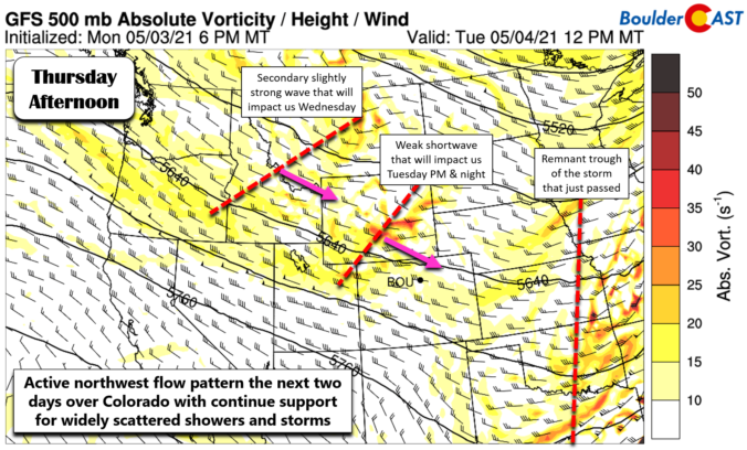
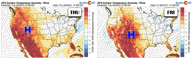
ADetailed Forecast Discussion: pleasant warming trend will ensue today and tomorrow as high pressure builds across the Rockies. The GFS 500mb height anomaly forecast animation below shows the pattern through Saturday. The ridge axis will be across western Colorado today with dry northwest flow over the Front Range. This will spell out sunny skies with just a few fair weather …

BoulderCAST Daily – Wed 05/05/21 | Cool with a slight chance of showers, but warming up to close out the week

IDetailed Forecast Discussion: nfrared satellite imagery this morning tells the story (shown below). Both weak disturbances we discussed yesterday are visible. The departing one that brought scattered showers and storms yesterday and last night has moved east into Kansas and Nebraska. However, right on its heels is the second disturbance already pushing south and east through Wyoming and northwest Colorado. …

BoulderCAST Daily – Tue 05/04/21 | Rainy, but certainly not as rainy as the last two days!

BDetailed Forecast Discussion: oth radar and satellite are quiet this morning across eastern Colorado. Our wet storm system has pushed eastward and weakened into an open wave over Kansas. The passage of the system and trough axis has ushered in drier air and subsidence bringing an end to the lingering light precipitation across the Boulder and Denver area. Both Sunday …

This week in Colorado weather: May 3, 2021

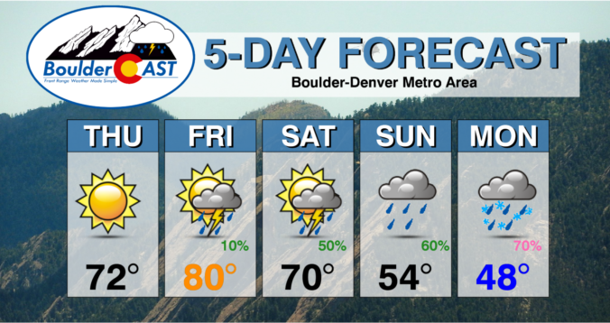
We begin very cold, rainy and snowy for some, but things will improve through the week slowly with a chance at hitting 80 degrees again by week’s end. Overall, though, the week remains fairly unsettled which is typical for this time of year and is welcomed considering the lingering drought. Let’s take a look at the forecast.

Continue reading

« Older posts Newer posts »