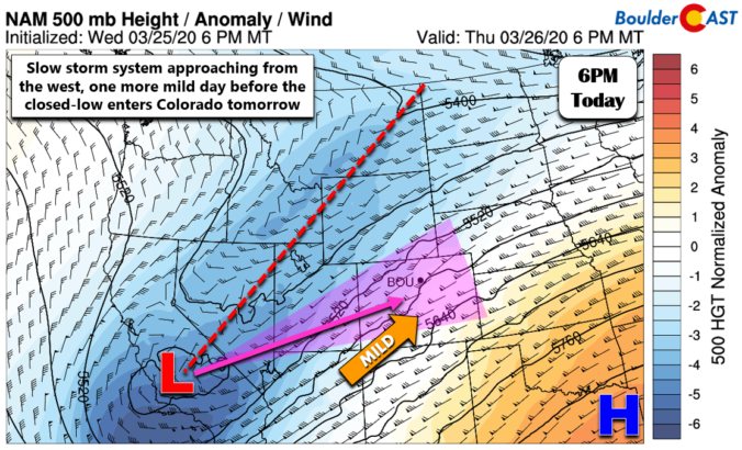
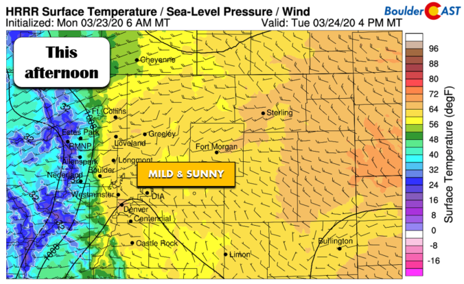
A wide range of weather and temperatures are expected this week as spring and winter continue to mingle. We’ll warm-up nicely through Wednesday into the 60’s, but another round of snowfall is taking aim on the Front Range for Thursday.
Author: Ben Castellani (Page 156 of 301)
Ben grew up in southwestern Pennsylvania and holds both a bachelor's and a master's degree in Meteorology, the latter being from CU Boulder. His hometown received nearly three feet of snow from the Storm of the Century back in March of 1993, sparking his initial interest in impactful weather. Ben currently works on remote sensing and data analysis software at NV5 Geospatial Software in Boulder.
From freezing drizzle, to fog and rain, to thundersnow and blizzard conditions, Friday’s storm system had it all across northeast Colorado! Or did it? As expected, its quick progression and lack of cold air ultimately left us with rather unimpressive snow totals. We take a quick look back at how Friday’s winter event played out across the Denver Metro area.

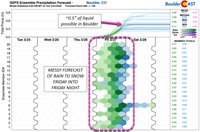
Another late-week system will impact much of Colorado Friday morning through Friday night with light rain turning to snow across the Metro area. With an unfavorable track and limited cold air, snow accumulations will be minimal. We take a look at when the rain will arrive, when it will change to snow, and expected snowfall amounts.


Live View of Boulder

Current Conditions

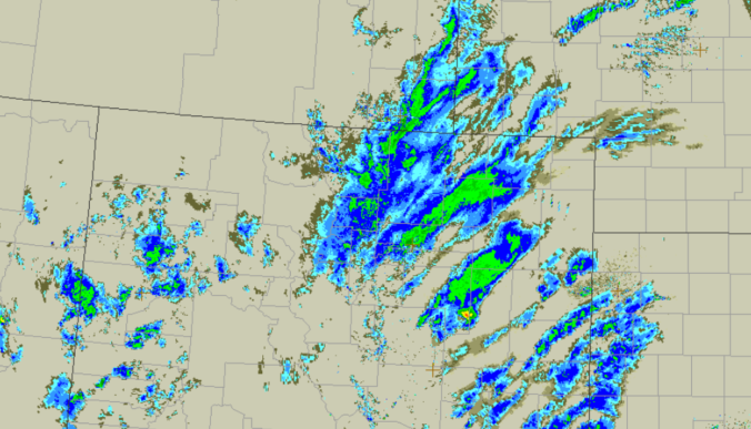
Live Radar

Recent Premium Posts

BoulderCAST Daily – Sun 05/03/26 | Beautiful weather will transition to late-spring snow by Tuesday!
☀️ Warm Start: Expect a quiet and pleasant start to the week, with …
BoulderCAST Daily – Sat 05/02/26 | A pleasant and warm first weekend in May
☀️Warming up for the first weekend in May, with upper 60s to near …
BoulderCAST Daily – Fri 05/01/26 | Warming up this weekend
🌡️ Warming up this weekend, from the upper 50s-60 today to the upper …
3-Day Forecast

Trending Content

© 2026 Front Range Weather, LLC