Author: Ben Castellani (Page 121 of 301)
Ben grew up in southwestern Pennsylvania and holds both a bachelor's and a master's degree in Meteorology, the latter being from CU Boulder. His hometown received nearly three feet of snow from the Storm of the Century back in March of 1993, sparking his initial interest in impactful weather. Ben currently works on remote sensing and data analysis software at NV5 Geospatial Software in Boulder.

This week will feature a continuation of the dangerous, unprecedented heatwave in the Pacific Northwest, but cool and rainy weather in the Front Range. Go figure! Our temperatures will remain below normal through the week with daily chances for showers and thunderstorms, helping to alleviate but not remove wildfire concerns across the state. We also discuss the status of monsoon season, the active tropical eastern Pacific, and what may lie ahead for the Fourth of July weekend.
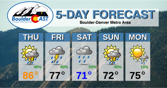
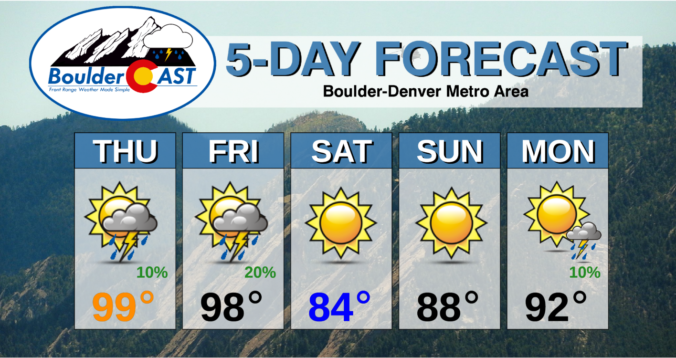
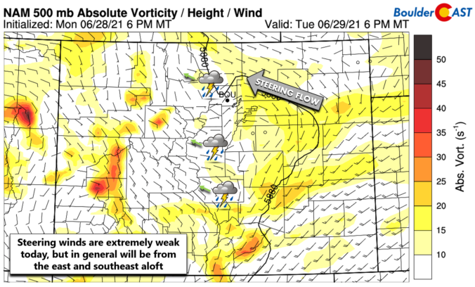
⦁❶⦁ Rain returns to the forecast today with temperatures in the 80’s
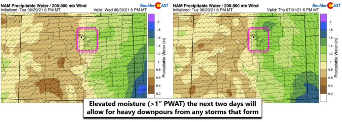
⦁❷⦁ An even better chance of thunderstorms on Friday with heavy downpours and some hail possible
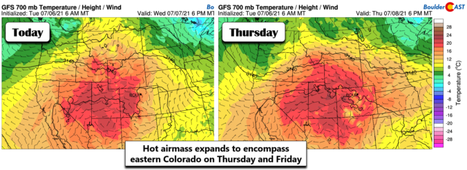
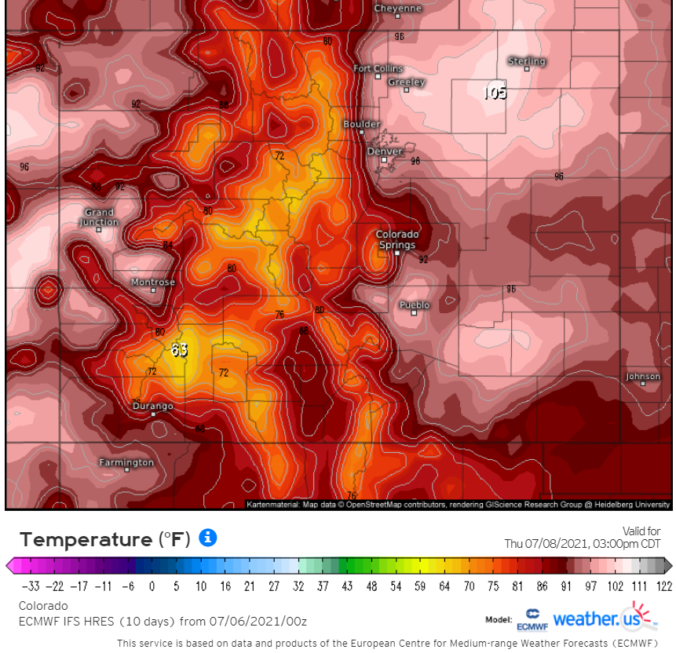
⦁❸⦁ An extremely dangerous heatwave is taking shape in the Pacific Northwest this weekend, but eastern Colorado will remain chilly
⦁❹⦁ Rain chances and below normal temperatures will persist into early next week

Live View of Boulder

Current Conditions

Live Radar

Recent Premium Posts

BoulderCAST Daily – Tue 04/28/26 | Staying cool with a couple showers, the late-week storm is still the main event despite trending south
🌧️ Morning wave = main show, with light rain showers and Foothills wet …
BoulderCAST Daily – Sun 04/26/26 | Showers and some storms later today and this evening
🌧️ A wet afternoon and early evening, with showers and a few rumbles …
BoulderCAST Daily – Sat 04/25/26 | Cooler today and wet Sunday into early next week
🌧️ A wet latter part of the weekend, with showers and a few …
3-Day Forecast

Trending Content

© 2026 Front Range Weather, LLC