Author: Ben Castellani (Page 119 of 301)
Ben grew up in southwestern Pennsylvania and holds both a bachelor's and a master's degree in Meteorology, the latter being from CU Boulder. His hometown received nearly three feet of snow from the Storm of the Century back in March of 1993, sparking his initial interest in impactful weather. Ben currently works on remote sensing and data analysis software at NV5 Geospatial Software in Boulder.
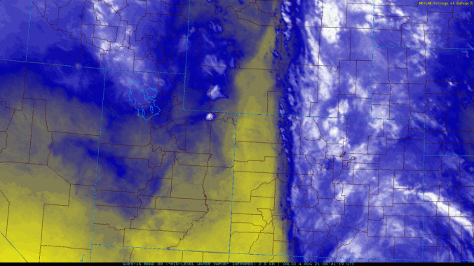
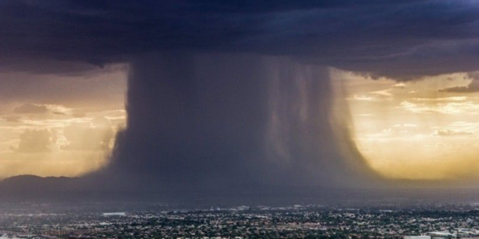
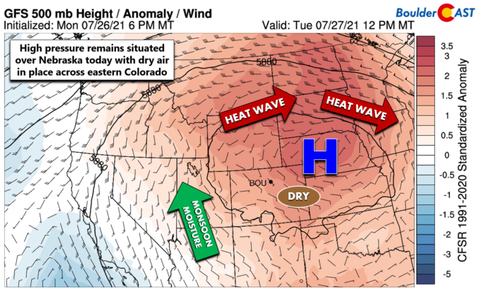
During July 2021, the summer monsoon pattern tended to favor areas further west with persistent high pressure holding over Colorado. Despite this, with a little luck involved, Boulder managed to notch a Top 20 wettest July, while most of the Front Range was very dry. Other weather highlights during the month included persistent smoke from new fires burning in the Pacific Northwest, multiple bouts of triple-digit heat, highly localized flooding in portions of Boulder, and frequent mudslides across the Mountains which has left Interstate 70 indefinitely closed near Glenwood Springs. Here’s a quick and colorful recap of our weather during July and how it relates to climatology.
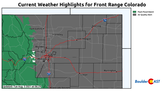


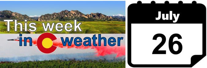
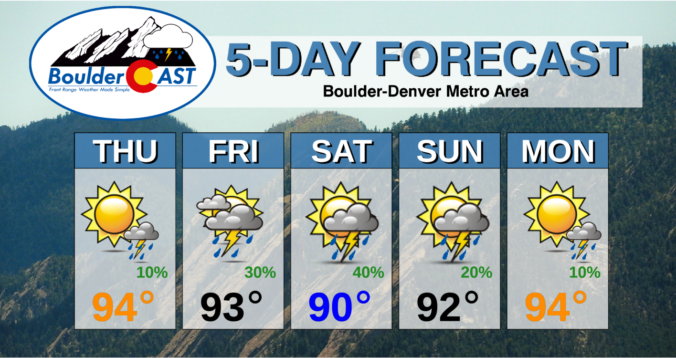
After a somewhat surprising urban flood scenario in Boulder on Sunday, smoky air and a heatwave will again be the forecast headlines this week for the Front Range as a strong ridge of high pressure develops just to our north and east. High temperatures will remain in the 90’s through Friday with just meager late-week rain chances. With a staggering number of large wildfires burning upstream, smoke will stay the course this week as well. Read on for our complete forecast of the week ahead.

Live View of Boulder

Current Conditions

Live Radar

Recent Premium Posts

BoulderCAST Daily – Tue 04/28/26 | Staying cool with a couple showers, the late-week storm is still the main event despite trending south
🌧️ Morning wave = main show, with light rain showers and Foothills wet …
BoulderCAST Daily – Sun 04/26/26 | Showers and some storms later today and this evening
🌧️ A wet afternoon and early evening, with showers and a few rumbles …
BoulderCAST Daily – Sat 04/25/26 | Cooler today and wet Sunday into early next week
🌧️ A wet latter part of the weekend, with showers and a few …
3-Day Forecast

Trending Content

© 2026 Front Range Weather, LLC