For the third time in the last seven days, another quick-mover will be passing through Colorado Monday morning producing snow for our region. Read on for details on timing and our official snowfall forecast map.
Really? Light snow again? If we sound like a broken record this winter, we promise, it isn’t our fault! Whether it be weak & shallow upslope, quick progression, or less-than-ideal tracks, snowfall events this winter have definitely left something to be desired. Our 2018-2019 Winter Summary page is nothing more than a sad memoir of 0 to 3″ Front Range snowfall events…
But alas, another light snowfall is nearly upon us. Let’s get to it…
A large ridge across the northeastern Pacific Ocean is still in place, helping to funnel the storm track and coldest air into north-central portions of the United States.

This set-up produces generally northwest flow across Colorado. The incoming storm system will be weak and embedded in this northwest flow. In the 500 mb vorticity animation below, the storm drops southeastward out of Canada and moves into Colorado late Sunday night.

All of the usual suspects will be involved…shallow upslope, weak lift from the passing trough, and cold air…albeit in a very minor capacity…
After a strong cold front moves through around midnight Sunday night, shallow upslope will flow into PORTIONS of the Front Range. The NAM 800 mb temperature forecast map below shows that near-surface upslope will only be present from Boulder County southward. Further north, models are not showing ANY upslope at all. This will ultimately focus the snow southward into the Denver Metro area, with areas like Loveland and Fort Collins seeing little to no snow from this event.

If we take a look at 700 mb, we see downsloping present everywhere. Not good for snow. It will be very cold, however!

Unlike our last several snow events, the jet stream will align nicely within this storm as it passes. This means we will see the return of the “X-Factor” for snow….jet-forced heavy snow bands. Notice the 160 MPH northwest to southeast oriented jet streak present Monday morning below:
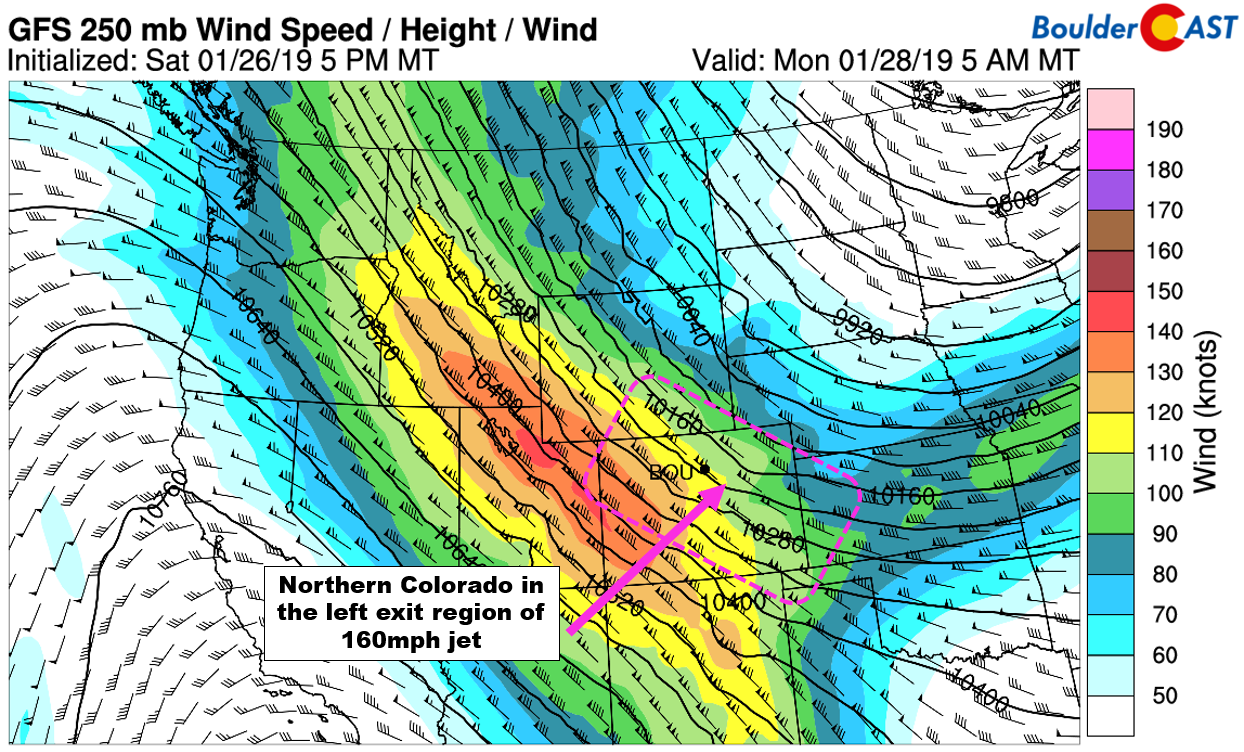
The Front Range will be in the left exit region of this jet much of the morning, the perfect location for added lift to fuel localized heavy bands of snow.
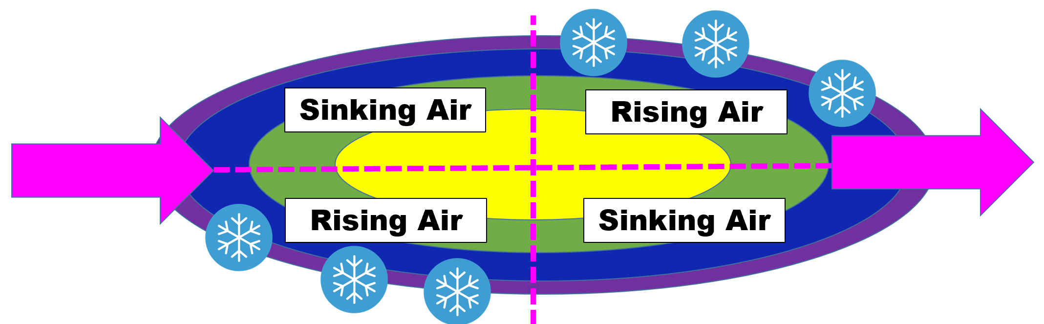
Idealized diagram of the quasi-geostrophic forcing imparted on the atmosphere by a jet streak.
While it’s not surprising that the global models are yet to show any signs of jet-forced banding, the higher-resolution models are indeed starting to give us some guidance where they may form and how widespread they might be. Both the 3km-NAM and the HRRR (shown below) paint the Front Range with these snow bands between 3:00 AM and 10:00 AM Monday. We’ve added in pink lines to show that the orientation of the bands are parallel to the jet.
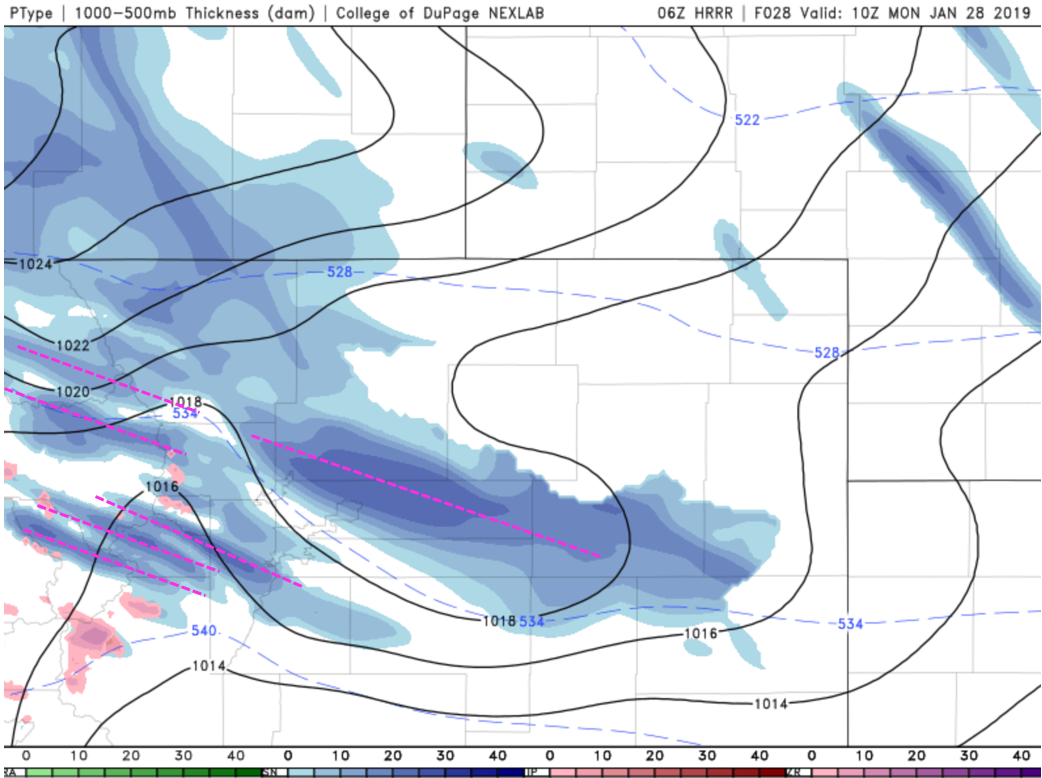
Our thoughts are that most of the banding will occur from Boulder southward to the Palmer Divide. The lift from the jet will be directly competing with the mid-level downslope present in our area. Thus, we’re not expecting these bands to be too intense or linger anywhere for too long. Still, if your area catches just one or two of these, it could mean the difference between seeing just 1″ or 5″ of fluff from this storm.
Here’s the timeline:
- Sunday to be mostly cloudy and breezy, but warm with highs in the 50’s. A High Wind Warning is in effect late this afternoon and evening for the Foothills with gusts of 65 mph expected. We don’t think “warning” level winds to cascade onto the adjacent Plains, but some stronger gusts to 50 mph will be possible on the very western fringe of the Metro area, including Boulder.
- The cold front moves through around midnight Sunday, with temperatures falling quickly into the 20’s where they will remain all of Monday
- Light snow with isolated heavy snow bands will begin around 3:00 AM and continue through the morning hours Monday. Winds will be blustery with gusts in the 20 mph realm. Poor travel conditions will exist in some areas as a result of the snow and wind. Keep this in mind for Monday’s morning commute as this could very well be a repeat of last Thursday.
- Snow will taper off from north to south by late morning or early afternoon Monday with partly cloudy skies taking over. Temperatures rebound only to the upper 20’s before sundown.
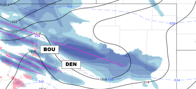
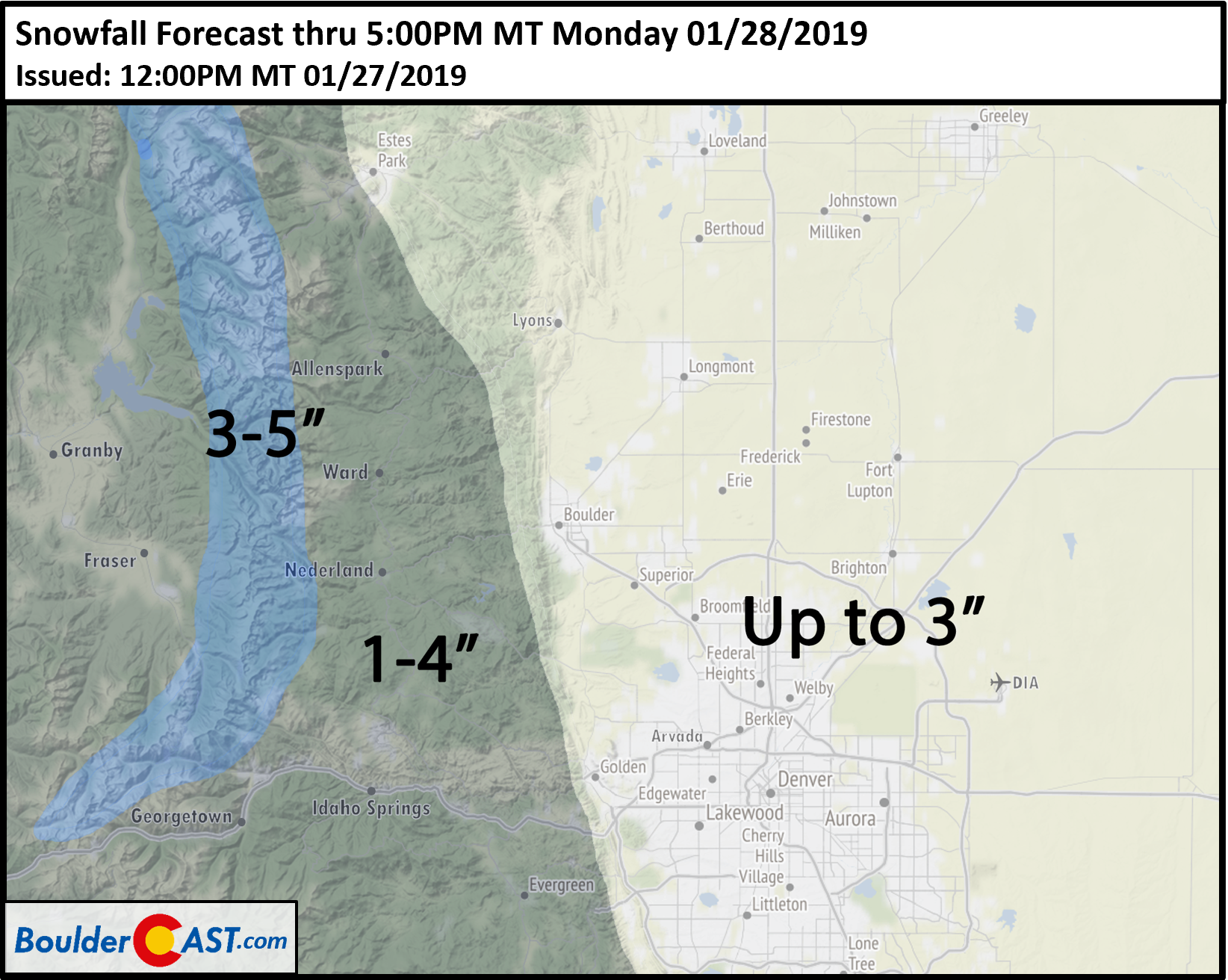
Our snowfall forecast for the event is shown below. Generally we are forecasting a dusting up to 3″ across the Plains. However, due to the banded nature of the snow, amounts could vary over short distances. Higher amounts of 4 to 6″ is entirely possible if a heavier band lingers overhead, but we do consider that a low-chance scenario for this event.
Share our forecast:
.


You must be logged in to post a comment.