Another moisture‑rich spring storm is lining up for the Front Range, and fortunately this one is coming in a tad warmer, but that doesn’t mean there won’t be snow. Here’s our latest quick thoughts on what to expect as this soggy system rolls in to end the weekend.
Good Saturday evening, everyone! Just a quick update on the inbound, moisture‑loaded storm poised to impact Boulder, Denver, and the broader Front Range from Sunday through Monday.
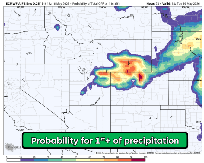
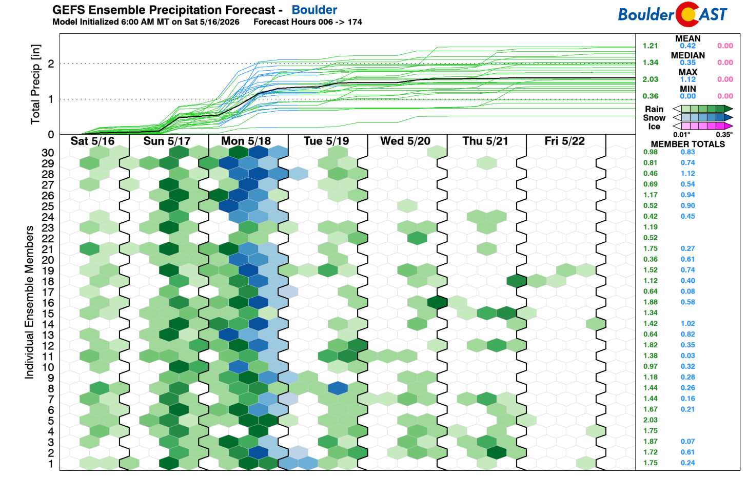
Guidance continues to lock onto a precipitation bullseye over Boulder and Larimer Counties, where 1 to 1.75 inches of liquid remains the most likely outcome. Despite recent drought improvement, we absolutely need this moisture.
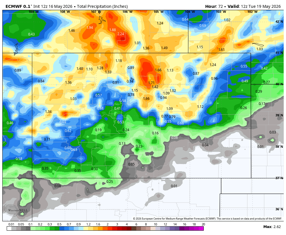
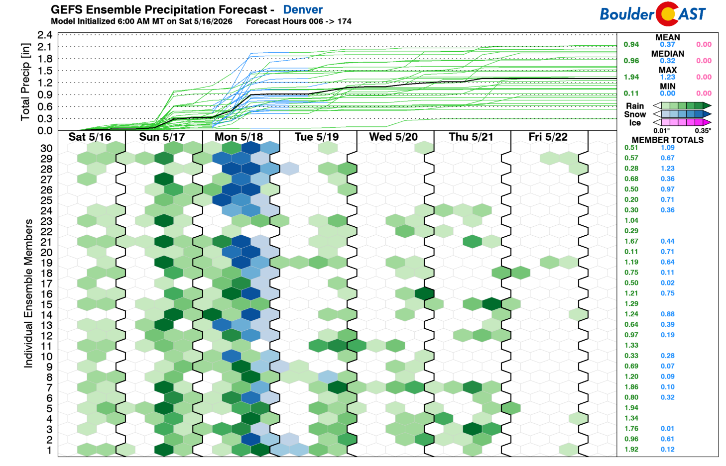
Denver has a pathway towards 1 inch as well, but probabilities taper quickly south of Interstate 70 and especially toward the Palmer Divide, where totals fall off sharply. There is definitely some bust potential for southern Denver with a gradient this tight.
While this setup shares some structural similarities with last week’s late‑season snowstorm, the thermodynamic environment is notably warmer. The lower elevations simply aren’t going to be cold enough for meaningful snow accumulation, so tree impacts are not a concern this time.
Despite widespread showers and embedded convection developing late Sunday, snow levels will remain elevated, generally above 10,000 feet, through Sunday night. A strong cold front then surges southward on Monday as a low rapidly deepens across eastern Colorado, tightening the gradient and driving cold upslope flow into the Front Range. Morning temperatures in the 40s to low 50s could fall into the mid to upper 30s behind the front.
Snow levels will nose-dive as well, reaching as low as 5,500 feet on Monday late afternoon into evening, but the event will be winding down by then. Almost all of the precipitation across the lower elevations is expected to fall as chilly rain Sunday into Monday afternoon, before potentially mixing with wet snow later on Monday. With some instability in play, the heavier bursts of showers (and even some embedded thunder) would aid in bringing snowflakes down lower. Minimal to no accumulation is favored in the Boulder/Denver area (trace to 1 inch at best). Just what we like to see for our fully leafed-out trees.
The Foothills, however, will see a more meaningful, earlier transition to snow. Even they start as rain Sunday into Sunday night, but change-over early Monday is increasingly likely. Current ensemble clustering supports 2 to 8 inches up there, with the highest totals above 8500 feet in Boulder and Larimer Counties. The more populated 6500-7500 feet level in the Foothills are trending toward 1–5 inches. The Continental Divide will once again be plastered in white this week, with 8 to 16 inches expected on the high peaks.
We’ll continue monitoring trends through the weekend and will issue our snowfall forecast map sometime on Sunday. Lower‑elevation expectations are unlikely to change in terms of the snow outlook—the storm is simply too warm—but Foothills totals still have room to shift slightly in either direction. There is also some chance that Denver may end up a bit too far south and trend lower.
Overall, the news this evening is good on all fronts. No damaging snow for the lower elevations, the Foothills gets more white stuff which is commonplace up there this time of year, and everyone gets drenched with much-needed moisture! More to come…
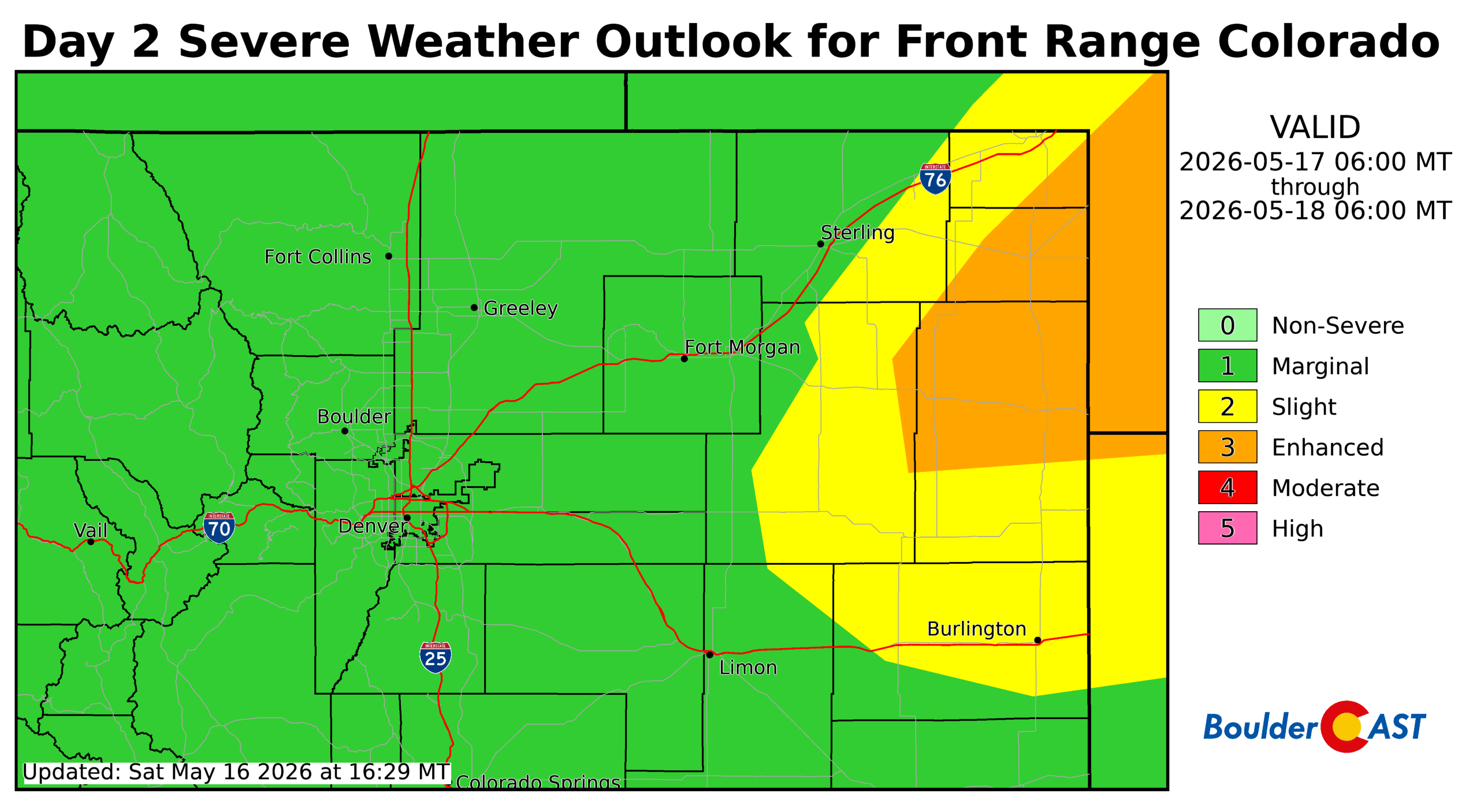
P.S. Keep an eye to the sky for another round of severe weather on Sunday, albeit a rather low chance in our immediate area.
Spread the word, share our crazy Colorado weather:

Go Premium, get all the perks.
Daily Forecast Updates
Get our daily forecast discussion every morning delivered to your inbox.
All Our Model Data
Access to all our Colorado-centric high-resolution weather model graphics. Seriously — every one!
Ski & Hiking Forecasts
6-day forecasts for all the Colorado ski resorts, plus more than 120 hiking trails, including every 14er.
Smoke Forecasts
Wildfire smoke concentration predictions up to 72 hours into the future.
Exclusive Content
Weekend outlooks every Thursday, bonus storm updates, historical data and much more!
No Advertisements
Enjoy ad-free viewing on the entire site.


You must be logged in to post a comment.