A stubborn weather pattern is settling in this week, and Colorado finds itself right in the middle of the action—or the lack of it. While the coasts deal with weather extremes, the Front Range gets a quieter blend of mild spells, a couple of cold fronts, and just enough uncertainty to keep things interesting. Read on for our full outlook of the next seven days to see if this translates into meaningful moisture or just more dry January days.
This week’s highlights include:
- 🌍 Stuck Pattern: A stagnant West Coast ridge and deep East Coast trough keep Colorado wedged in between all week.
- 🌬️ North/Northwest Flow: Denver–Boulder stays in cooler, dry air with a couple of weak Canadian fronts sliding through.
- ☀️ Mild Start: Monday–Tuesday stay warm and sunny near 60° before the first front arrives Tuesday evening.
- 🌧️ Tiny Rain Chance Tuesday Night: A touch of moisture + weak lift may spark isolated light showers Tuesday night, mainly northeast of Denver.
- 💨 Windy & Warm Thursday: Temps rebound toward 60° with gusty downslope winds; Red Flag conditions possible in spots.
- ❄️ Colder Late Week: A stronger front Thursday night cools things into the 40s by Friday
- 🏔️ No Mountain Snow Either: Snow chances look minimal statewide, and Mountain snowpack will continue to struggle for the foreseeable future.
DISCLAIMER: This weekly outlook forecast is created Monday morning and covers the entire upcoming week. Accuracy will decrease as the week progresses as this post is NOT updated. To receive daily updated forecasts from our team, among many other perks, subscribe to BoulderCAST Premium.

Go Premium, get all the perks.
Daily Forecast Updates
Get our daily forecast discussion every morning delivered to your inbox.
All Our Model Data
Access to all our Colorado-centric high-resolution weather model graphics. Seriously — every one!
Ski & Hiking Forecasts
6-day forecasts for all the Colorado ski resorts, plus more than 120 hiking trails, including every 14er.
Smoke Forecasts
Wildfire smoke concentration predictions up to 72 hours into the future.
Exclusive Content
Weekend outlooks every Thursday, bonus storm updates, historical data and much more!
No Advertisements
Enjoy ad-free viewing on the entire site.
A Tale of Two Dry Cold Fronts
This week’s weather across Colorado will be shaped by a stubborn, slow‑moving pattern gripping much of North America. An amplified—but basically stationary—ridge of high pressure will hold firm along the West Coast, while a persistent trough digs in over the Great Lakes and much of the eastern U.S.
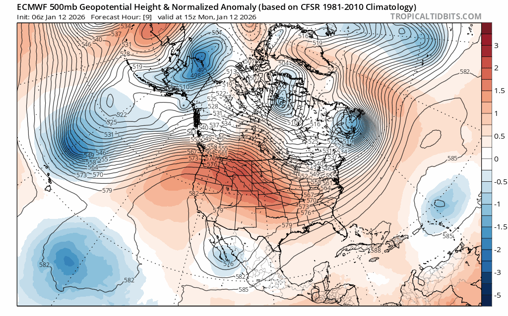
Euro model 500mb height anomaly forecast animation for the week showing the West Coast ridge locked in place
That leaves the Front Range wedged squarely between these two major players. We won’t tap into the record warmth sitting just to our west, nor will we feel the full force of the Arctic air spilling into the Great Plains to our east. Instead, Denver and Boulder will spend the week under northwesterly to northerly flow, with the door open for a couple of dry Canadian cold fronts to slide through eastern Colorado.
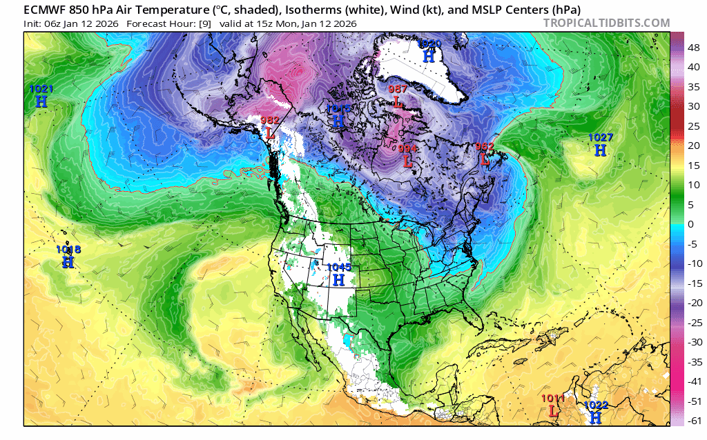
Euro model 850mb temperature forecast animation through the week showing the cold fronts sweeping south across the center of the country and clipping eastern Colorado
Before any of those changes arrive, the week starts off unsurprisingly mild. Highs near 60° on Monday and Tuesday, light winds, and plenty of sunshine will make it feel more like early spring than mid‑January.
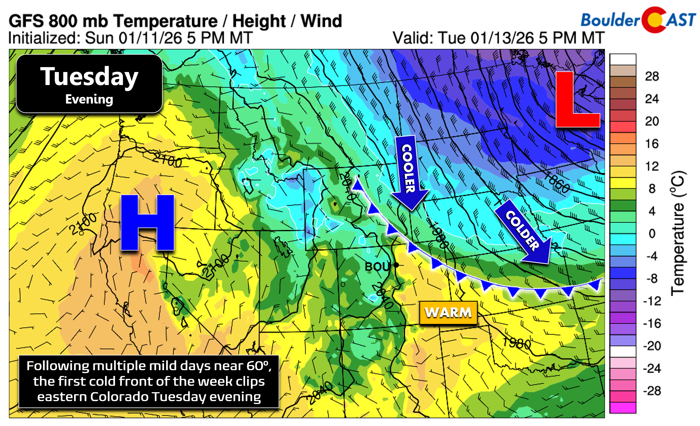
By Tuesday evening, the first cold front drops in from the north/northeast. Current model trends bring it through right around or just after sunset.
Behind the front, moisture will nudge upward and a passing vorticity max could provide just enough lift for a few isolated to widely scattered rain/snow showers Tuesday night into early Wednesday. The best chance sits northeast of Denver out on the Plains, but a few stray raindrops or snowflakes in the Metro aren’t impossible. Even then, we’re talking only a few hundredths of an inch at most. Highs on Wednesday fall back into the 50s—still above normal, but noticeably cooler.
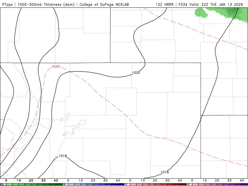
HRRR model simulated precipitation forecast for Tuesday evening into Wednesday morning showing the potential for a few rain/snow bands to encroach from the northeast
Thursday brings a brief rebound. Downslope northwesterly winds will help temperatures climb back toward 60° across eastern Colorado. Those winds could get gusty—20 to 35 mph—which raises the possibility of Red Flag conditions in parts of the Metro area depending on how humidity trends evolve.
That warmup won’t last long. A stronger, colder front arrives Thursday evening or Thursday night, tied to a deep low spinning over the Great Lakes. This one could generate a short window of upslope flow.
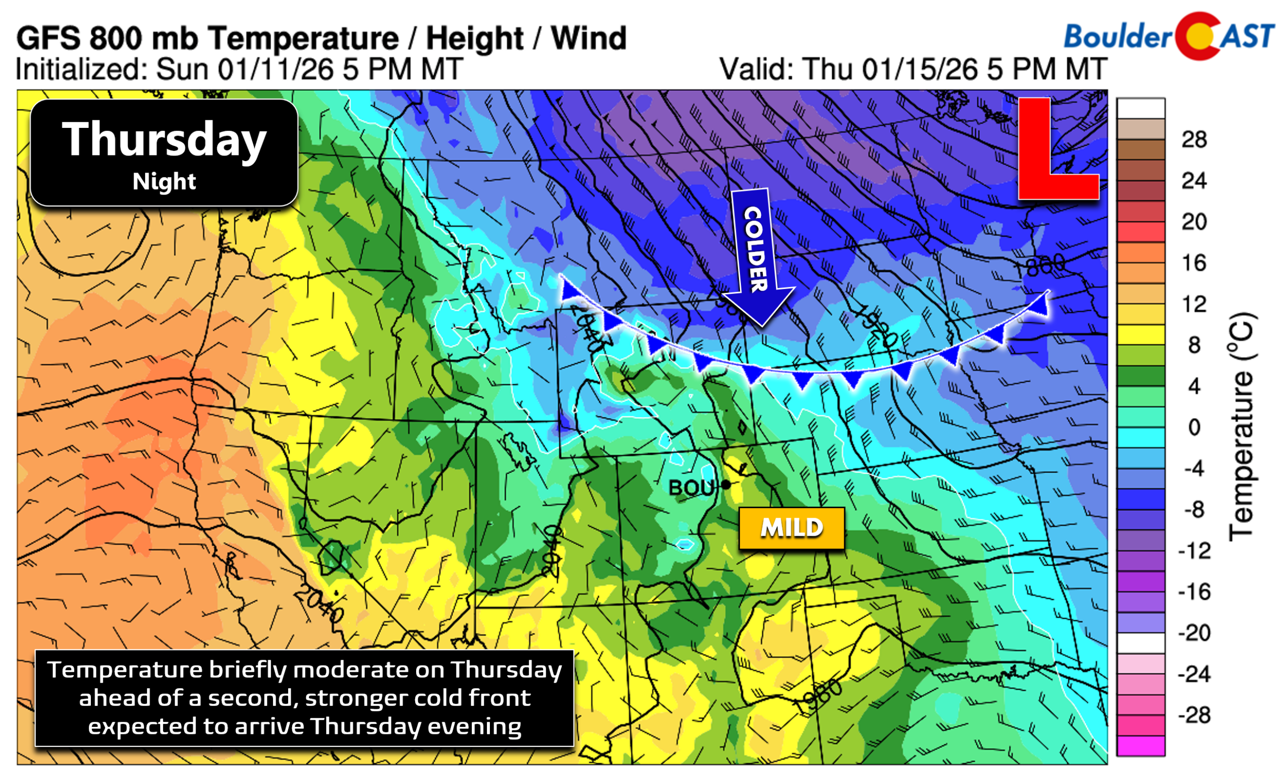
A handful of ensemble members still hint at light snow Thursday night into Friday, but that scenario is losing support as models trend drier. For now, both fronts this week look like they’ll bring only tiny, low‑impact precipitation chances.
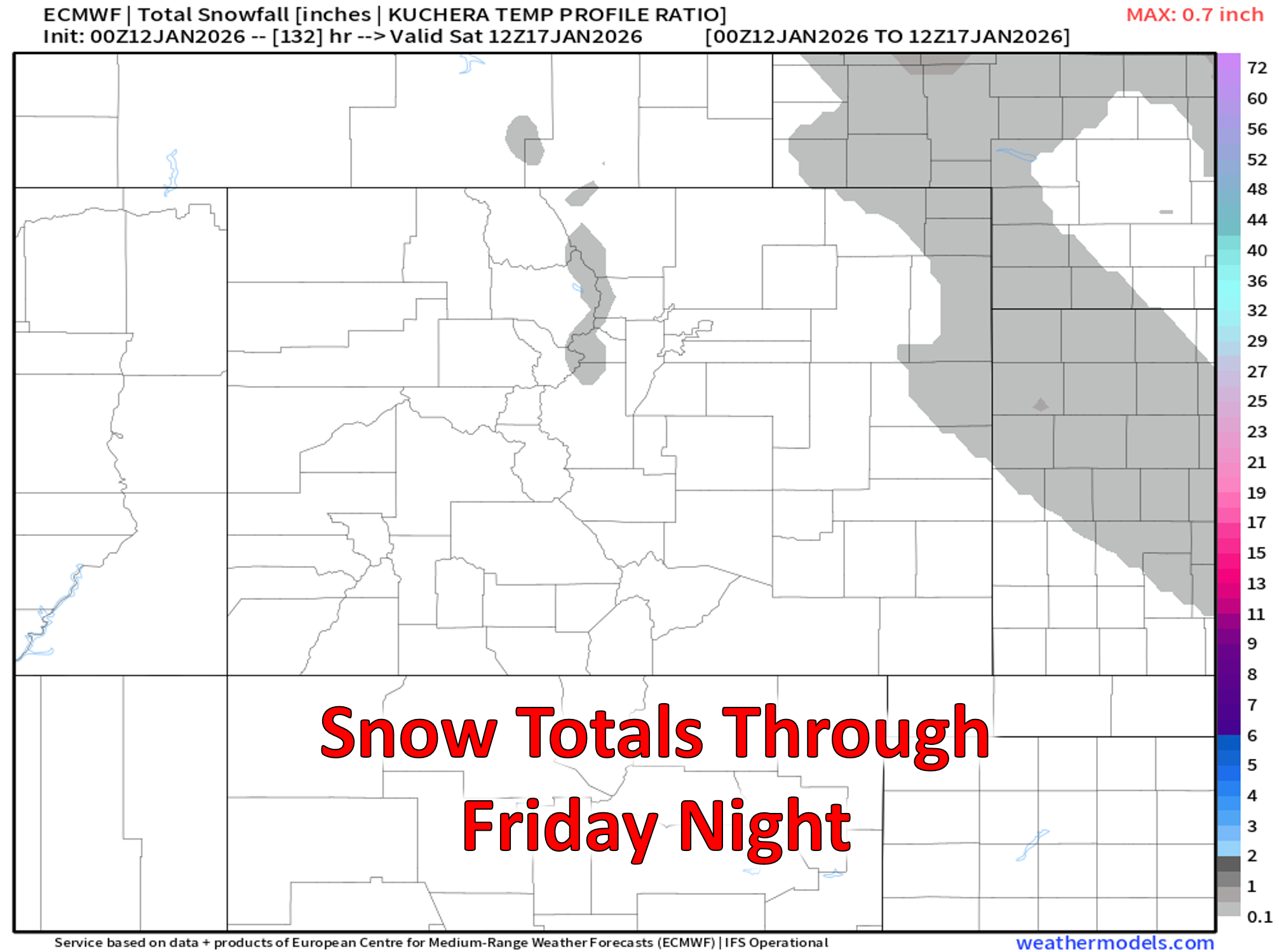
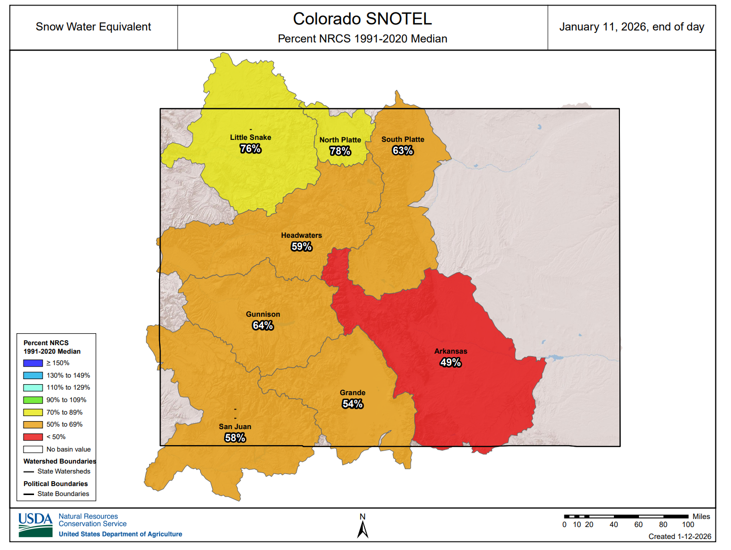
The Mountains won’t fare any better. Despite the persistent northwest flow, the overarching ridge keeps moisture starved across the state. Mountain snow chances remain minimal, and Colorado’s already struggling snowpack will continue to lag.
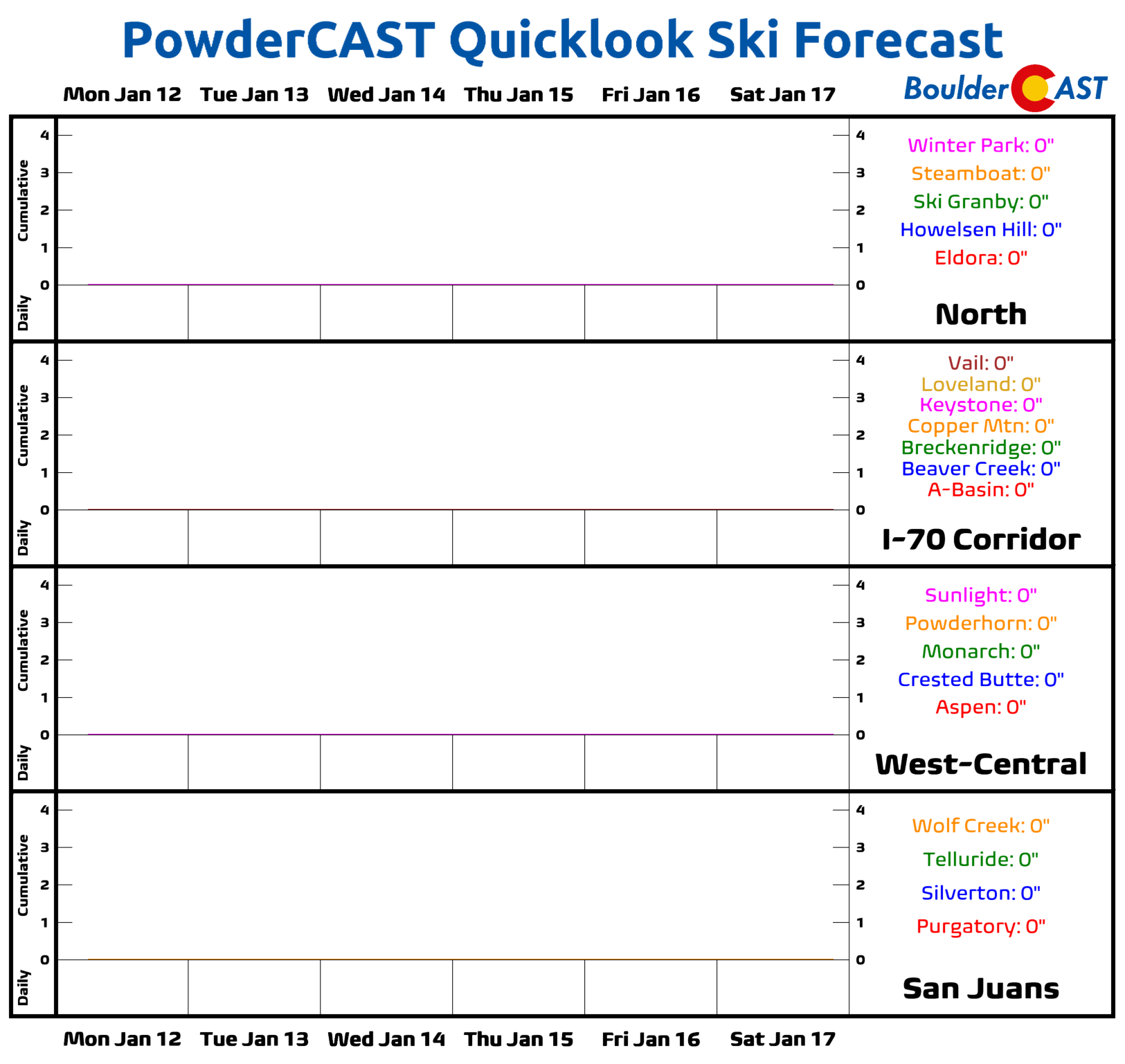
Skiers will have to travel to another state to find fresh snow this week, with PowderCAST indicating zero chance for anything statewide through at least Saturday.
Friday’s highs settle back into the low to mid‑40s as cooler air lingers over the eastern half of the state.
Looking ahead to the weekend and early next week, the pattern barely budges. The West Coast ridge and East Coast trough stay locked in place, keeping Colorado mostly dry with the occasional weak, dry cold front slipping through.
Have a great week!
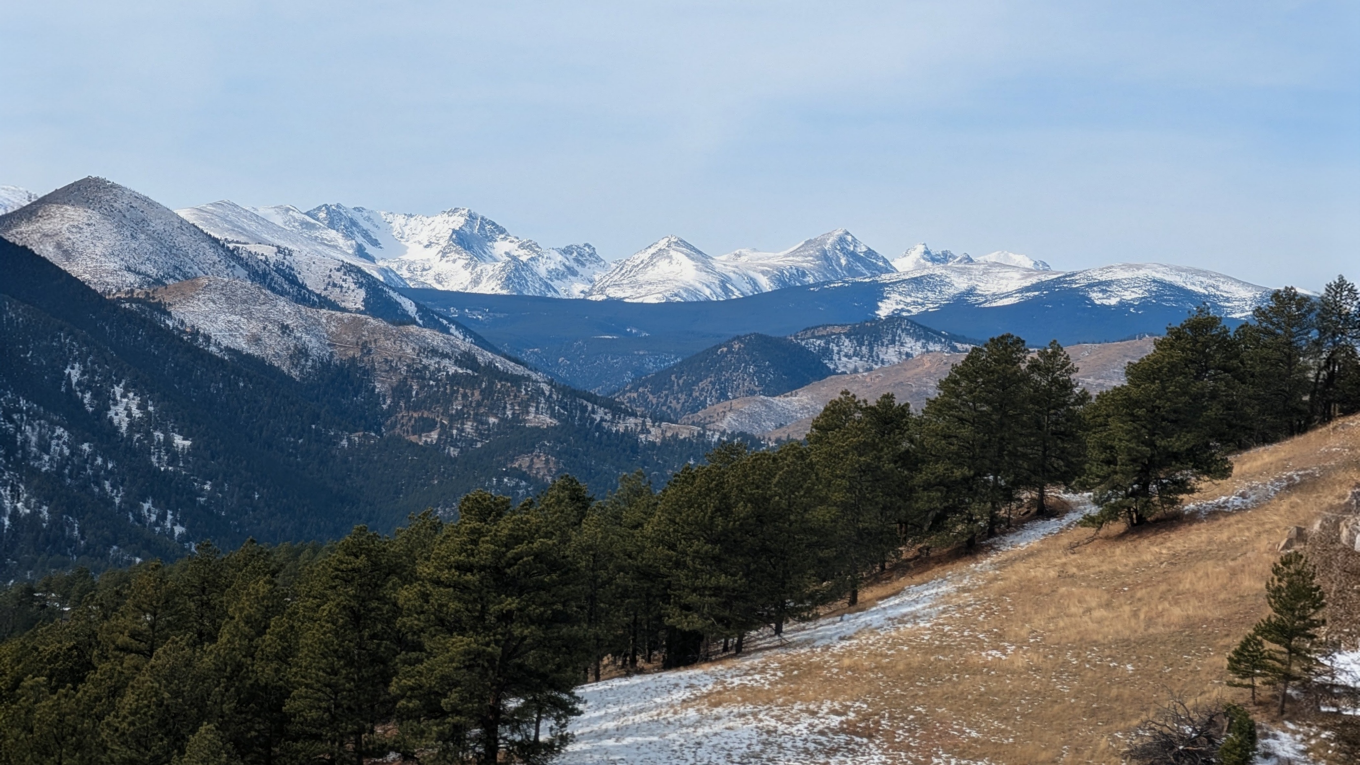
View looking west of Boulder on Sunday January 11, 2026.
Forecast Specifics:
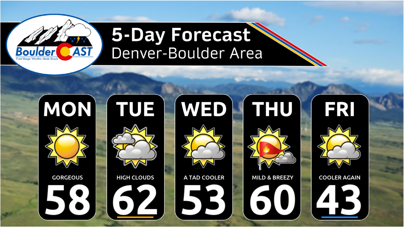
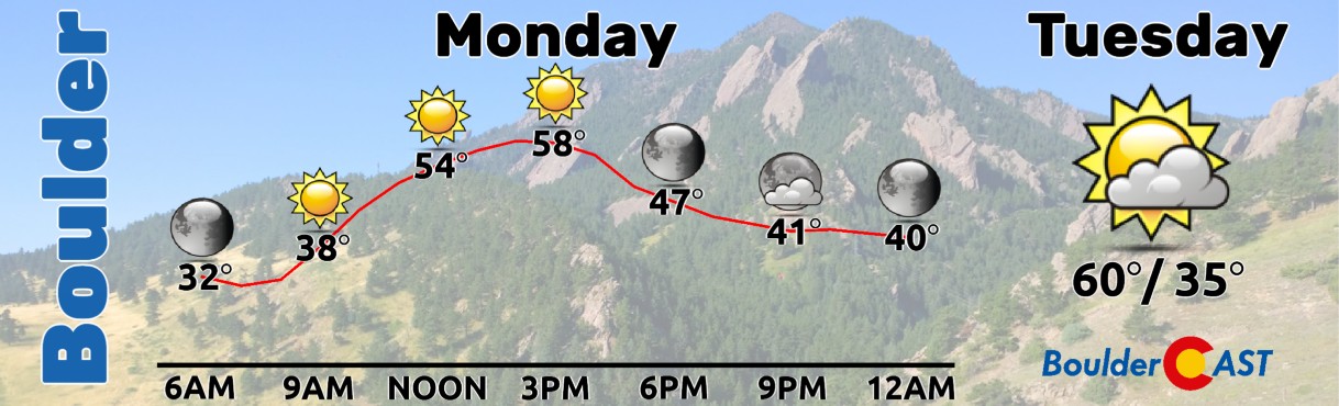
Monday: Mild, sunny and gorgeous. Highs in the upper 50s to near 60 degrees on the Plains with upper 40s in the Foothills.
Tuesday: Mid and high-level clouds increases from the north. Highs tick up further into the lower 60s on the Plains with near 50° in the Foothills. A weak cold front will arrive Tuesday evening with a slight chance of a few rain showers developing during the night.
Wednesday: A tad cooler, but still above normal. Partly cloudy skies early becoming sunny through the day. Highs across the lower elevations top out in the lower 50s with lower 40s in the Foothills.
Thursday: Mild temperatures return, but with an uptick in downslope winds. Gusts of 20 to 35 MPH will be possible, with a chance of Red Flag conditions for portions of the Front Range. Highs reach around 60° on the Plains with upper 40s in the Foothills. A cold front moving in Thursday night could produce a few snow showers, but odds of that appear quite low right now.
Friday: A chillier end to the week but with quiet conditions. Highs top out in the low to middle 40s on the Plains with lower 30s in the Foothills.
Weekend: Dry and quiet weather is expected over the weekend with moderating temperatures back into the 50s.
DISCLAIMER: This weekly outlook forecast is created Monday morning and covers the entire upcoming week. Accuracy will decrease as the week progresses as this post is NOT updated. To receive daily updated forecasts from our team, among many other perks, subscribe to BoulderCAST Premium.
Go Premium, get all the perks.
Daily Forecast Updates
Get our daily forecast discussion every morning delivered to your inbox.
All Our Model Data
Access to all our Colorado-centric high-resolution weather model graphics. Seriously — every one!
Ski & Hiking Forecasts
6-day forecasts for all the Colorado ski resorts, plus more than 120 hiking trails, including every 14er.
Smoke Forecasts
Wildfire smoke concentration predictions up to 72 hours into the future.
Exclusive Content
Weekend outlooks every Thursday, bonus storm updates, historical data and much more!
No Advertisements
Enjoy ad-free viewing on the entire site.
Enjoy our content? Give it a share!


You must be logged in to post a comment.