
A few wobbly overnight snow bands dropped a light, fluffy coating of powder across the Front Range—right on target with our forecast. We break down where the bands hit, why the snow ratios were so sky‑high, and what this tiny event means for our growing seasonal deficit. We also look ahead to the warm, dry pattern set to carry us into the New Year.
D
espite the low confidence going in, several healthy snow bands did manage to spin up along the Front Range Saturday night. They weren’t widespread, but they were just organized enough to lay down a light blanket of fluffy snow for much of the Denver Metro to wake up to this morning. The most persistent banding wobbled around between about 1 and 5 AM, which you can clearly pick out in the overnight radar loop.
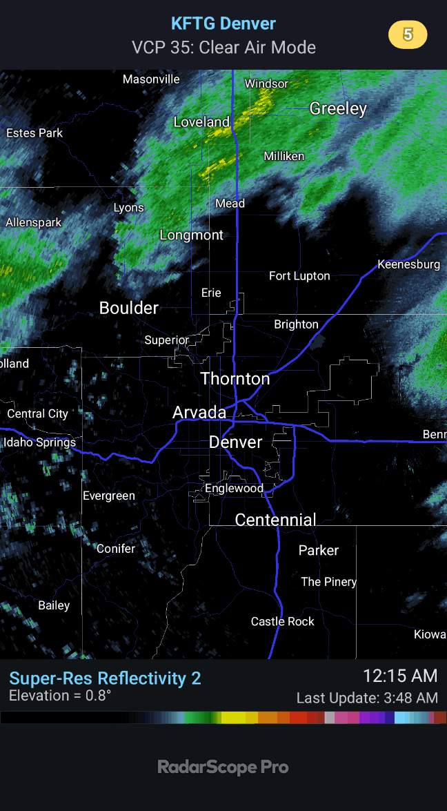
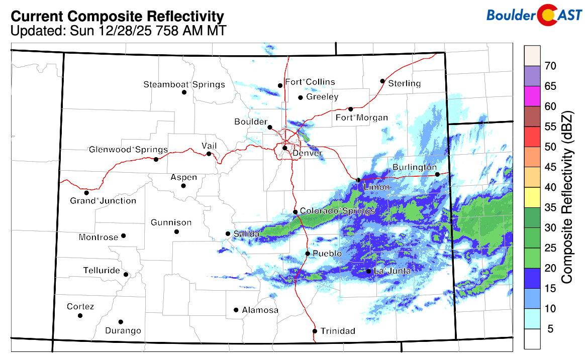
As of early Sunday, the event is essentially wrapped up. All remaining banding has slid southeast out of the Denver area, leaving only lingering flurries behind.
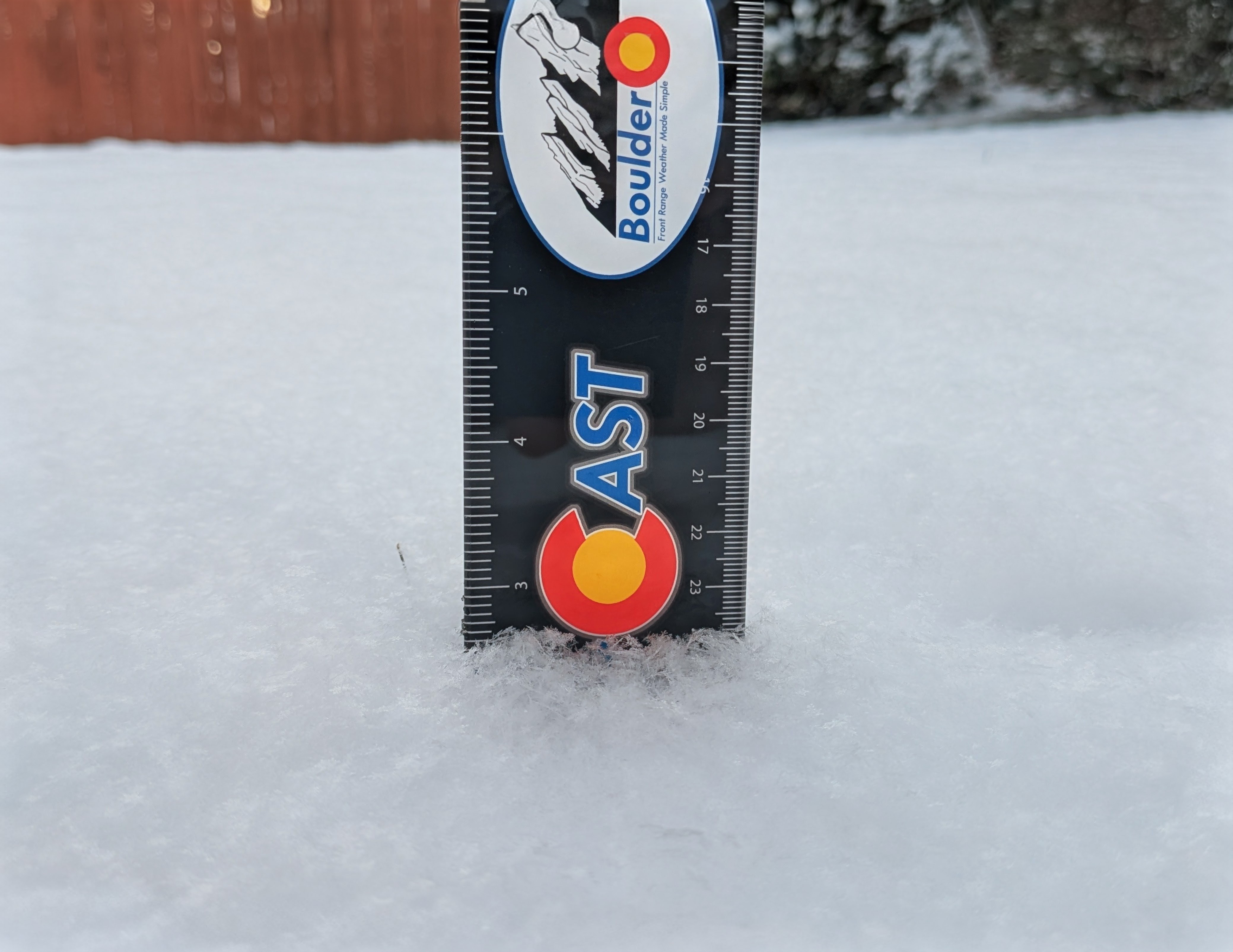
At our station, we measured 2.5″ of some of the fluffiest dendrites you’ll ever see—classic cold‑temperature crystal growth, easily visible in our observation photo below:
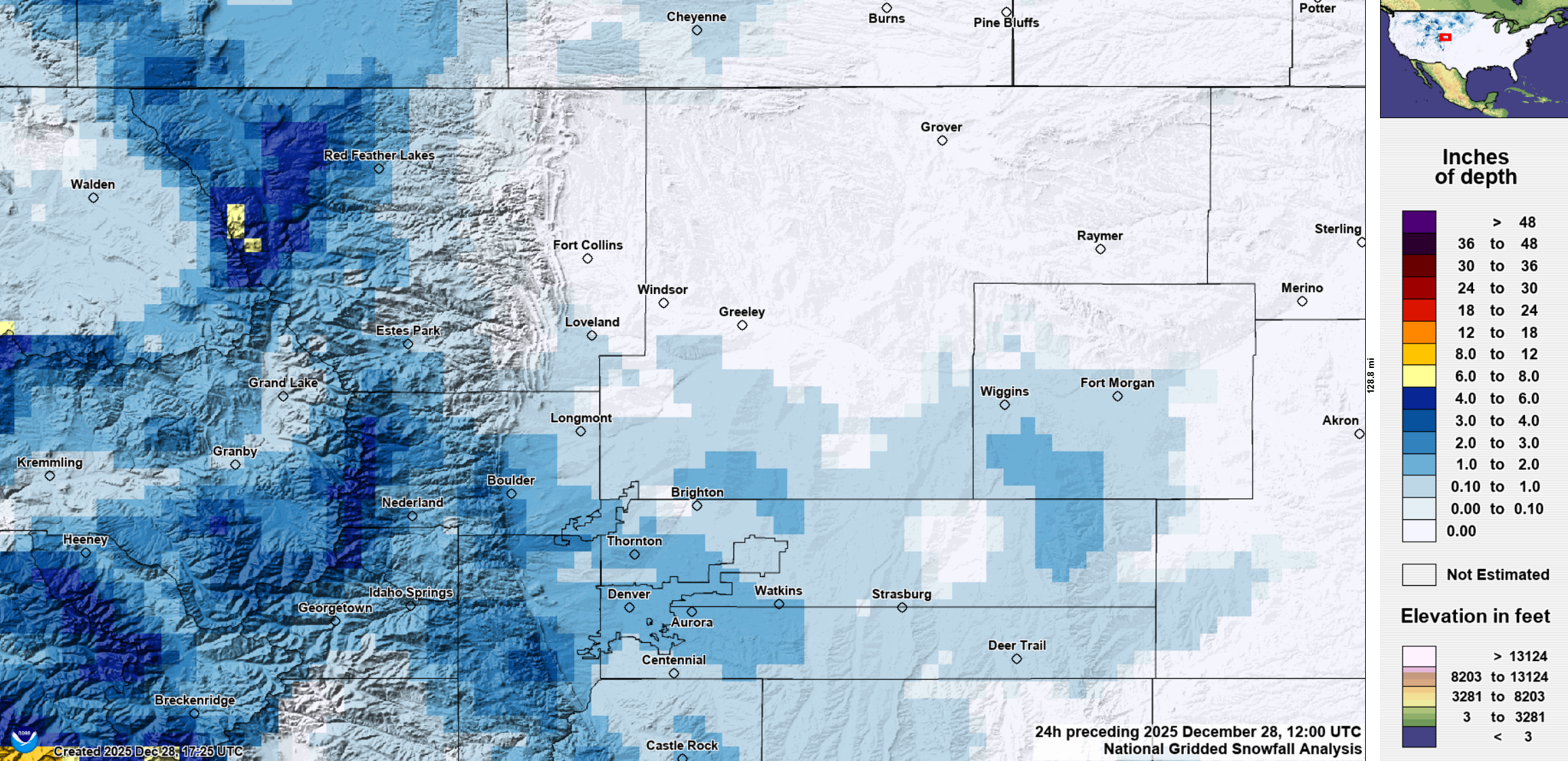
Below is the snowfall forecast map we issued Saturday morning, now overlaid with observed totals. Green markers show where our forecast verified, Yellow indicates totals just outside our range, and Red marks a true bust (more than 1″ off). Most locations ended up with a dusting to around 2″, with a few pockets hitting 3–4″. That’s right in line with what we expected. The short‑range models that tried to kill this event off ended up being too pessimistic, and we did squeeze out a little holiday white after all.
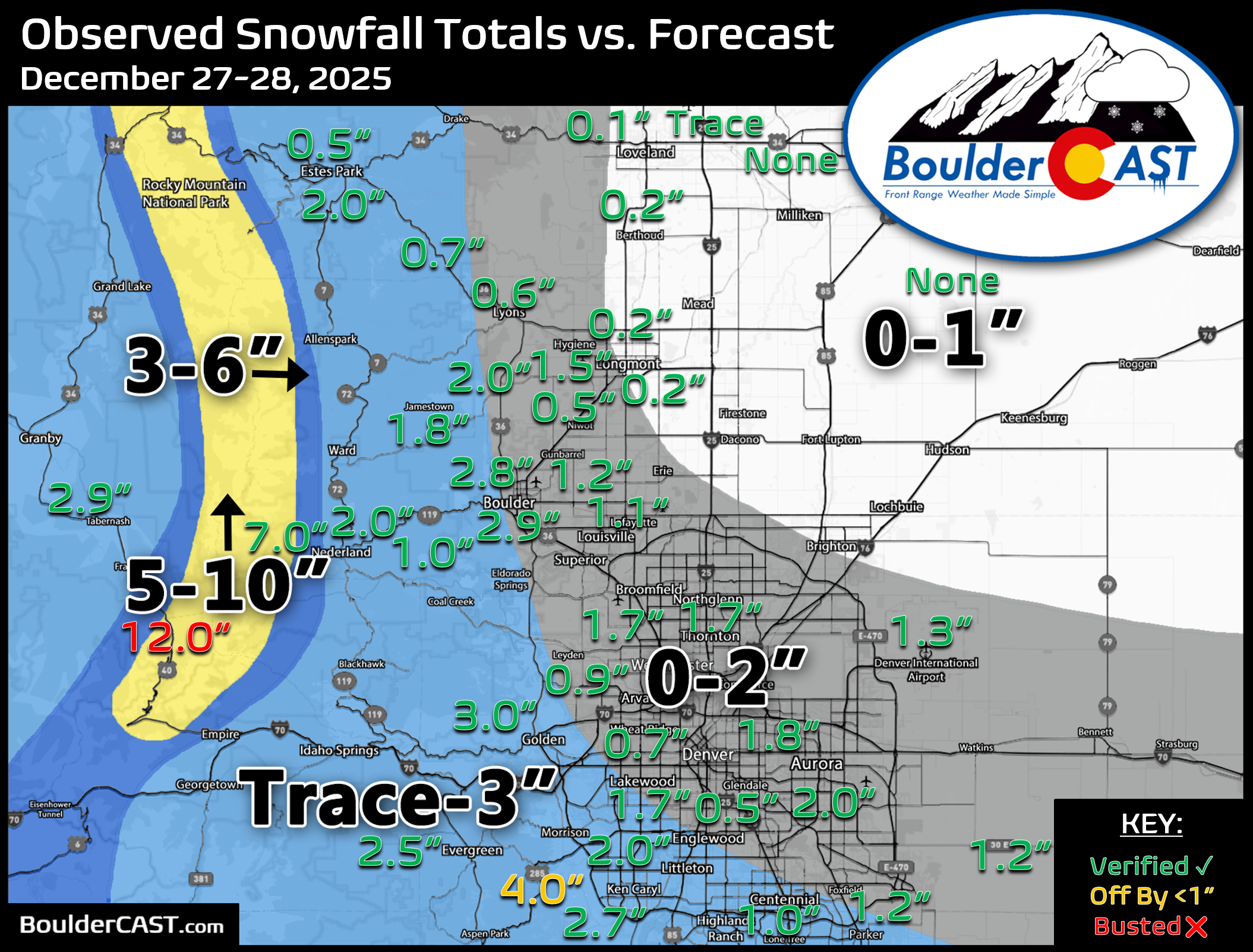
Officially, Boulder checked in at 2.9″ while Denver reported 1.3″ (Denver’s number may still be updated).
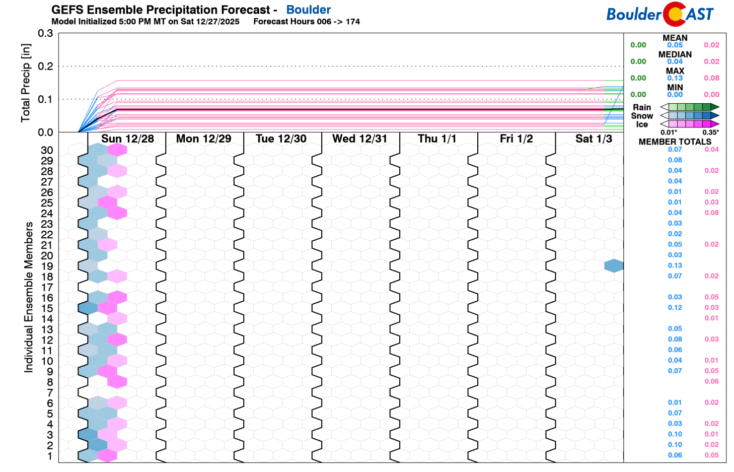
Liquid observations confirm just how powdery this snow was—snow‑to‑liquid ratios ran near 25:1 across the board.
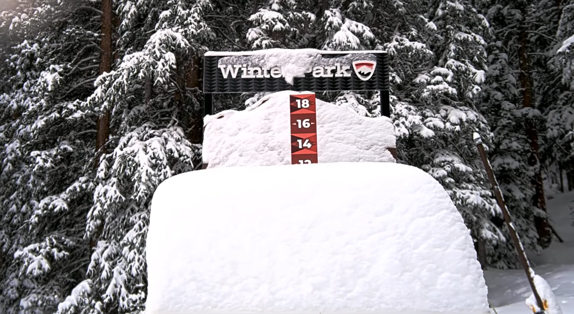
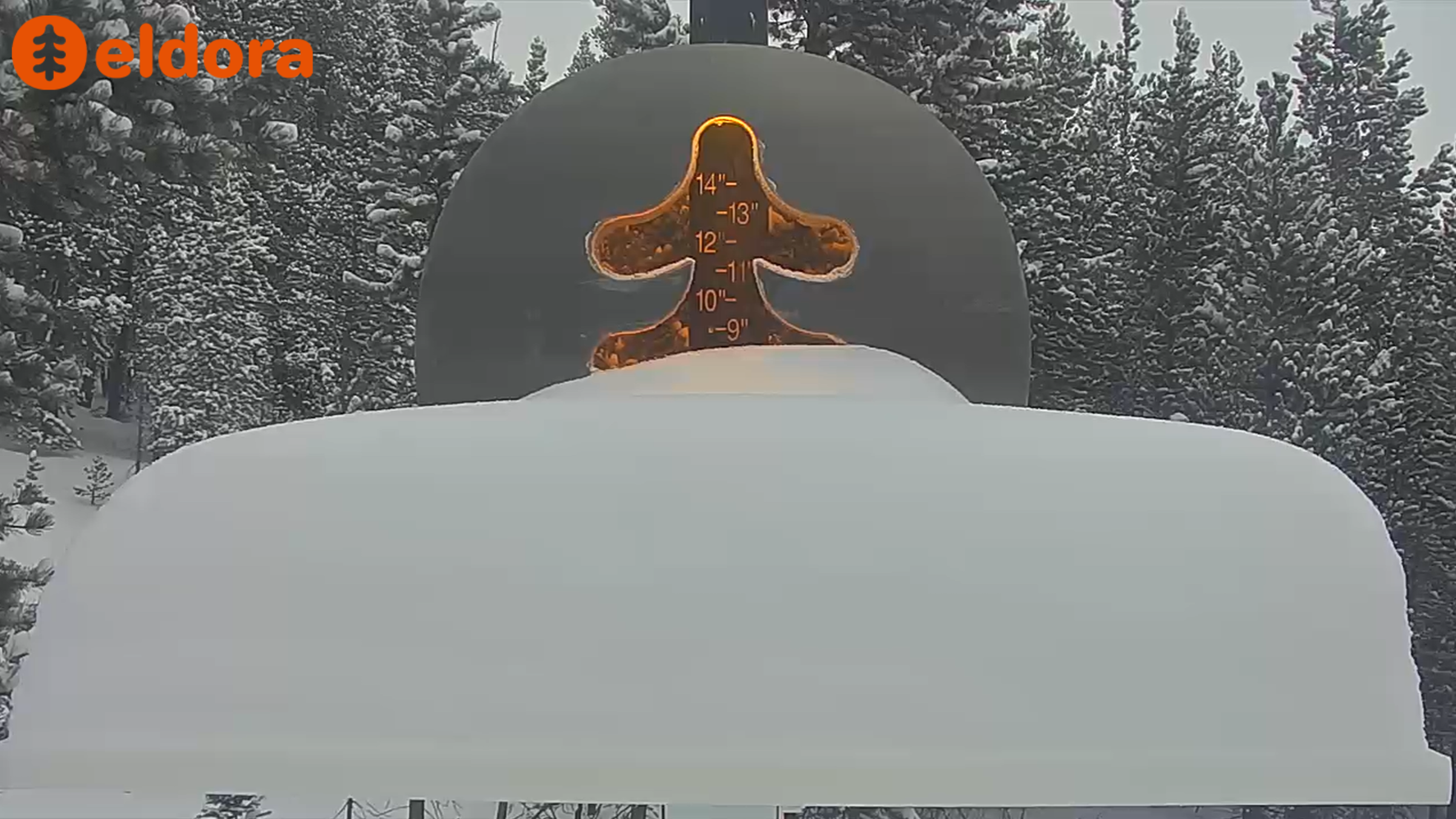
The Mountains fared better, as usual. Winter Park picked up around 12″ and Eldora reported 7″, a nice boost to what was record low statewide snowpack before this event. This snow should also please desperate skiers.
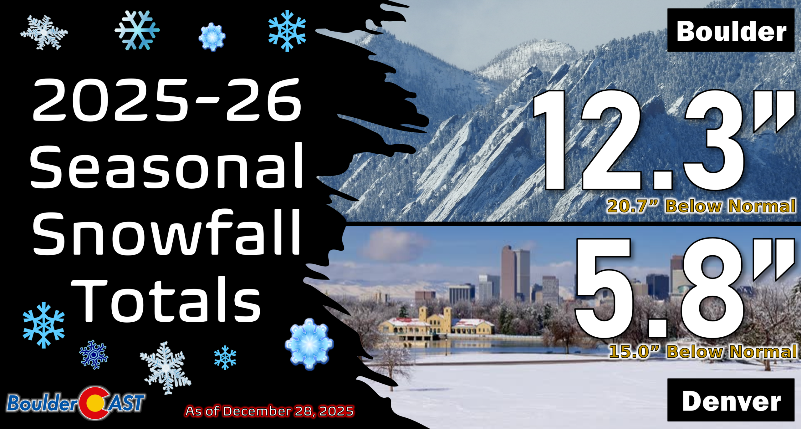
Even with this little appetizer of snow, we’re still running well behind for the season—roughly a 15 to 20″ deficit now in both Boulder and Denver after more than three weeks without measurable snowfall. You can revisit every storm so far in the 2025–26 season over on our seasonal summary page HERE.
Our station dipped to 16° this morning—the coldest we’ve been since December 4th and our first sub‑freezing night in more than a week. Across the Boulder–Denver area, light winds are keeping wind chills mostly in the teens, but stronger gusts elsewhere in Colorado are driving wind chills well below zero to start the day.

Last night’s flakes will also be the final snow of 2025. Our next chance looks to be at least a week out as dry weather and a warming trend take us straight into the New Year. Check back Monday morning for our weekly outlook, where we’ll almost certainly be talking about yet another round of holiday‑week warmth building for the Front Range. Happy snow day!
Spread the word, share our crazy Colorado weather:

Go Premium, get all the perks.
Daily Forecast Updates
Get our daily forecast discussion every morning delivered to your inbox.
All Our Model Data
Access to all our Colorado-centric high-resolution weather model graphics. Seriously — every one!
Ski & Hiking Forecasts
6-day forecasts for all the Colorado ski resorts, plus more than 120 hiking trails, including every 14er.
Smoke Forecasts
Wildfire smoke concentration predictions up to 72 hours into the future.
Exclusive Content
Weekend outlooks every Thursday, bonus storm updates, historical data and much more!
No Advertisements
Enjoy ad-free viewing on the entire site.


You must be logged in to post a comment.