Snow season has finally arrived along the Front Range, and this week’s storm looks ready to deliver more than just a token dusting. After Thanksgiving’s overhyped flurries broke our snow drought, we’re now tracking a midweek system with real staying power—nearly 24 hours of upslope flow, solid moisture, and model agreement pointing to a medium‑impact event. Boulder, Denver, and the Foothills are all in line for several inches, with tricky travel expected Wednesday morning. Curious how much snow your neighborhood could see? We break down the setup, snow totals, and timing…
What You Need to Know
- 🌨️ Midweek storm locked in: Widespread accumulating snow expected Tuesday night through Wednesday, trending toward a medium‑impact event, the first of the season for us!
- 🌀 Storm track & setup: System drops from Montana/Idaho into the Four Corners, aided by a moist frontal boundary and ~24 hours of upslope flow.
- 💧 Moisture supply: 0.25–0.5″ liquid for most areas; up to 0.7″ possible in lower southern Foothills, with most models in agreement.
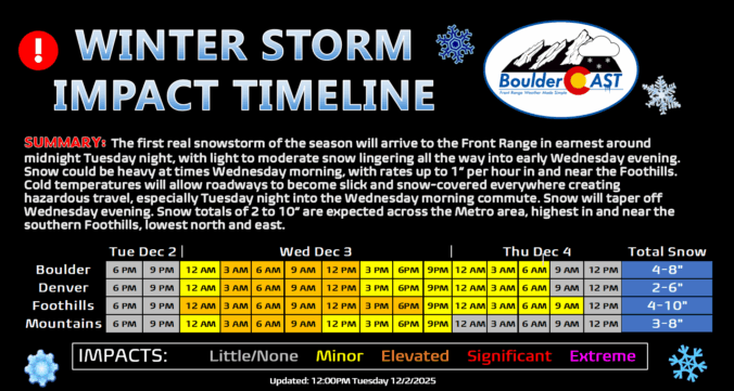
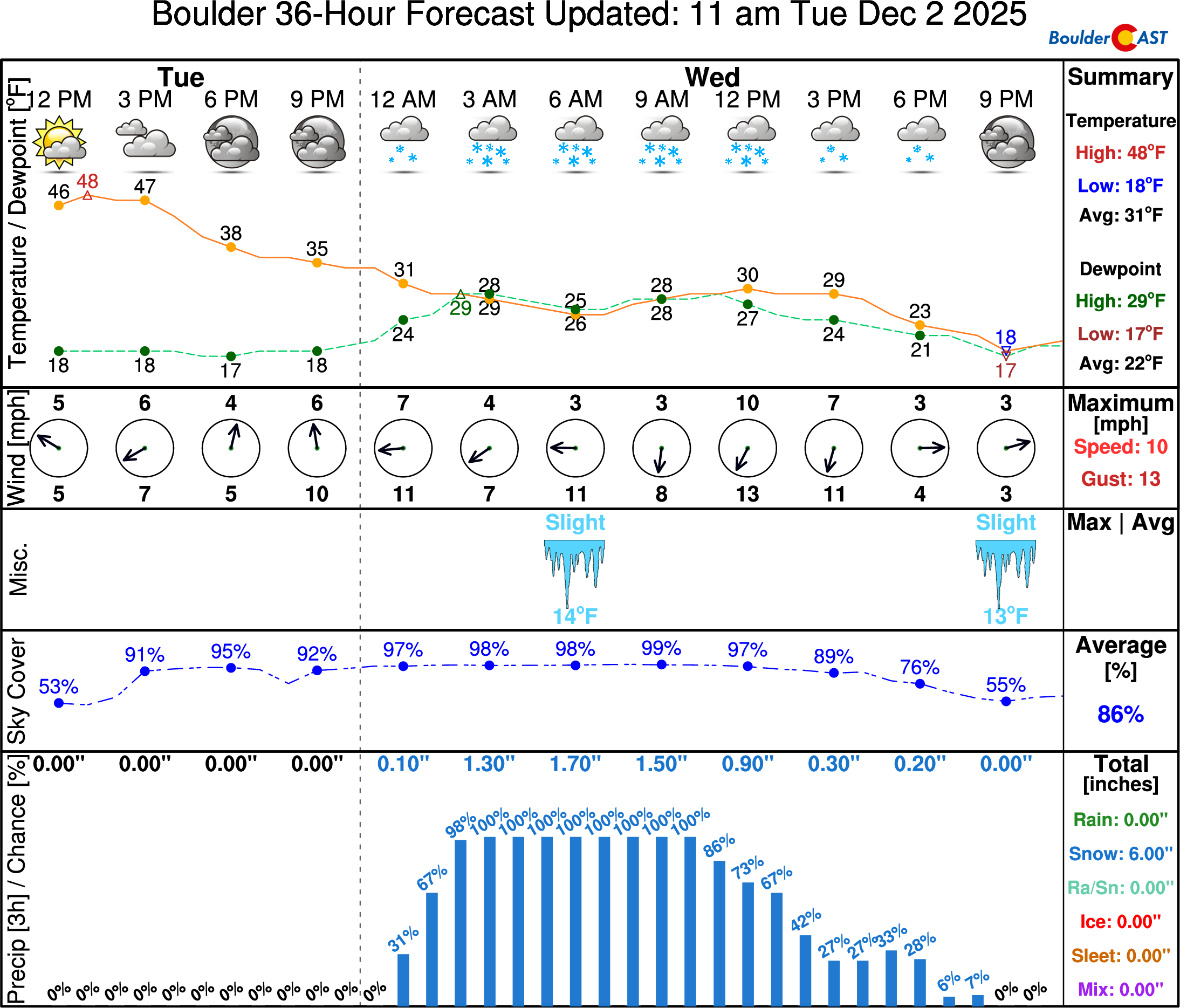
- 🛑 Storm timeline: Snow begins quickly near or slightly after midnight Tuesday night and lingers into Wednesday evening. Snow could be heavy at times, especially Wednesday morning.
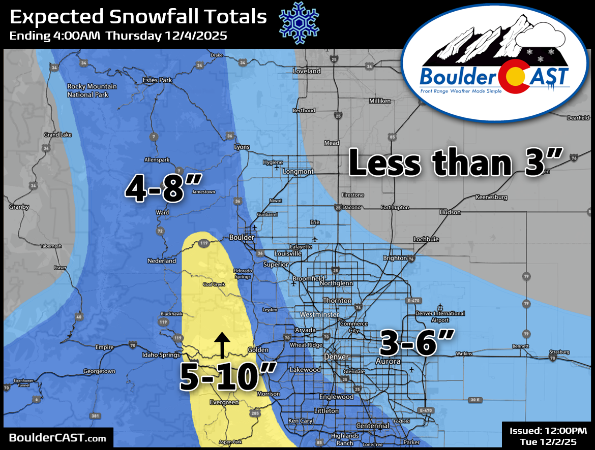
- 📏 Snow totals forecast: Boulder 4–8″, Denver 3–6″, southern Foothills up to 10″, DIA ~3″.
- 🚗 Travel impacts: Snow sticks to roadways quickly with temps in the 20s; Wednesday morning commute expected to be treacherous, especially in Foothills and western/southern suburbs. Only minor impacts to flights through DIA. Take it slow, folks!

Go Premium, get all the perks.
Daily Forecast Updates
Get our daily forecast discussion every morning delivered to your inbox.
All Our Model Data
Access to all our Colorado-centric high-resolution weather model graphics. Seriously — every one!
Ski & Hiking Forecasts
6-day forecasts for all the Colorado ski resorts, plus more than 120 hiking trails, including every 14er.
Smoke Forecasts
Wildfire smoke concentration predictions up to 72 hours into the future.
Exclusive Content
Weekend outlooks every Thursday, bonus storm updates, historical data and much more!
No Advertisements
Enjoy ad-free viewing on the entire site.
Finally our first real snow!
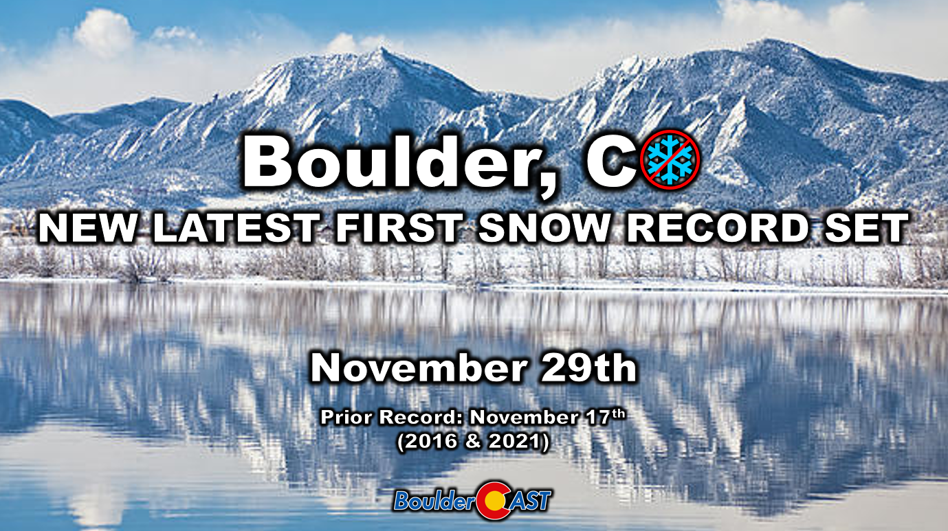
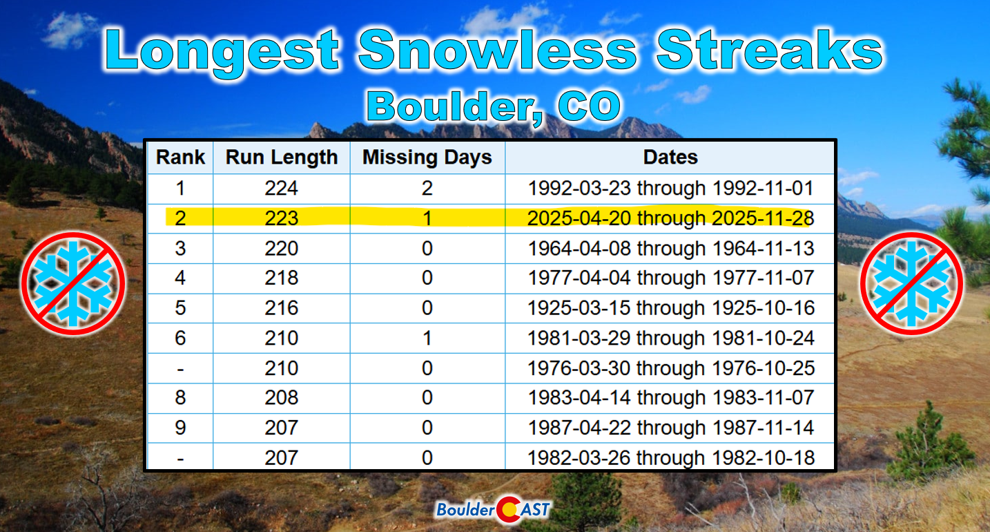
The two little brushes with winter weather we saw over Thanksgiving weekend were definitely overhyped and a bit over-forecast (#1 | #2). That’s not surprising, given the buzz around finally ending our historic snow drought and late first snow. But with that light coating last Saturday, both records are officially behind us. Now we can shift back to “normal” forecasting—focusing on the dynamic atmospheric ingredients of real storm systems instead of splitting hairs over whether a single neighborhood gets a dusting or not. Snow season is back, and it feels so good to say that.
We first flagged this midweek storm in our weekly outlook Monday morning (or on Sunday if you’re a Premium member). Since then, we’ve been tracking it closely, and confidence has only grown. Not only is the storm still on track, but snowfall projections have been trending upward into what we’d classify as a medium-impact event.
As of Tuesday morning, the system sits across western Montana and Idaho. On GOES-East water vapor imagery, it doesn’t look like much—just a swirl of clouds and a dip in the height lines. But that subtle feature is our snow-maker, set to swing into Colorado Tuesday night into Wednesday.
The storm’s core energy will track west of us tonight, even west of Salt Lake City, before spinning into the Four Corners by Wednesday evening.
That’s not usually a favorable path for Front Range snow, but this setup is different. A moist frontal boundary drops in Tuesday evening, and that’s the key ingredient.
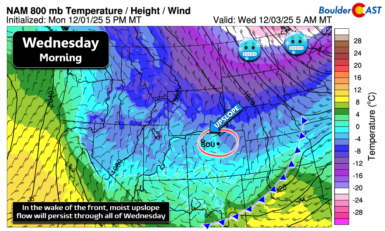
Behind the front, we’ll see deep (though somewhat weak) upslope flow persist for nearly 24 hours, reaching all the way to the Continental Divide. The 700mb wind forecast shows upslope kicking in just after midnight Tuesday night, holding steady through Wednesday, then flipping to downslope late Wednesday evening. Meanwhile, the 700mb low slides south along the Utah border into southwest Colorado—a neat little feature that’ll help lock in the upslope easterly wind direction for us.

The Boulder–Denver corridor and adjacent Foothills should see light to moderate snow falling almost continuously during this window. The long duration is what will drive totals upward. Honestly, model composite radar hasn’t looked this snowy for Boulder since last spring!
Moisture supply looks solid too. This will be the Front Range’s biggest precipitation event since early October, with most areas picking up 0.25–0.5″ of liquid. A narrow zone in the lower Foothills could squeeze out 0.5–0.7″, thanks to the weak but persistent upslope.
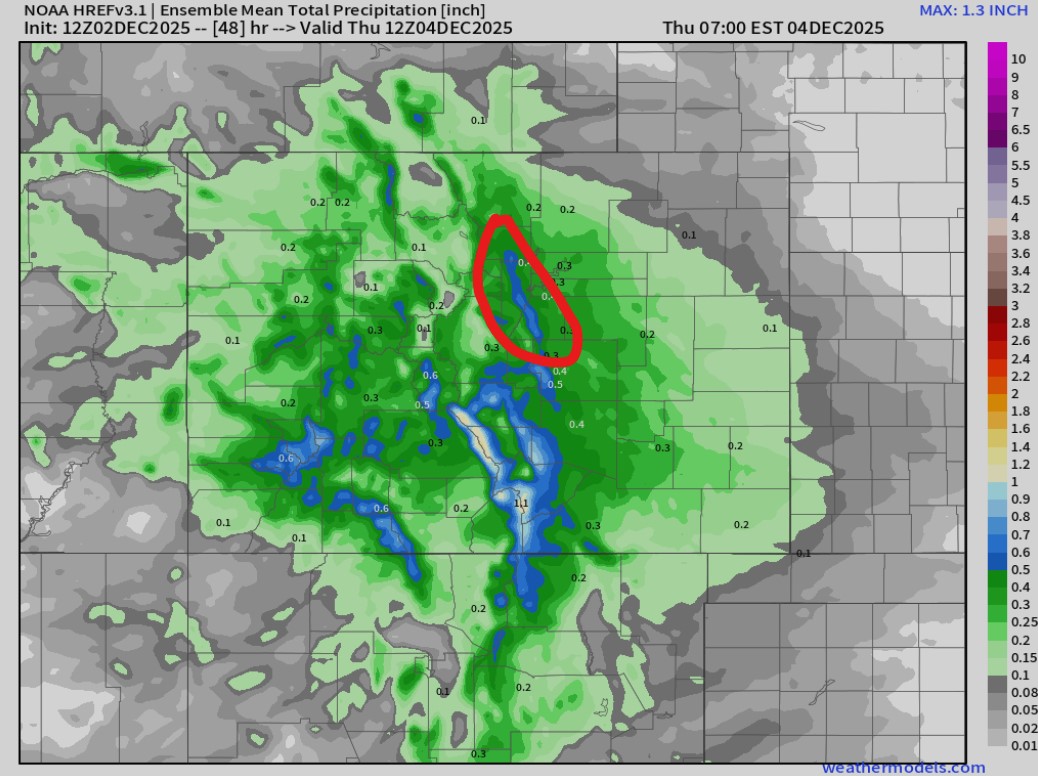
Boulder might sneak into that bullseye, though it’s not guaranteed. Interestingly, the Euro and GFS—often at odds—are in near-perfect agreement for this storm.
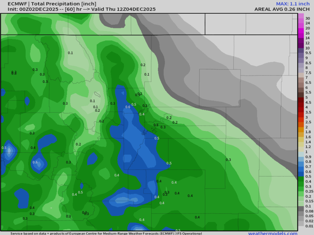
Euro precip forecast
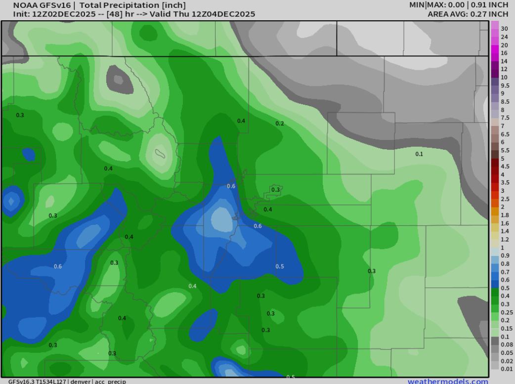
GFS precip forecast
So what does that moisture translate to in terms of snow? Looking at Wednesday morning’s atmospheric profiles, we see:
- The dendritic growth zone (DGZ) is shallow and elevated from 12,000 to 15,000 elevation.
- Upslope and the layer of peak vertical motion are below the DGZ — NOT co-located.
- Surface temperatures will be in the middle 20s while snow is falling.
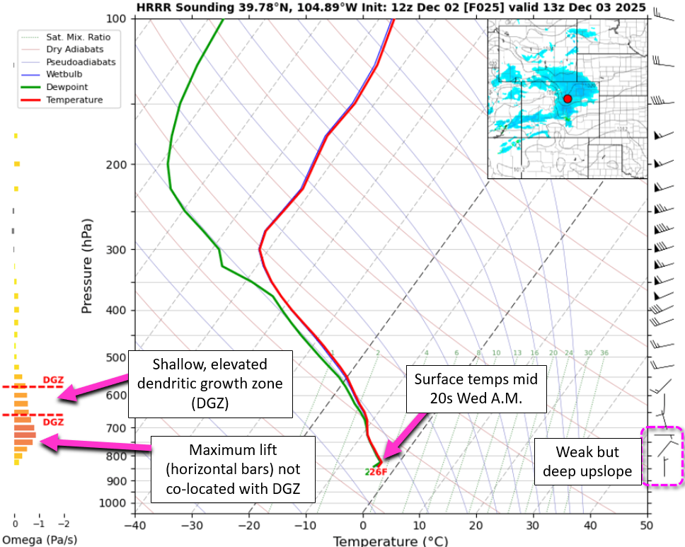
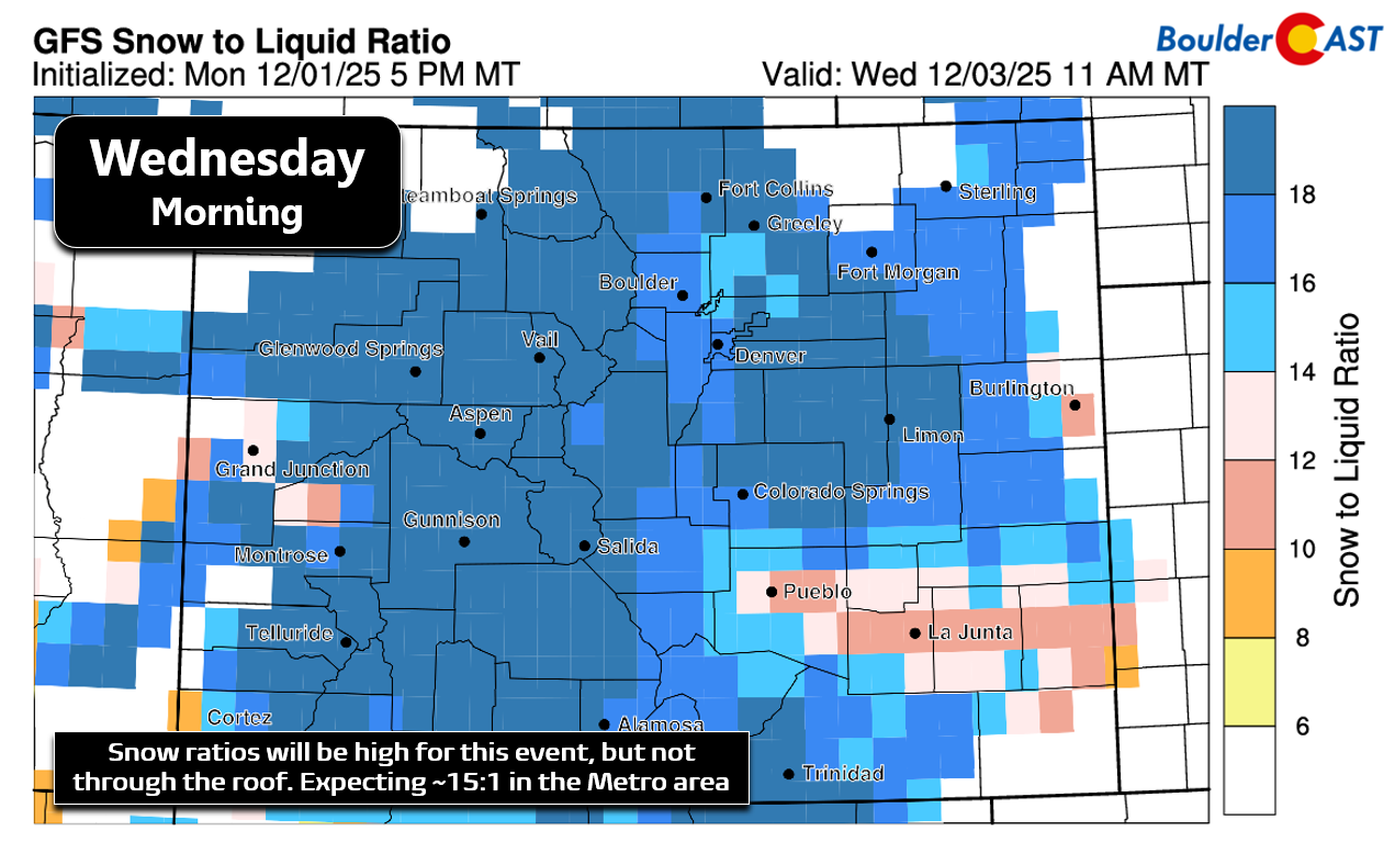
That means snow growth will be reasonably efficient, but not maxed out. Ratios should land around 14:1—fluffy, but not the fluffiest. Multiply that by our liquid totals, and we’re looking at a broad brush of 3–8″ across the Denver Metro area.
Our snowfall forecast map for the event is shown below and covers all snow through Wednesday evening. Totals will be highest, up to 10 inches, in and near the southern Foothills of Jefferson County. Boulder can expect 4 to 8 inches, with 3 to 6 inches in the heart of Denver. Areas to the northeast will miss out on most of the action and receive less than 3 inches. We’re expecting around 3 inches out by DIA which wouldn’t cause major travel issues, but may lead to a few delays.
Temperatures will drop quickly into the 20s Tuesday night, so snow will stick to roads right away. Expect widespread travel impacts, especially for the Wednesday morning commute. And yes—drivers will be relearning how to handle the “real” first snow of the season.
Our Winter Storm Impact timeline highlights the worst travel windows, with the Foothills seeing the biggest issues, followed closely by Boulder and the western/southern suburbs.

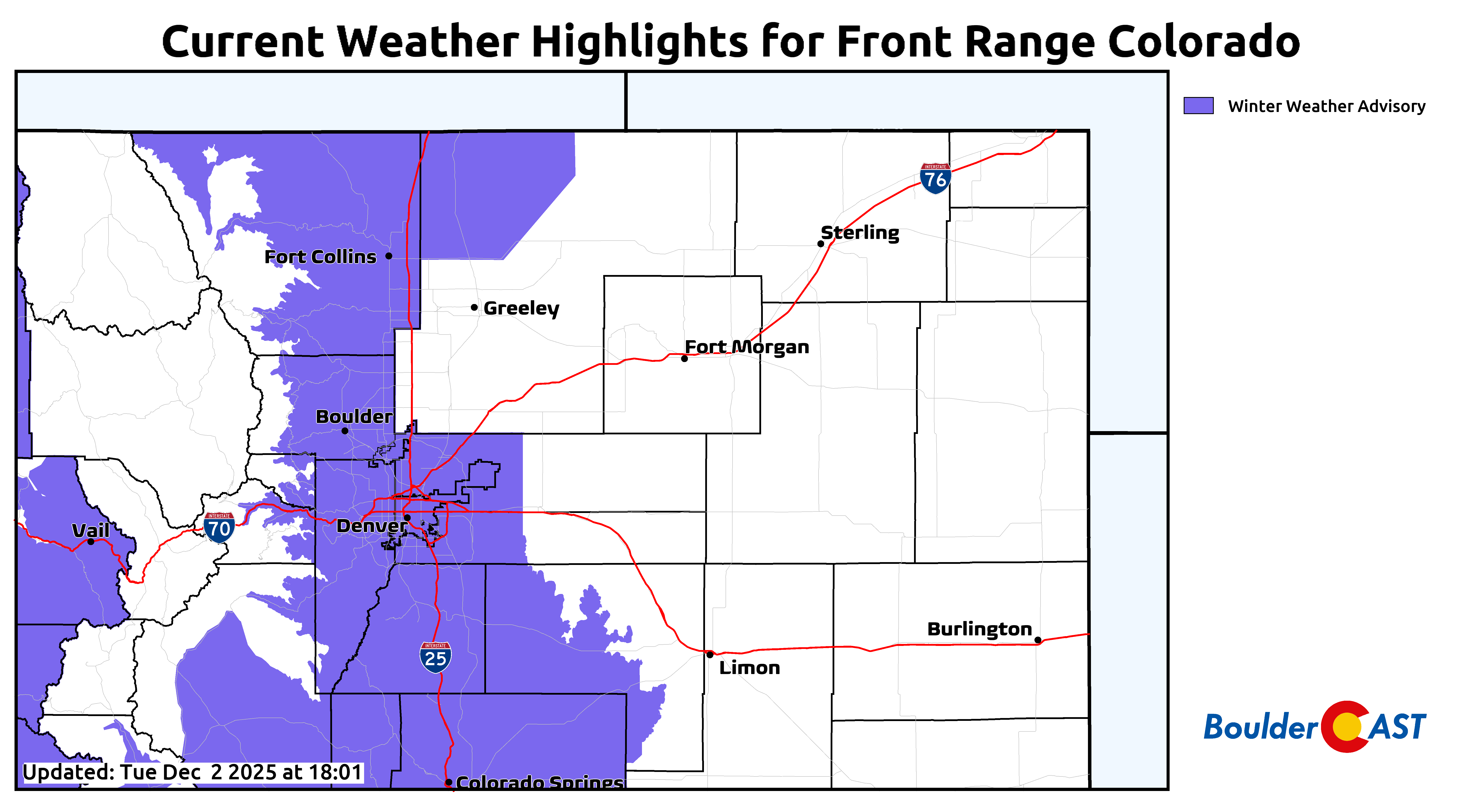
Winter Weather Advisories are posted for most of the Denver Metro area and Foothills from Midnight to 6PM on Wednesday for adverse travel conditions.
In summary, this midweek storm has all the right ingredients to deliver the Front Range’s first true taste of winter—steady upslope, solid moisture, and enough cold air to make travel tricky. While totals will vary by location, most of us can expect several inches of fluffy accumulation and a messy Wednesday A.M. commute. After weeks (months?) of waiting, Boulder’s snow season is finally back in business, and this storm is set to remind us why we love winter!
FINAL NOTE: As of writing around midday Tuesday, a decent percentage of the short range models are coming in more bullish on amounts by a couple inches. We’re not jumping on that ship just yet, but we will continue to monitor trends and observations through the rest of Tuesday and pass along pertinent updates in this post.
Now, LET IT SNOW and enjoy!
Spread the word, share our crazy Colorado weather:
Go Premium, get all the perks.
Daily Forecast Updates
Get our daily forecast discussion every morning delivered to your inbox.
All Our Model Data
Access to all our Colorado-centric high-resolution weather model graphics. Seriously — every one!
Ski & Hiking Forecasts
6-day forecasts for all the Colorado ski resorts, plus more than 120 hiking trails, including every 14er.
Smoke Forecasts
Wildfire smoke concentration predictions up to 72 hours into the future.
Exclusive Content
Weekend outlooks every Thursday, bonus storm updates, historical data and much more!
No Advertisements
Enjoy ad-free viewing on the entire site.


You must be logged in to post a comment.