
A few snowflakes fell across the area Sunday evening with some jet-forced snow bands around. These were largely south of Denver leaving just a trace of snow for most of us. The Mountains made out better with several inches of orographic snow piling up under moist northwesterly flow. We briefly review both the snow totals from this single storm and the seasonal ones.
O
ur snowfall forecast map issued Sunday morning is shown below with storm totals overlaid. Green values indicate our forecast verified, Yellow values mean the observed total was just outside our forecast, while Red was a busted forecast (more than 1″ off). The main aspect of this snow event was spotty jet-forced snow bands east of the Mountains. Those were highly uncertain, as detailed in our forecast, but ended up developing a bit further south across the Colorado Springs area. Thus, little to no snow was observed below 8000 feet in the Denver area. Skies resorts like Vail, Breck, Loveland and Winter Park all received 4 to 8 inches.
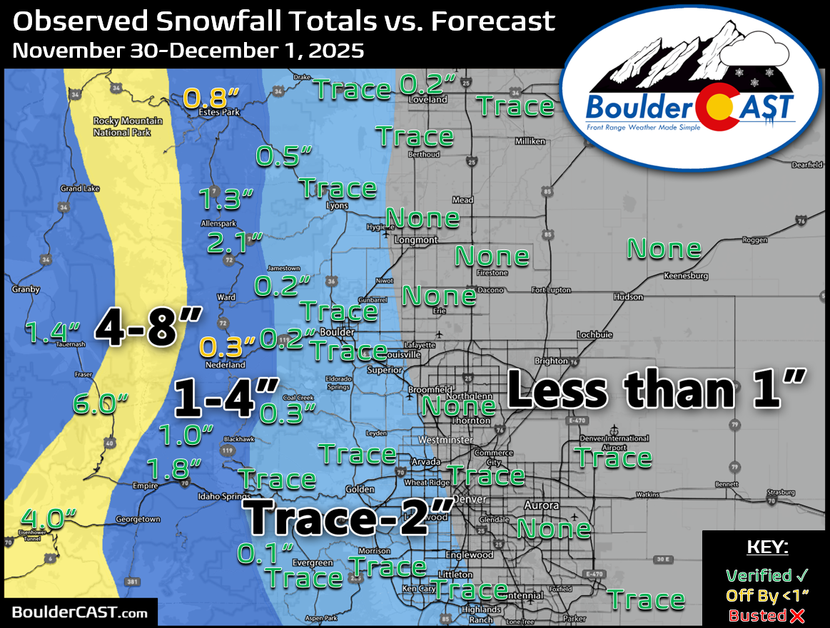
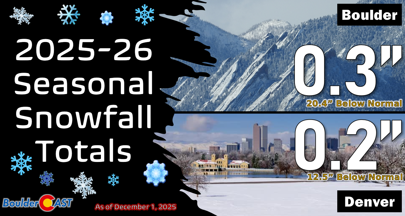
Officially Boulder and Denver both received just a trace of snow from this event, so our pitiful seasonal snowfall totals remain unchanged after the record late first snow a few days prior.
You can find a recap of all the winter storms so far in the 2025-2026 snow season HERE.
By the way, we’re already tracking our next potential chance of snow later this week, one which should offer a good chance for the entire area to receive up to a few inches of accumulation….


You must be logged in to post a comment.