This week’s weather will once again be excruciatingly quiet in the Front Range. It’ll be a roller-coaster ride in temperatures from the 70s to around 90 degrees, but no rain is in the forecast as high pressure ridging keeps things totally dry. Two dry cold fronts will pass through the area — one on Monday and another later in the week, but this won’t prevent us from nearing record heat on Wednesday. We also discuss the potential for tropical development in the days ahead and take a look at the devastating aftermath of Hurricane Helene in North Carolina.
This week’s highlights include:
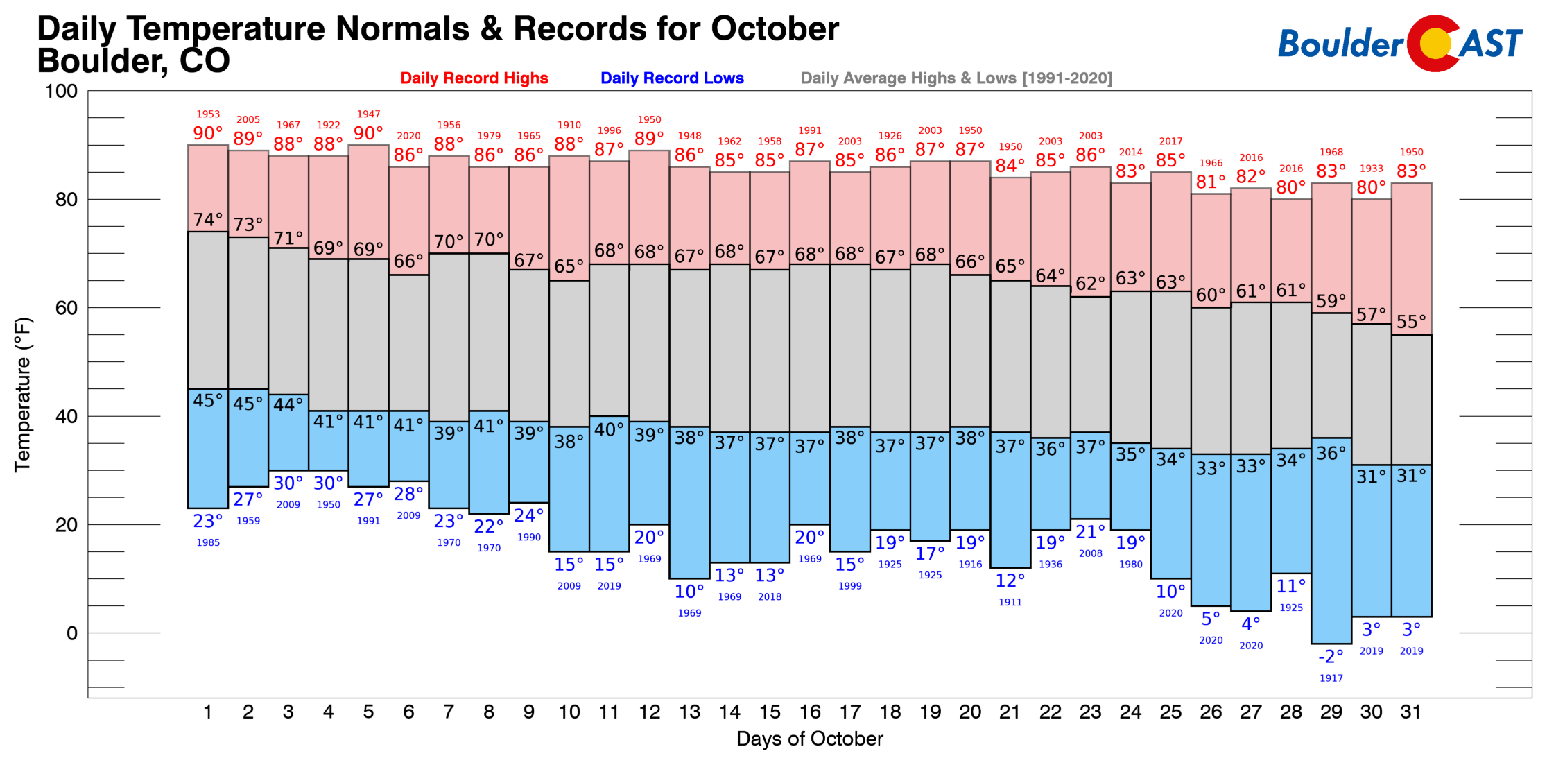
- Hello October! Our average highs start out the month in the middle 70s, but tumble to the middle 50s by Halloween.
- Staying Warm This Week: Closer to normal highs Tuesday behind a cold front, but most of the week will be unseasonably warm.
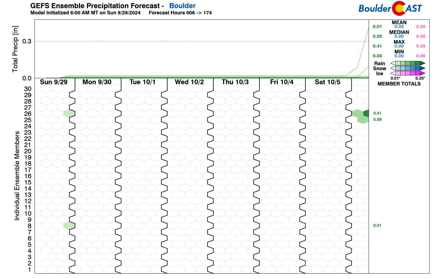
- No Precipitation In Sight: The week stays totally dry in the Front Range, and the extended outlook also looks dry. Keep this in mind when submitting your prediction in our 10th Annual First Snow Contest!
- Watching the Gulf of Mexico: A tropical system could form yet again in the Gulf later this week, but the track remains uncertain.
- Recapping Hurricane Helene: Historic devastation, flooding, mudslides and tornadoes accompanied the passage of Hurricane Helene last week in North Carolina.
DISCLAIMER: This weekly outlook forecast is created Monday morning and covers the entire upcoming week. Accuracy will decrease as the week progresses as this post is NOT updated. To receive daily updated forecasts from our team, among many other perks, subscribe to BoulderCAST Premium.

Go Premium, get all the perks.
Daily Forecast Updates
Get our daily forecast discussion every morning delivered to your inbox.
All Our Model Data
Access to all our Colorado-centric high-resolution weather model graphics. Seriously — every one!
Ski & Hiking Forecasts
6-day forecasts for all the Colorado ski resorts, plus more than 120 hiking trails, including every 14er.
Smoke Forecasts
Wildfire smoke concentration predictions up to 72 hours into the future.
Exclusive Content
Weekend outlooks every Thursday, bonus storm updates, historical data and much more!
No Advertisements
Enjoy ad-free viewing on the entire site.
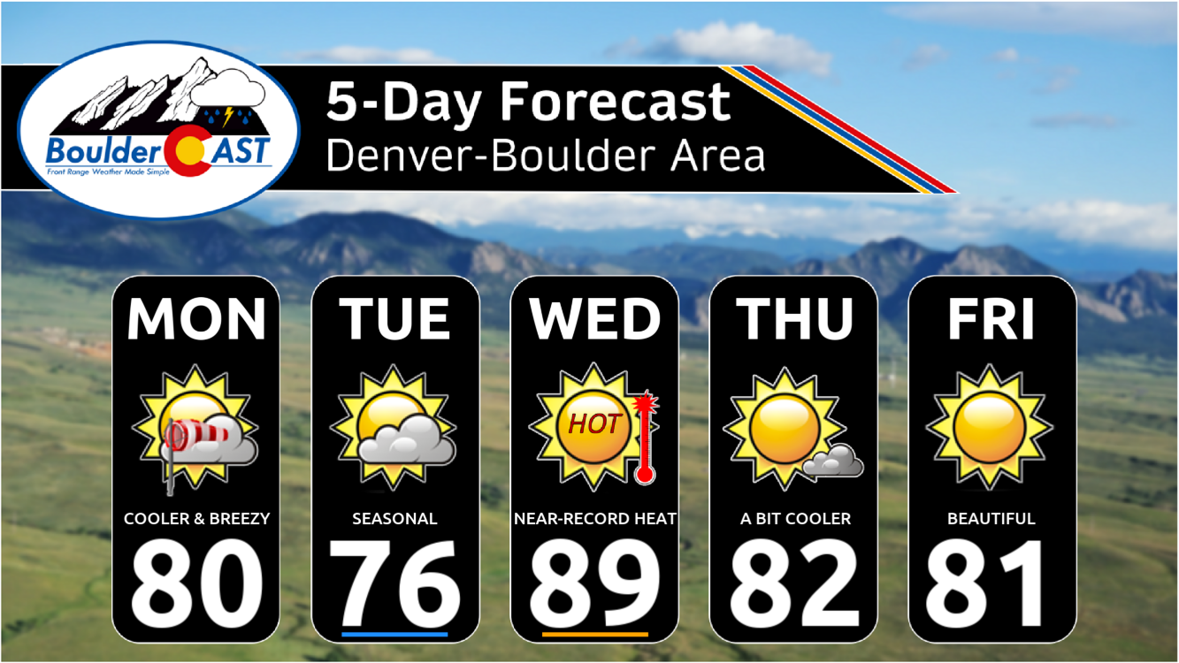
A few dry cold fronts this week with up and down temperatures
The chance for any rain (or snow) this week is roughly nil, at least according to the the GEFS ensemble forecast (below). In fact, nearly all guidance shows little to no rain chances for the next seven days in the Front Range. Instead, the main story for this week will be our temperatures, which will oscillate from the 70s to near 90, staying for the most part above normal, though some near-average highs are possible on Tuesday.
This week also marks the transition into October when our average highs really begin to tumble. Boulder’s daily average high temperatures start the week in the middle 70s, and end in the upper 60s. Record highs, on the other hand, are largely in the upper 80s to around 90° this time of year. This will be important around midweek as we could reach record highs ahead of a secondary cold front.
A trough over the northern Great Plains and Canada will usher in a dry cold frontal passage Monday morning. The result will bring northeast flow for the remainder of our afternoon. A few spotty showers could form in the wake of the front south of Denver, but our immediate area will be dry as a bone.
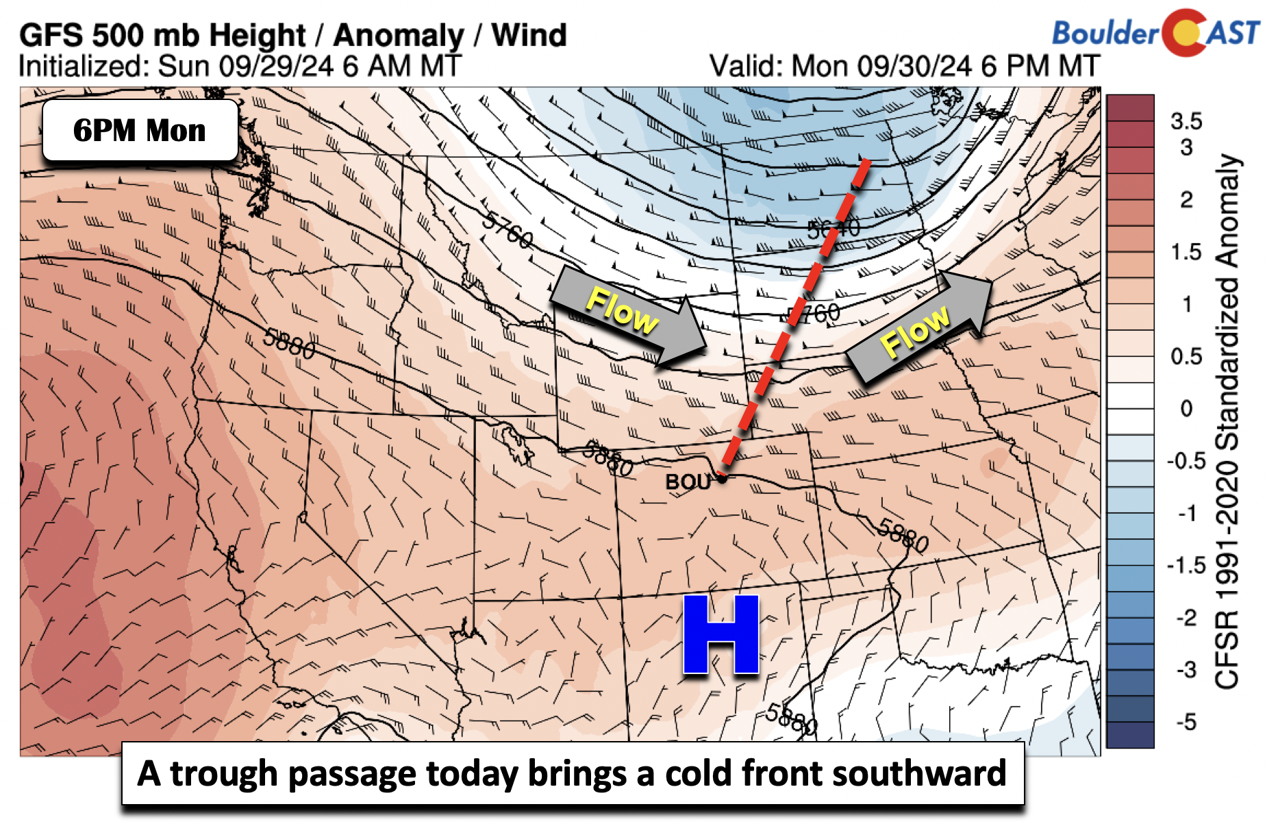
Temperatures will top out in the middle 70s to lower 80s prior to the frontal passage which occurs around 10:00 AM local time on Monday, with a gusty northeast flow of 10-20 MPH at times along and behind the front.
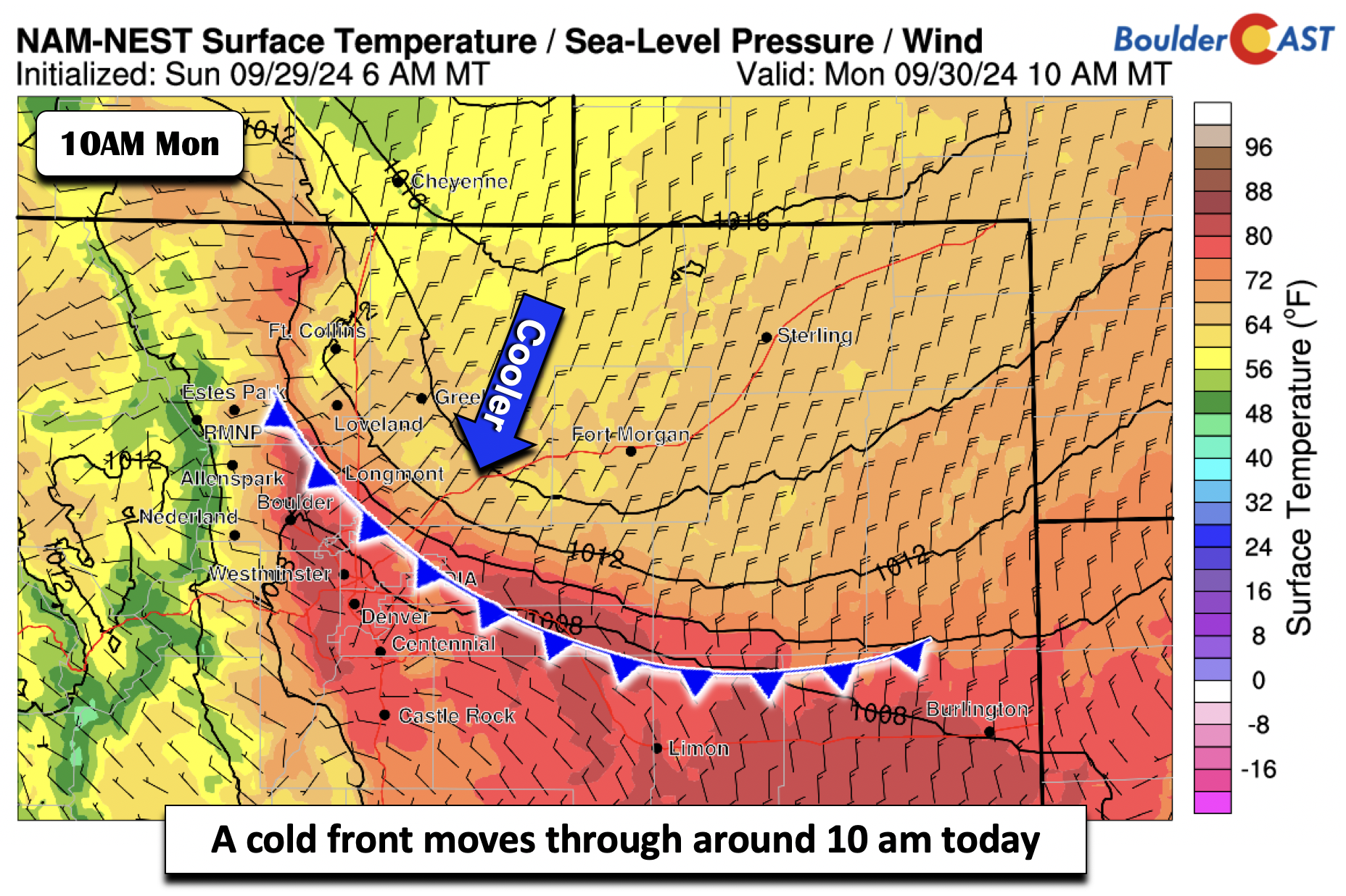
Temperatures should settle nicely into the middle 70s for the remainder of the afternoon — definitely a nice way to start the week, but this is still above normal.
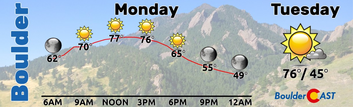
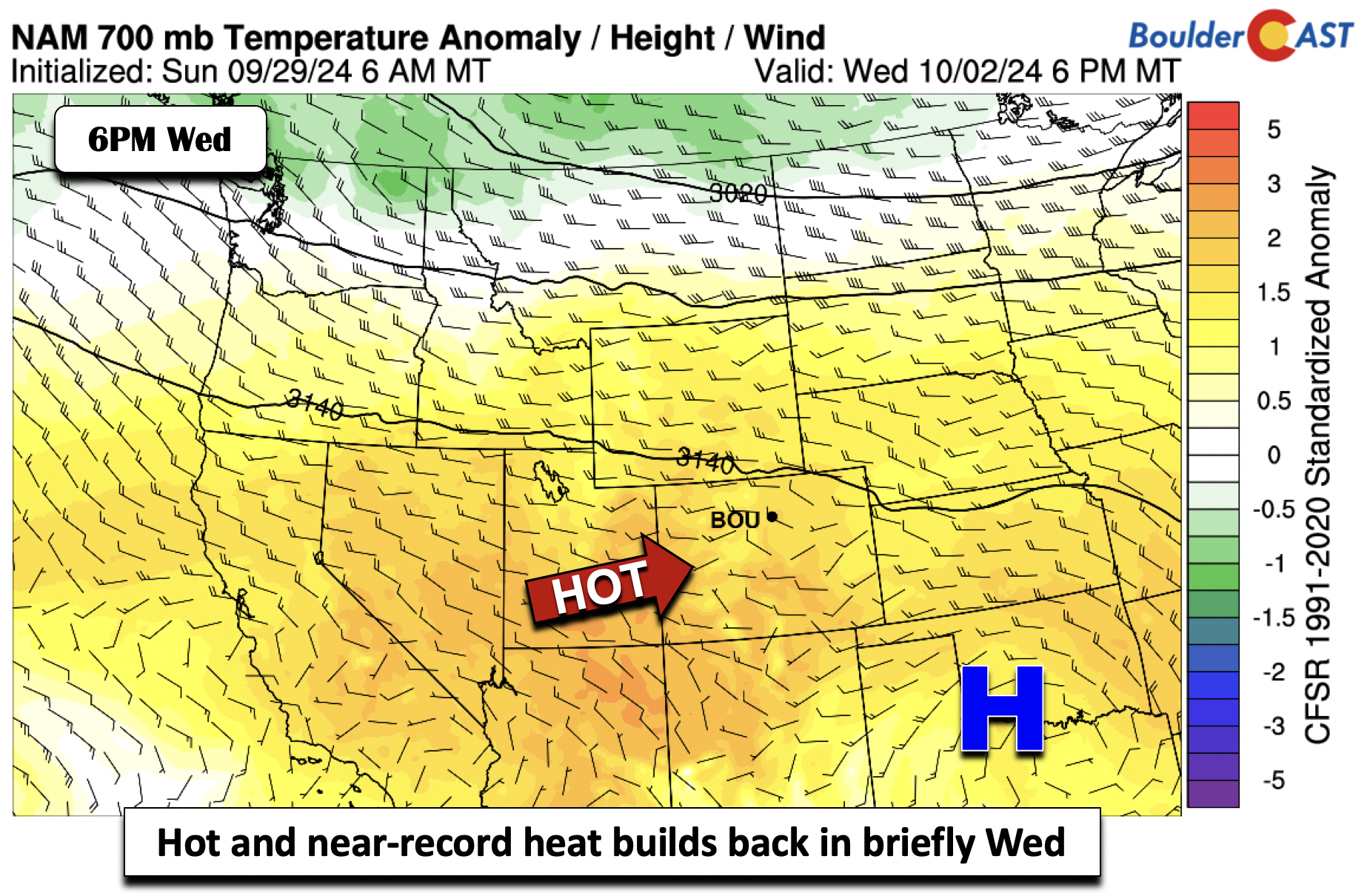
Our coldest day of the week should unfold on Tuesday in the wake of the frontal passage. A much cooler airmass will offer highs near the mid to upper 70s. Thus, the first day of October will be closer to seasonal normals, but that won’t last long. A resurgent hot, westerly downslope flow will take over again on Wednesday. Record highs could be tied or exceeded in the Denver Metro area. The record to beat for Boulder is 89°F set in 2005, so it will be close. We are forecasting upper 80s to near 90 degrees.
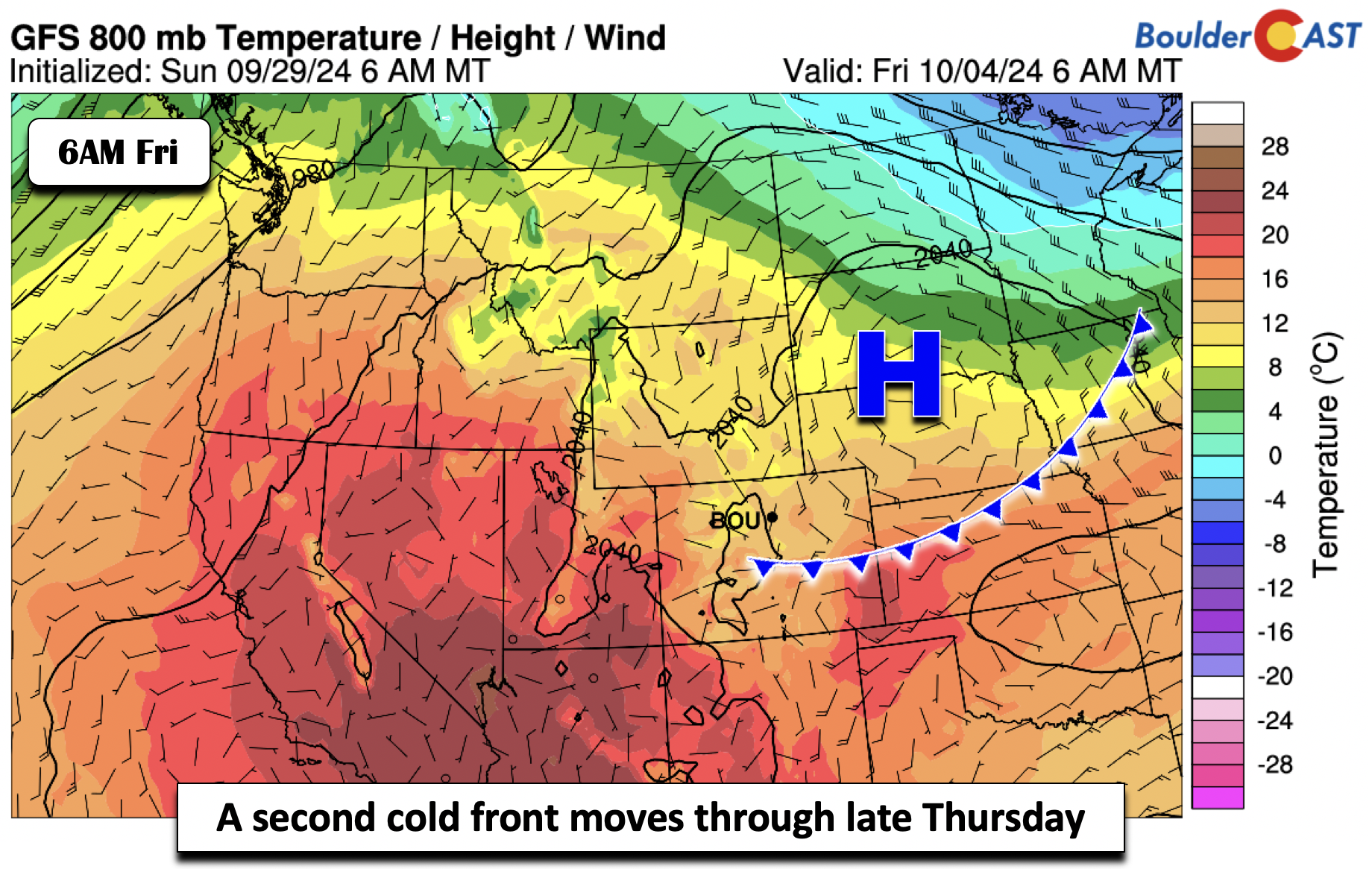
A late-week cold front will also move south out of the Plains. There remains some uncertainty as to the strength of the front, with the colder solutions showing a much cooler airmass and some mid 70s for highs by Friday. On the other hand, some solutions keep the coolest air to our east and north, with low to mid 80s for highs. For now, we are forecasting near the middle of the ensemble solutions in the upper 70s to lower 80s Thursday and Friday, warmest on the former. Sadly, this front will be totally dry yet again.
Despite some ups and downs this week in temperatures, we won’t be able to squeak out any precipitation. More dry weather is not what we need right now, but try to take advantage of the cards we are dealt — hopefully this is summer’s last gasp…
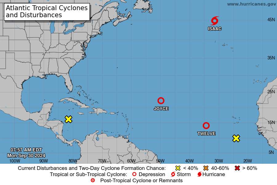
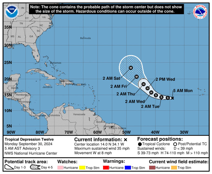
Switching gears a bit — the tropics remain active, especially in the Atlantic Basin, where there are currently five areas of interest — this includes two named storms and Tropical Depression 12 which is forecast to become a major hurricane later this week out over the wide open waters of the central Atlantic.
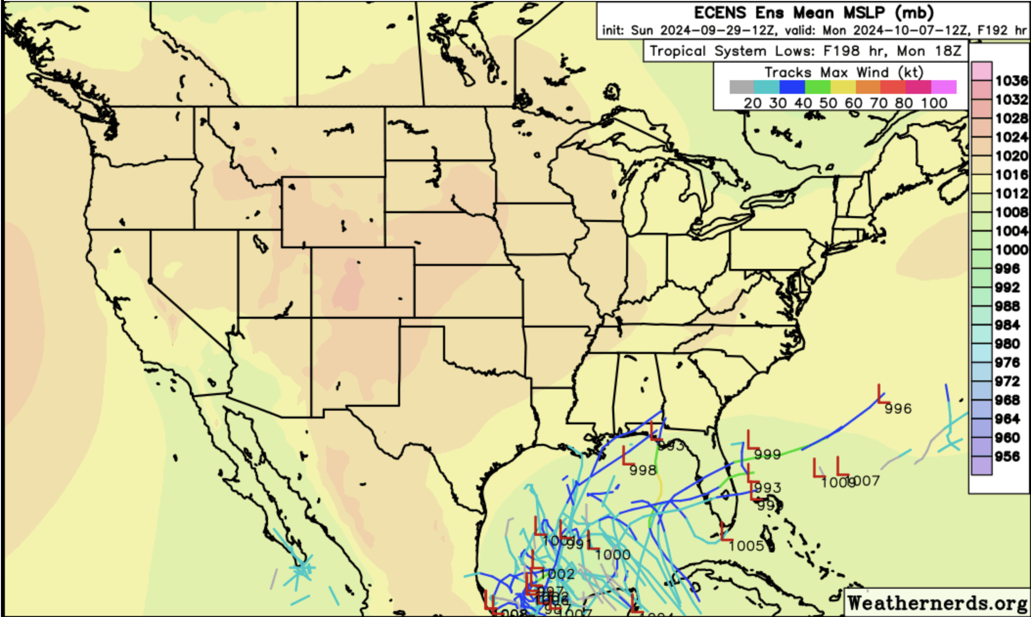
The image below shows low pressure tracks of tropical system development in the Gulf of Mexico over the next seven days from the European ensemble. Note the wide spread in where tropical development could both form and track. Some solutions bring a tropical system along a similar path to what Helene just took, while other solutions keep it south over southern Florida. Time will tell, but Gulf Coast residents should closely monitor the ongoing tropical forecast.
Finally, don’t forget to get your submission in for our 10th Annual First Snowfall Contest which closes to entries on WEDNESDAY (October 2nd at 11:59PM). Based on everything we discussed here, and the latest model projections, we may be waiting a while for our first snow so do predict accordingly…

Recapping Hurricane Helene in North Carolina
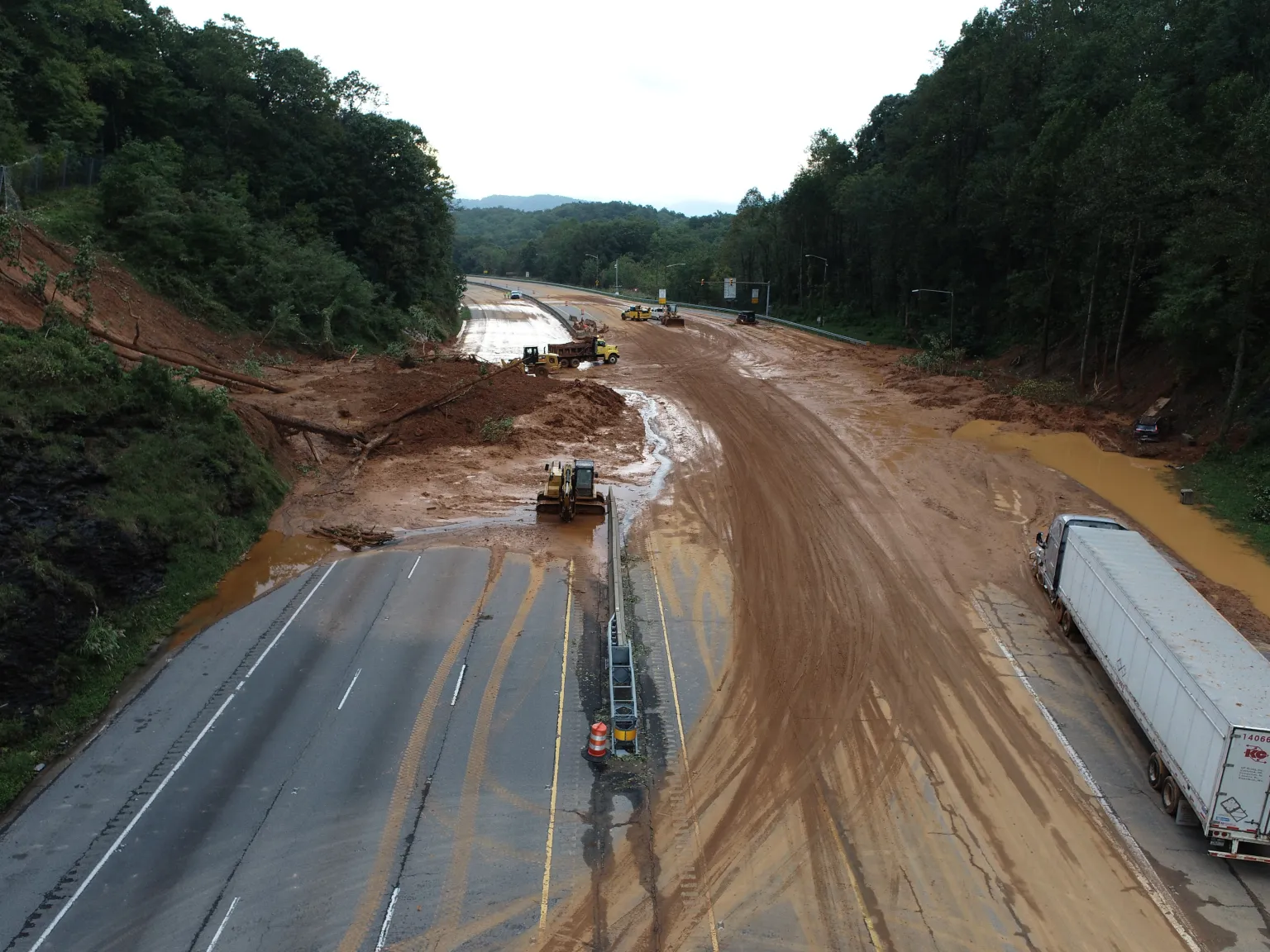
Hurricane Helene brought historic devastation to many areas of western North Carolina. Several tornadoes were reported, as well as flooding from 10 to 18 inches of rainfall, landslides, mudslides, including some injuries and fatalities. The image below shows a section of Interstate 40 washed out from a landslide. Many of the roads in and out of Asheville and Boone are closed — it could be months before they are able to reopen.
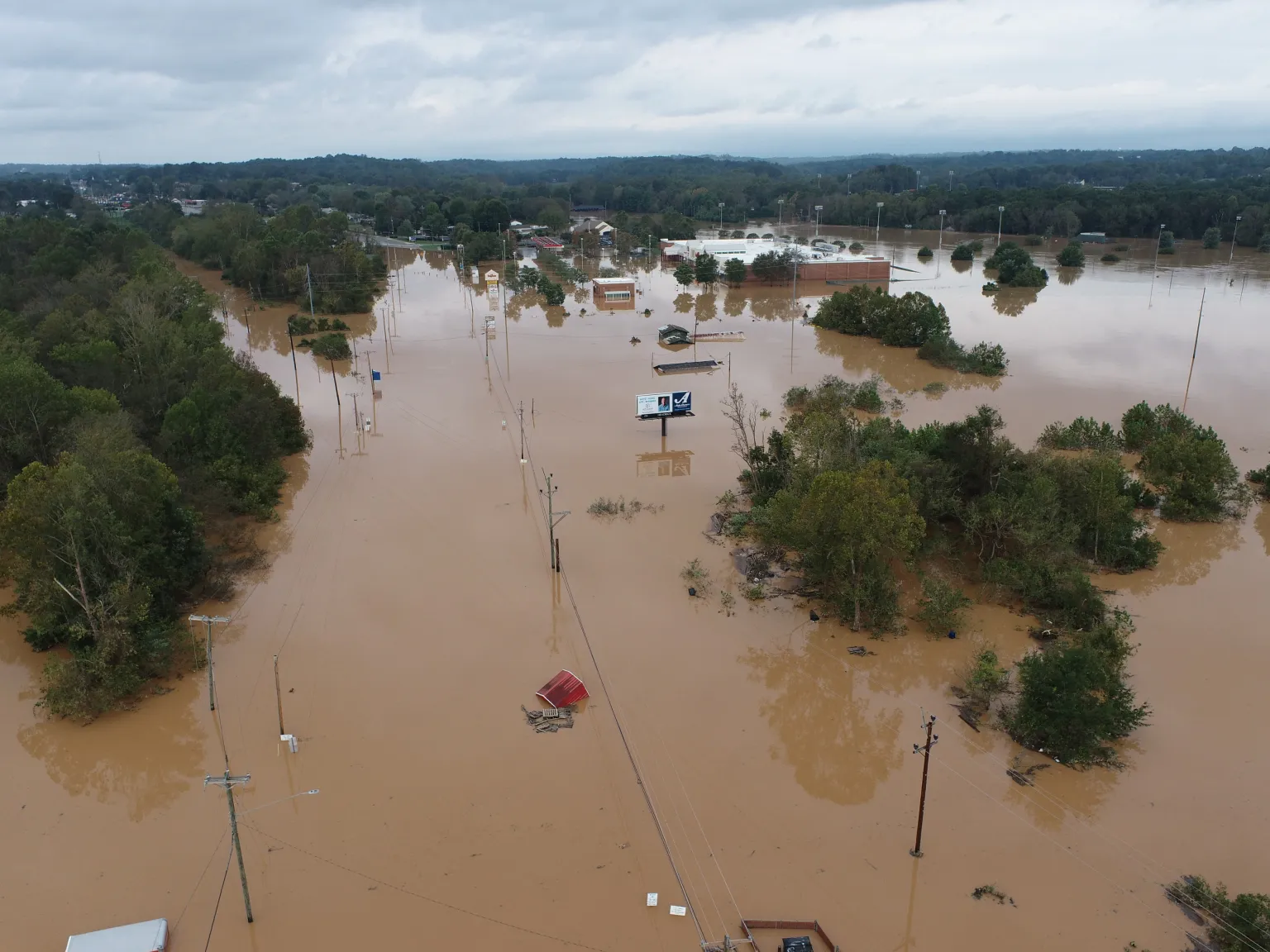
Below shows a US highway in western NC under flood waters, barely noticeable. To this day, several fatalities were confirmed and many folks are still missing or unaccounted for.
A few tornadoes were reported as well due to the combination of strong shear and instability within the right-front quadrant of Helene. The National Weather Service in Raleigh confirmed four tornadoes in central North Carolina, one that was upwards of EF3 strength. The image below shows a confirmed EF1 tornado about 50 miles north of Raleigh, where several trees were uprooted or split. About 15 injuries were reported from the tornadoes, but thankfully no fatalities.

Forecast Specifics:
Monday: Partly cloudy. Highs in the low 80s on the Plains prior to frontal passage, settling into the upper 70s. Over the Foothills, highs in the middle 70s. Breezes of 10-20 MPH will accompany and follow the front.
Tuesday: Partly cloudy and pleasant, but still a few degrees above normal in the middle 70s in the Denver Metro and upper 60s in the Foothills.
Wednesday: Turning hot with highs in the upper 80s to near 90 degrees for the Plains and upper 70s over the Foothills. This will be the hottest day of the week with numerous record highs possible across the area.
Thursday: Mostly sunny and mild with low to mid 80s on the Plains and mid 70s in the Foothills.
Friday: A tad cooler but sunny. Highs near 80 on the Plains and upper 60s over the Foothills.
Weekend: Staying warm and dry with temperatures likely in the 80s both days.
Get BoulderCAST updates delivered to your inbox:
DISCLAIMER: This weekly outlook forecast is created Monday morning and covers the entire upcoming week. Accuracy will decrease as the week progresses as this post is NOT updated. To receive daily updated forecasts from our team, among many other perks, subscribe to BoulderCAST Premium.
Go Premium, get all the perks.
Daily Forecast Updates
Get our daily forecast discussion every morning delivered to your inbox.
All Our Model Data
Access to all our Colorado-centric high-resolution weather model graphics. Seriously — every one!
Ski & Hiking Forecasts
6-day forecasts for all the Colorado ski resorts, plus more than 120 hiking trails, including every 14er.
Smoke Forecasts
Wildfire smoke concentration predictions up to 72 hours into the future.
Exclusive Content
Weekend outlooks every Thursday, bonus storm updates, historical data and much more!
No Advertisements
Enjoy ad-free viewing on the entire site.
Enjoy our content? Give it a share!


You must be logged in to post a comment.