Rain chances in the Front Range will be front-loaded this week with a moist monsoonal flow in place. Temperatures will consequently hover near average in the 80s with plentiful clouds and storms developing each day, some of which could cause localized flash flooding. Rain chances will remain for the latter part of the week, but coverage lessens significantly as drier air is forecast to move in. We’ll also likely see the return to the 90s by week’s end. Read on for all the details.
This week’s highlights include:
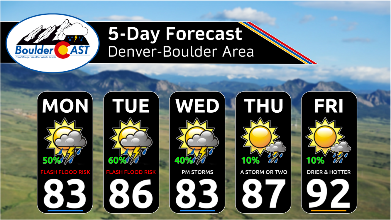
- Rain chances: A moist monsoonal flow will aid our highest storm chances Monday, Tuesday, and Wednesday ahead of a cold front. Storms will include a risk of localized flash flooding and damaging hail/wind gusts.
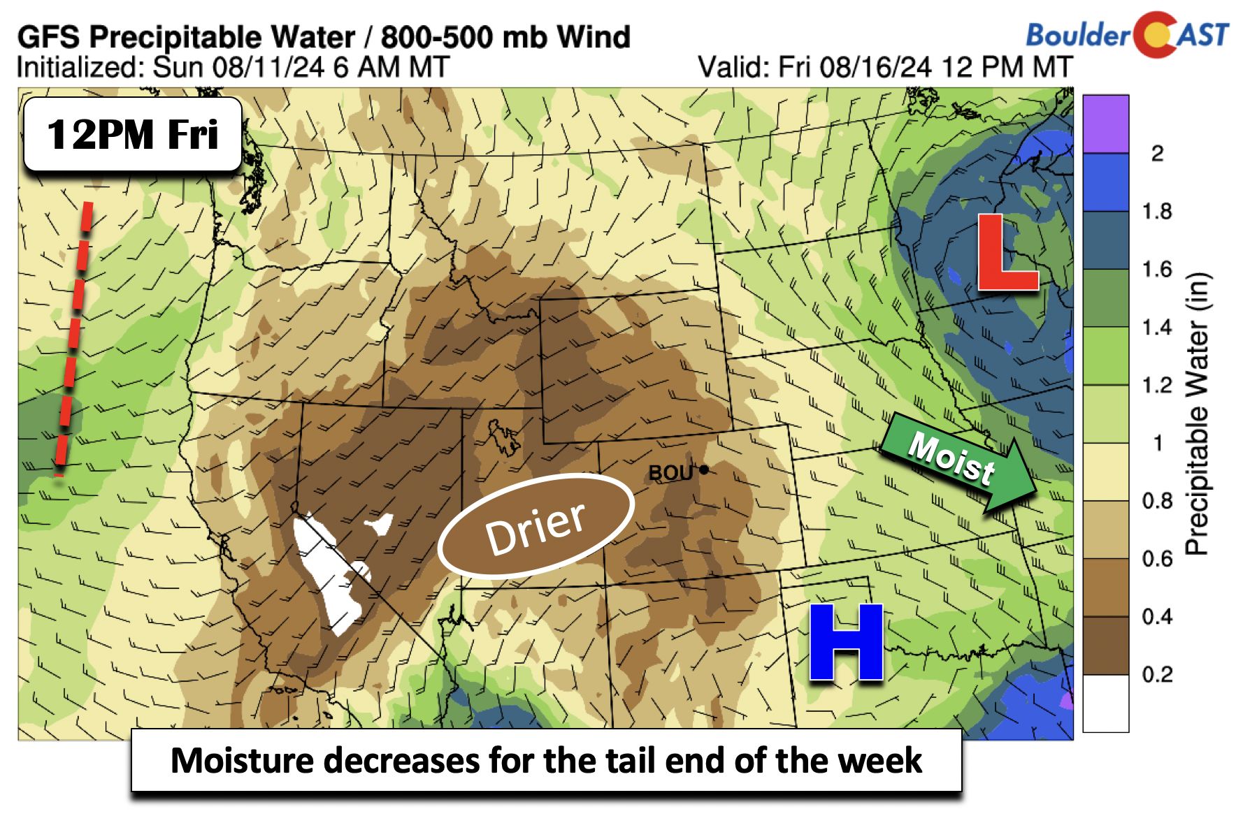
- Drying out: Rain chances lessen considerably Thursday and Friday but still cannot be fully ruled out to end the week
- Temperatures: Near average most of the week, with a trend slightly above normal by Friday
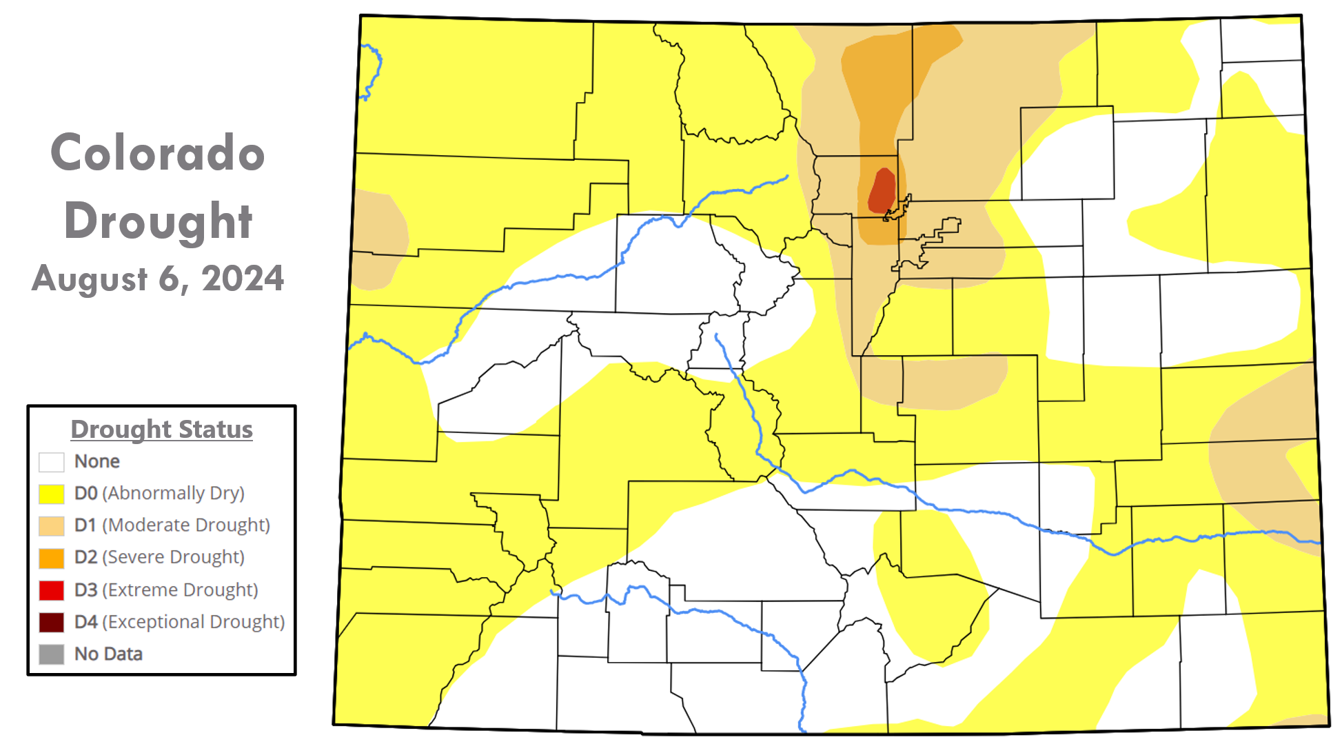
- Drought Has Worsened: Severe to Extreme Drought now encompasses much of the Front Range — we need whatever rain we can get this week, even if it comes with the risk of flash flooding
DISCLAIMER: This weekly outlook forecast is created Monday morning and covers the entire upcoming week. Accuracy will decrease as the week progresses as this post is NOT updated. To receive daily updated forecasts from our team, among many other perks, subscribe to BoulderCAST Premium.

Go Premium, get all the perks.
Daily Forecast Updates
Get our daily forecast discussion every morning delivered to your inbox.
All Our Model Data
Access to all our Colorado-centric high-resolution weather model graphics. Seriously — every one!
Ski & Hiking Forecasts
6-day forecasts for all the Colorado ski resorts, plus more than 120 hiking trails, including every 14er.
Smoke Forecasts
Wildfire smoke concentration predictions up to 72 hours into the future.
Exclusive Content
Weekend outlooks every Thursday, bonus storm updates, historical data and much more!
No Advertisements
Enjoy ad-free viewing on the entire site.
A wet early week will trend drier
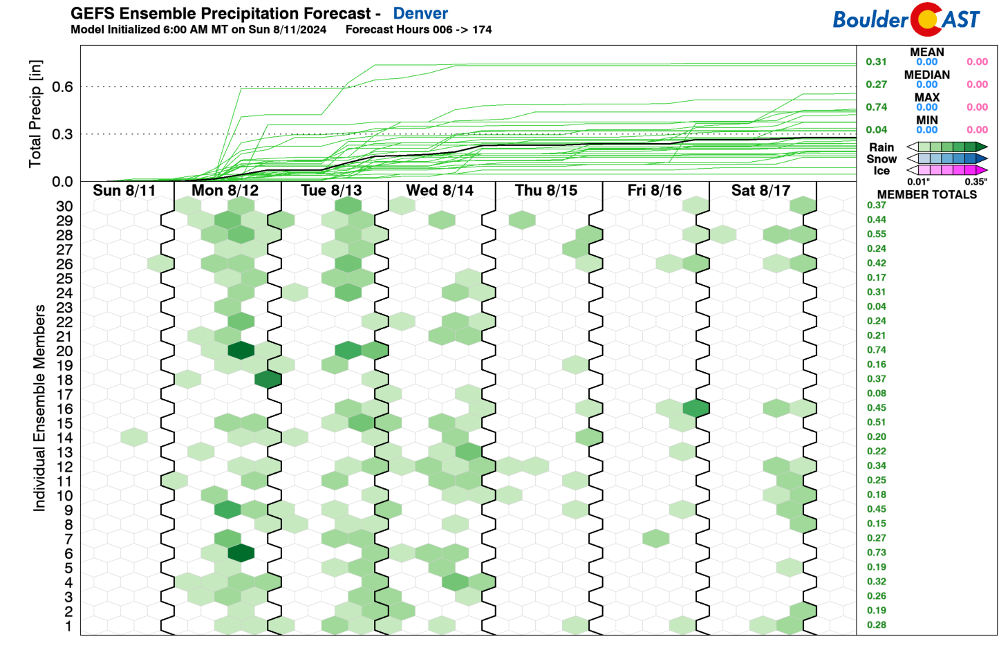
Our shower and storm chances will be front-loaded this week, as the GEFS ensemble plume graphic below shows. This will be tied to a favorable monsoon pattern continuing, as we’ll discuss below. The rain chances will largely fall off a cliff by the tail-end of the week as drier air and a less favorable downslope flow takes over.
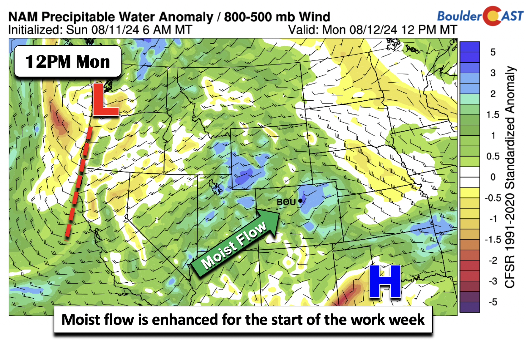
The first part of the week will feature influences from two pressure centers across the Nation. The first is a trough of low pressure over the West Coast. A second is high pressure ridging over the Southern Plains. The result will be a juicy southwest flow over Colorado, typical of a monsoon pattern. This is going to favor good shower and storm chances Monday, Tuesday, and Wednesday. The trough will eventually move east of us by Thursday, but before that happens, we’ll see storm chances in the 40-60% range each day.
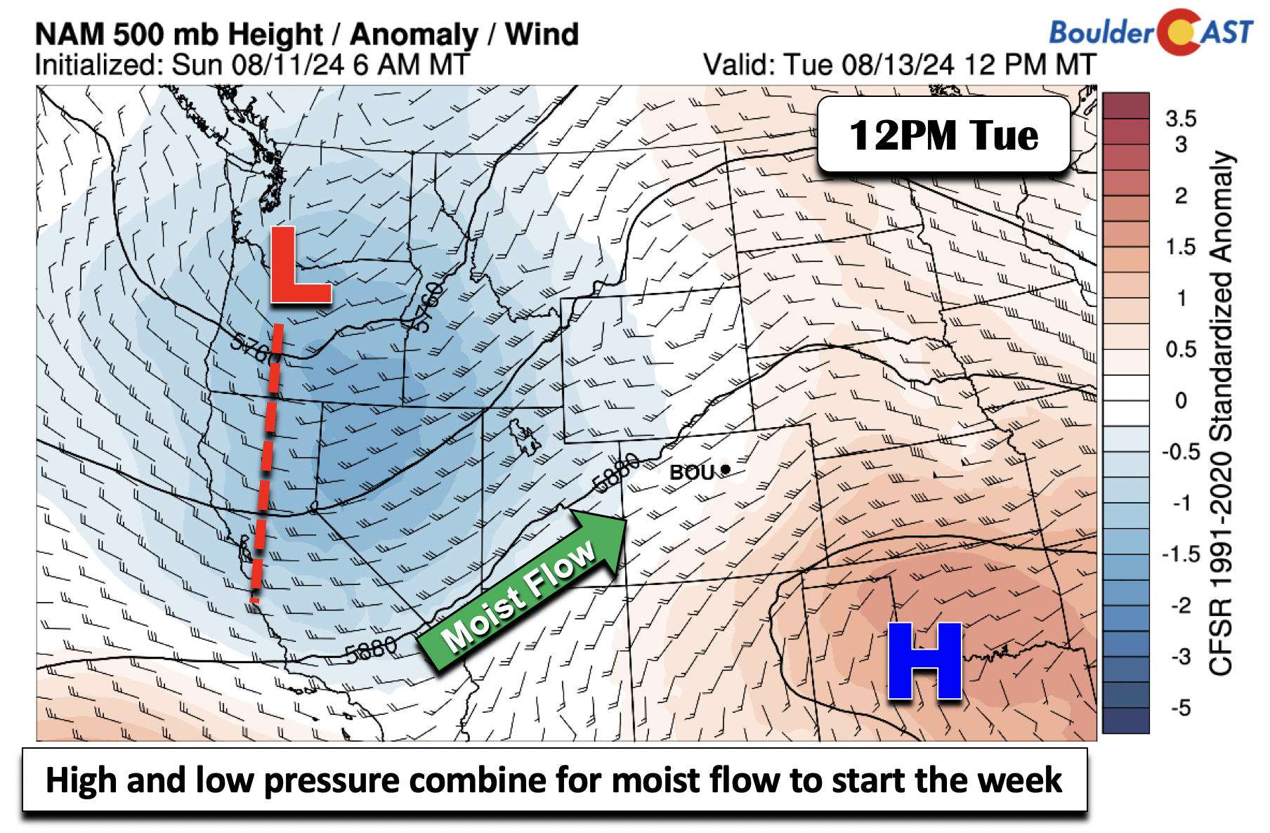
Below shows the moist flow on Monday, with precipitable water values some 2 to 3 standard deviations above normal. Storms will be efficient rain-producers and could result in localized flash flooding across the area. The recent burn scars will be particularly at risk early this week.
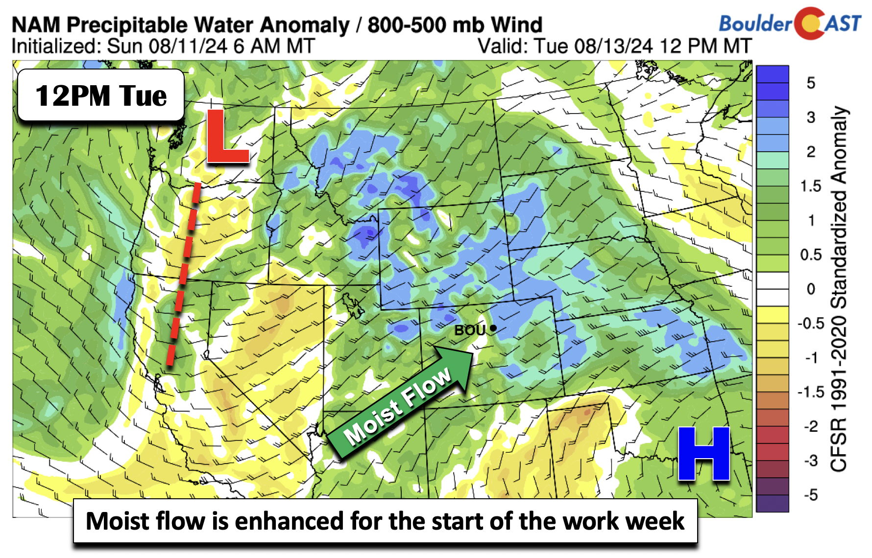
A similar pattern is in place Tuesday, but this time the flow is more concentrated as the trough gets closer.
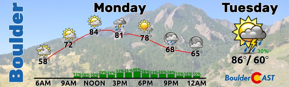
Temperatures through Wednesday will be tempered by clouds and precipitation in the mid to upper 80s, which is a few degrees on either side of normal for us.
By Thursday, the aforementioned trough will likely move east of our area. At the surface, it appears a cold front will push through, aiding a more drying downslope flow. While cooler air usually follows, it appears we won’t drop off much given the greatest cold advection will be east over Nebraska. Nevertheless, it should keep highs in the 80s for one more day.
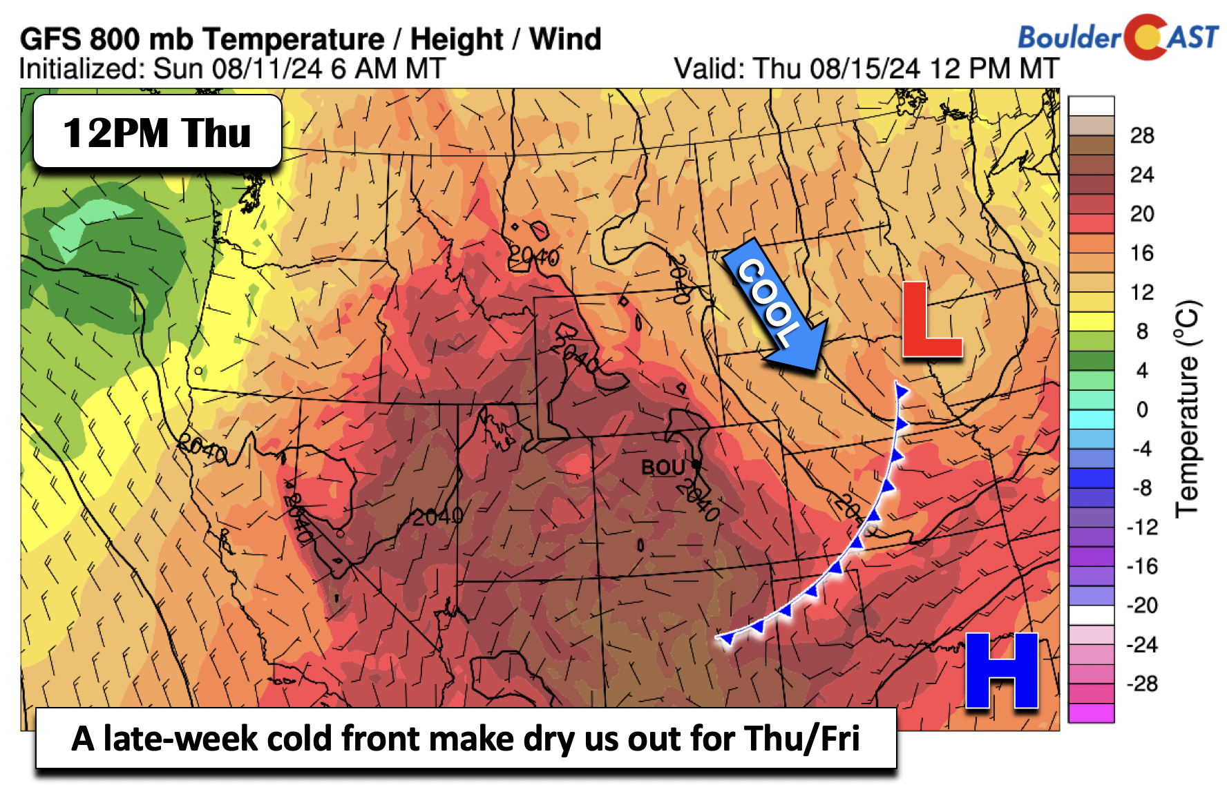
That front will be supported by quasi-zonal flow at the mid-levels Thursday and Friday — a downslope setup that will lower precipitable water values to between 0.4 to 0.5 inches — well below normal for mid August. This should drastically cut into our storm chances, with potential plummeting to just 10-20% by the end of the week.
Hopefully much of our area can cash in on some heavy rain (but not too heavy) early this week as Severe to Extreme Drought now encompasses much of the Front Range from Denver to Cheyenne.
Enjoy the weather!
Forecast Specifics:
Monday – Wednesday: Partly cloudy skies becoming mostly cloudy with scattered to numerous showers and storms in the afternoon and evening. Storms could produce localized flash flooding and/or severe hail and wind. Highs in the middle 80s for the Plains and middle 70s in the Foothills.
Thursday: Much lower rain chances with highs in the middle to upper 80s under mostly sunny skies. Highs in the Foothills in the middle 70s.
Friday: A very slight chance of isolated showers and storms with highs in the lower 90s on the Plains and upper 70s in the Foothills.
Get BoulderCAST updates delivered to your inbox:
DISCLAIMER: This weekly outlook forecast is created Monday morning and covers the entire upcoming week. Accuracy will decrease as the week progresses as this post is NOT updated. To receive daily updated forecasts from our team, among many other perks, subscribe to BoulderCAST Premium.
Go Premium, get all the perks.
Daily Forecast Updates
Get our daily forecast discussion every morning delivered to your inbox.
All Our Model Data
Access to all our Colorado-centric high-resolution weather model graphics. Seriously — every one!
Ski & Hiking Forecasts
6-day forecasts for all the Colorado ski resorts, plus more than 120 hiking trails, including every 14er.
Smoke Forecasts
Wildfire smoke concentration predictions up to 72 hours into the future.
Exclusive Content
Weekend outlooks every Thursday, bonus storm updates, historical data and much more!
No Advertisements
Enjoy ad-free viewing on the entire site.
Enjoy our content? Give it a share!


You must be logged in to post a comment.