After a cool and unsettled past several days, the week ahead turns much drier, notably hotter, and quite hazy with Canadian wildfire smoke engulfing the Front Range. Rain chances will be limited through the week as the monsoon stays largely suppressed. We will return to the 90s as early as Tuesday, perhaps nearing 100 degrees by week’s end. When is our best chance of rain, how hot will it get and when will our air quality finally improve? Let’s take a look!
This week’s highlights include:
- The Smokiest Air of 2024: Wildfire smoke from Canada will entrench the Front Range for the start of the week causing reduced visibility and degraded air quality
- Summer Heat Returns: Highs return to near or above normal by Tuesday with temperatures soaring into the mid to upper 90s the rest of week
- Where’s the Monsoon? Rain this week will be limited as the monsoon remains suppressed and redirected westward — the best chances for rain will come Friday into the weekend…. but don’t get your hopes up!
DISCLAIMER: This weekly outlook forecast is created Monday morning and covers the entire upcoming week. Accuracy will decrease as the week progresses as this post is NOT updated. To receive daily updated forecasts from our team, among many other perks, subscribe to BoulderCAST Premium.

Go Premium, get all the perks.
Daily Forecast Updates
Get our daily forecast discussion every morning delivered to your inbox.
All Our Model Data
Access to all our Colorado-centric high-resolution weather model graphics. Seriously — every one!
Ski & Hiking Forecasts
6-day forecasts for all the Colorado ski resorts, plus more than 120 hiking trails, including every 14er.
Smoke Forecasts
Wildfire smoke concentration predictions up to 72 hours into the future.
Exclusive Content
Weekend outlooks every Thursday, bonus storm updates, historical data and much more!
No Advertisements
Enjoy ad-free viewing on the entire site.
A smoky start as heat slowly builds
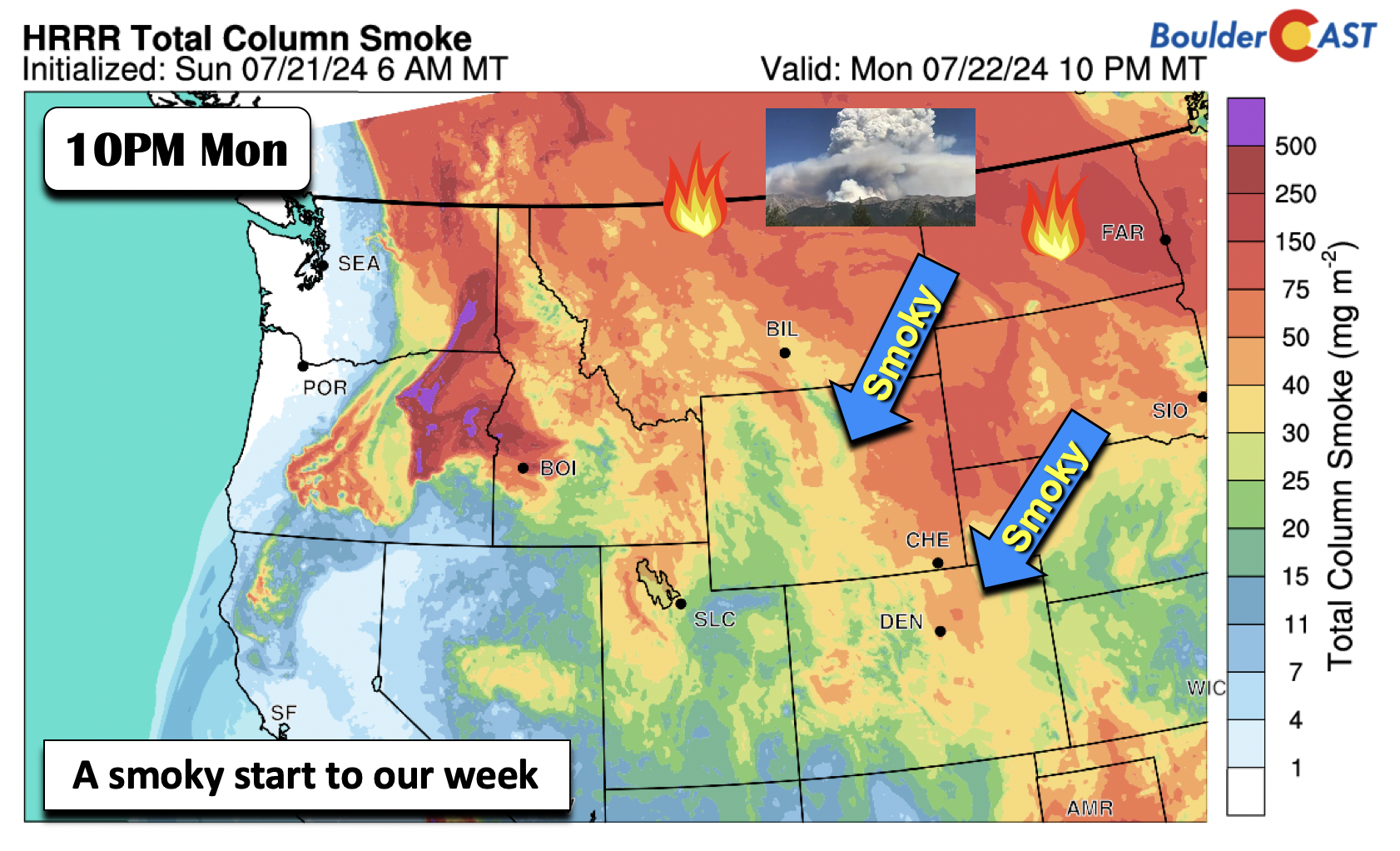
It is going to be a hazy start to the week in the Front Range as the smokiest air of the summer so far arrives from the north! As expected, Canadian wildfire smoke has entrenched Colorado Monday morning resulting in reduced air quality and haze for the entire region. Too bad Canada can’t send us something more useful than smoke, such as truckloads of real maple syrup!
A look at the GOES-East geocolor satellite imagery from Monday morning as the sun came up shows just how much smoke is present to our north and northeast, and even already in Colorado. Continued northerly flow in the coming days will keep this very smoky airmass locked in over Denver and Boulder.
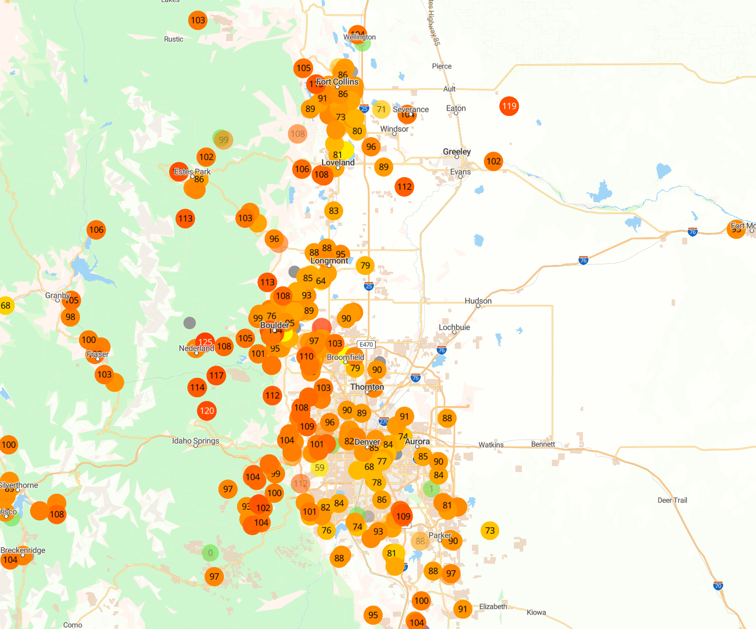
PM2.5 air quality across the Front Range has degraded slowly overnight, with most areas now situated between 80 and 120 early Monday morning. Air quality is expected to decline further through the day as more smoke filters in and the smoke higher up in the atmosphere mixes down to ground-level. Extensive outdoor activities are not recommended these next few days, especially for individuals with sensitive respiratory systems.
The wildfire smoke will be at its worst the next couple days but likely will linger through the week with at least some northerly component to our winds expected through Thursday. The forecast animation below is for ground-level smoke concentration through Wednesday morning.
There are signs for a more west-southwesterly flow late in the week which should help improve our smoky situation somewhat heading into Friday and the weekend. Be sure to check our Colorado Smoke Forecast page for up-to-date total and surface smoke forecasts from various models as the week progresses.
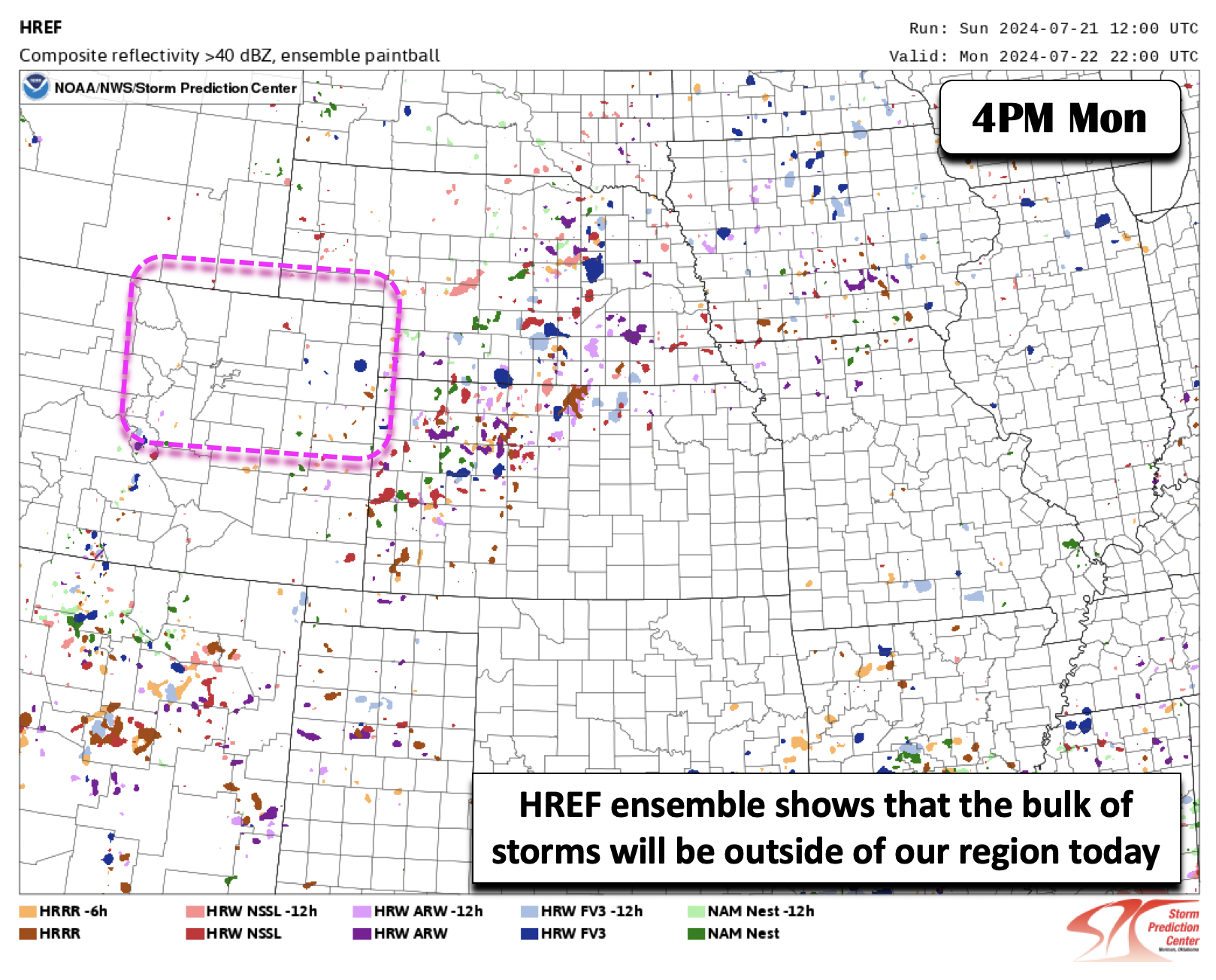
Coincident with the increase in smoke will be a sharp decline in rainfall chances this week. Below shows the High Resolution Ensemble Forecast (HREF) paintball of storm centroids from various model members for this afternoon and evening. This is courtesy of the Storm Prediction Center. You can see that in our area, encircled by the pink box, there is limited coverage of storms for Monday. We think there is less than 10% chance of storms today, but most of us will be hard-pressed to see anything due to moisture starting to dry out.
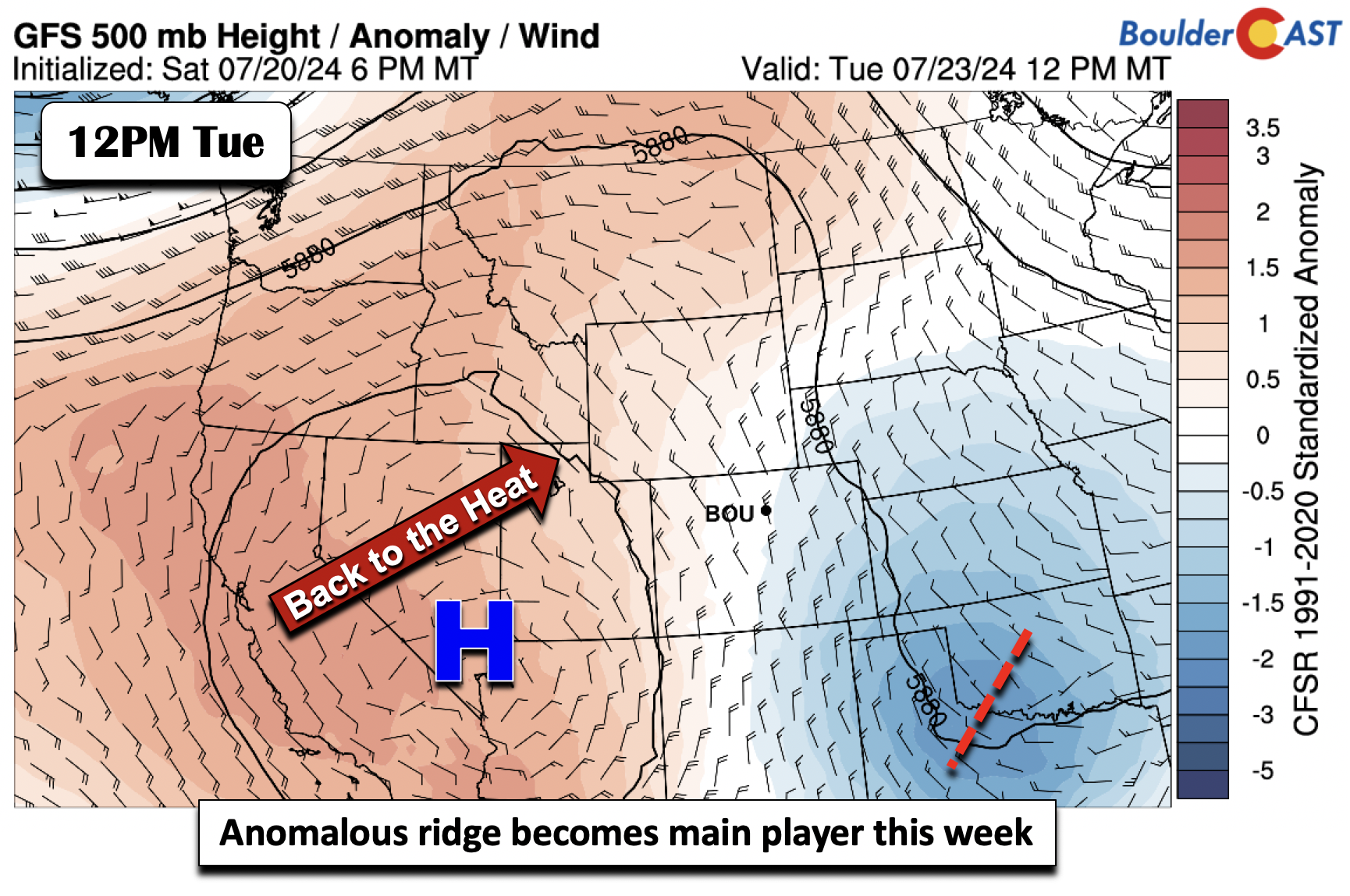
On top of the smoky conditions, the start of the week will see high temperatures quickly rising into the low to mid 80s Monday and then upper 80s to near 90 by Tuesday. An anomalous ridge currently to our west will slowly build east as the week goes on.
This setup will unfortunately keep the monsoonal moisture out of our area for the foreseeable future. Below shows the precipitable water anomalies for Tuesday. Note the drier air over Colorado (below normal precipitable water values), but deeper moisture out in California, Nevada and western Arizona where the monsoonal plume will reside. This suppression of monsoonal moisture will spell out a much drier week overall for the Boulder-Denver Metro area.
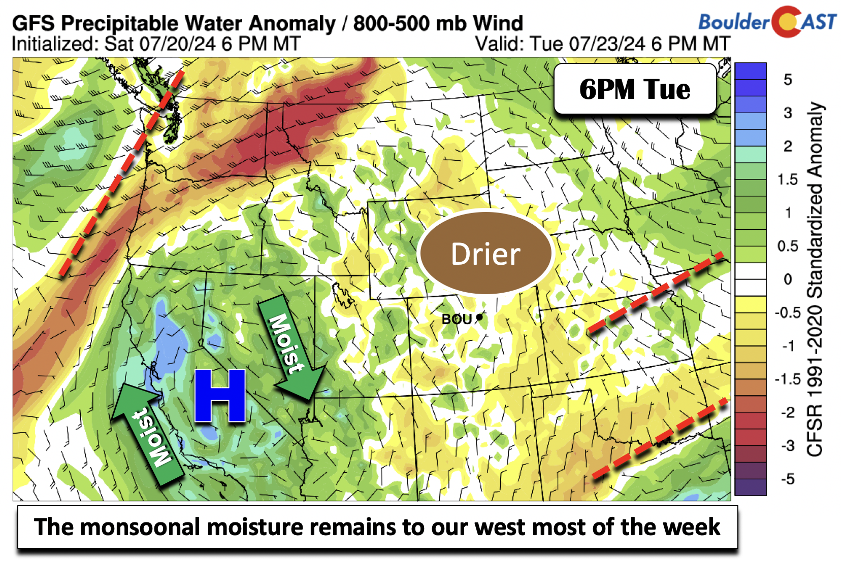
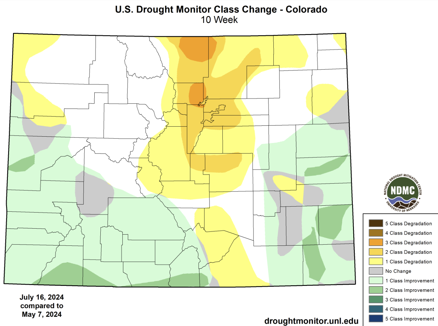
This on top of the intensifying heat will not be good for the ongoing and expanding Colorado drought — we may even see near-critical fire danger late in the week.
If you can, try to take advantage of the cooler weather Monday and Tuesday as the remainder of the week will be much hotter — as we’ll soon discuss. However, it is hard to actually recommend outdoor activities these next few days given the smoke.
Heating up late-week with a slight chance of storms
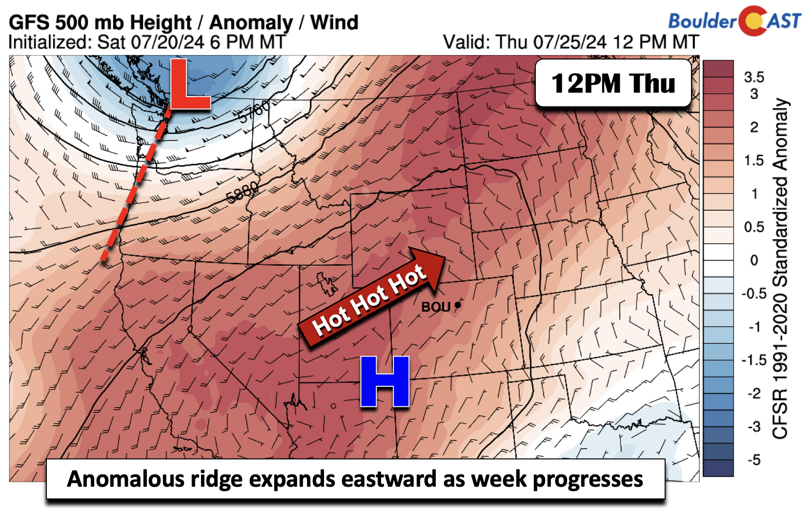
Our hottest days are toward the middle to latter part of the week ahead as the anomalous ridge further expands eastward. By Thursday, it will be near the Four Corners region, with positive height anomalies stretching from Arizona into North Dakota. This pattern will easily spell out our return to the mid to upper 90s for the tail-end of the week.
Our best chance of rain will likely come Friday as guidance shows a weak mid-level trough axis pushing eastward into South Dakota and Wyoming.
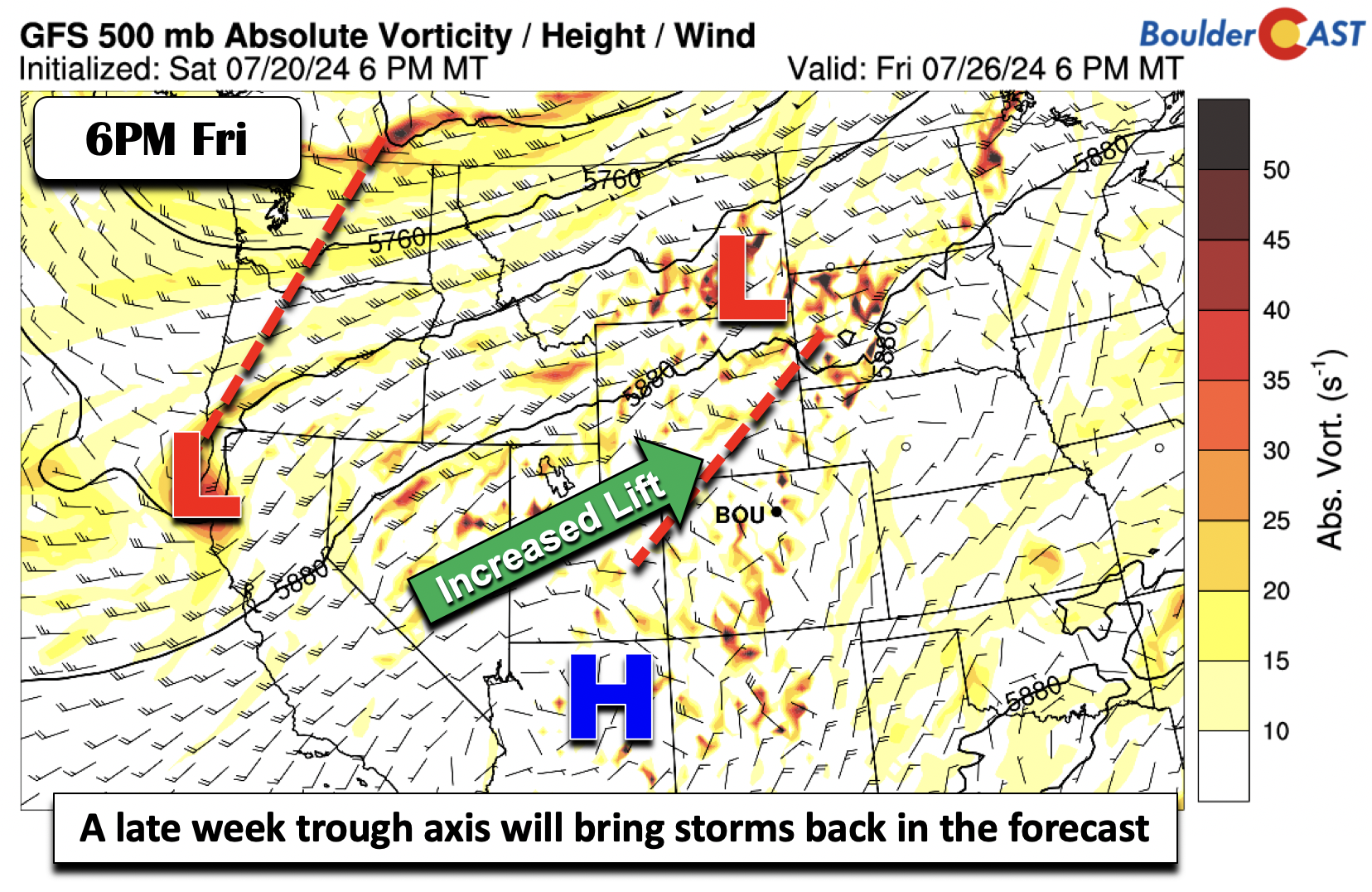
That axis will be colocated with some slightly higher moisture that will push into western sections of Colorado. This should increase our rain chances, though not by much as the ridge is likely to hold in place, aiding in the suppression of thunderstorm convection.
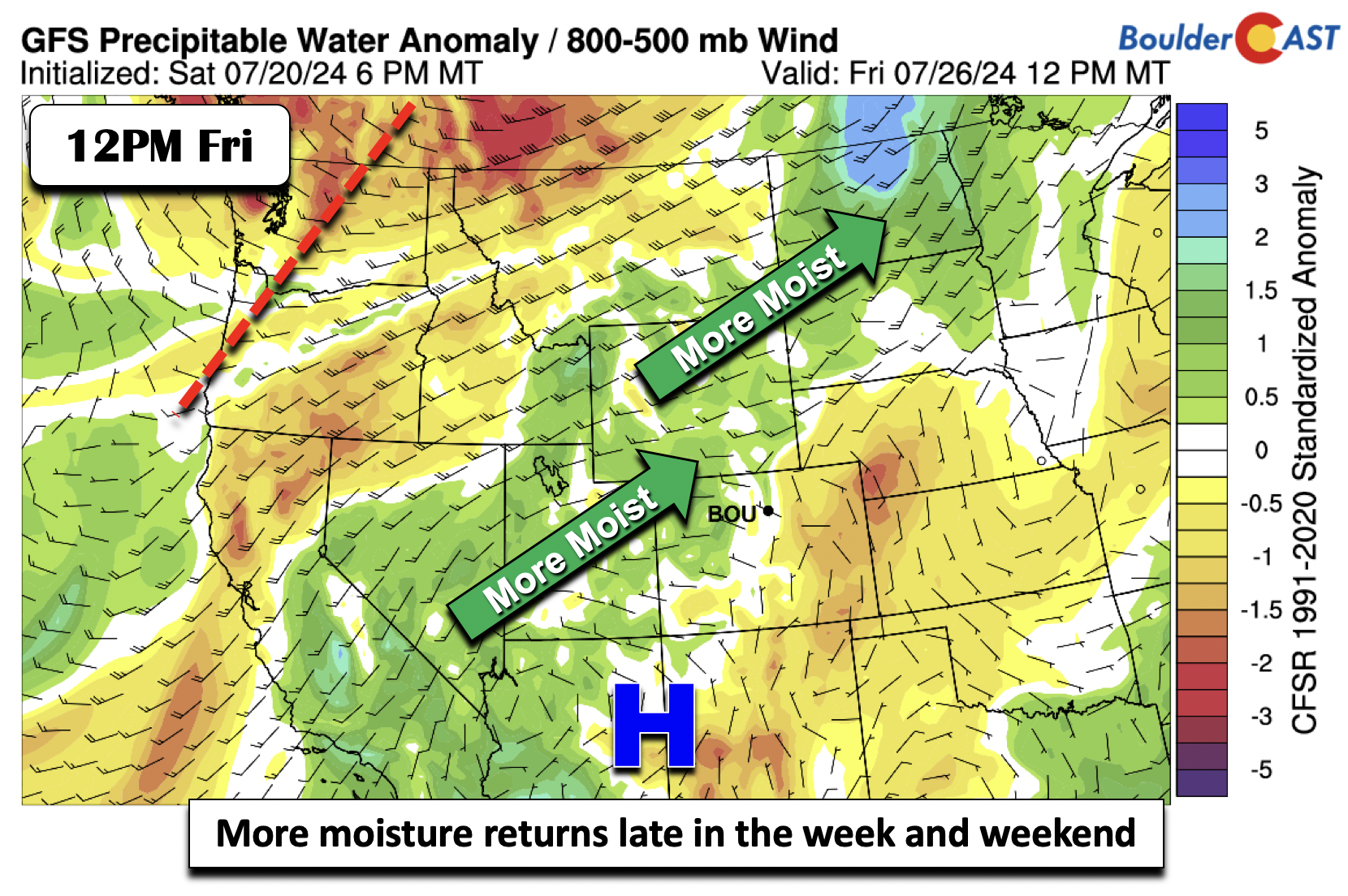
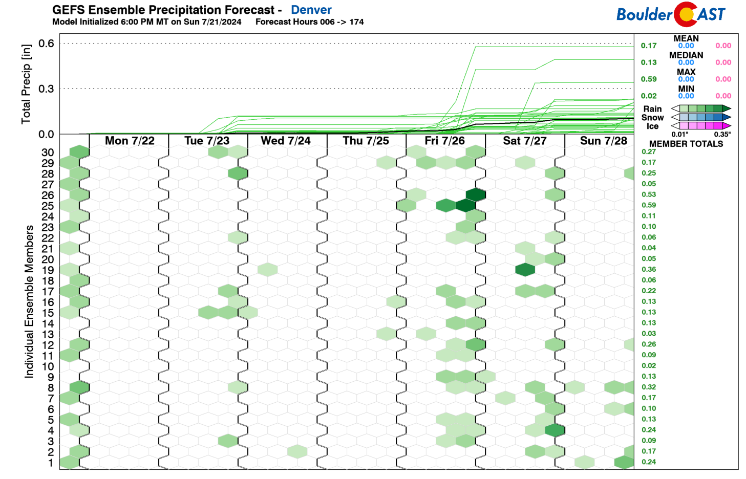
The chance of rain should remain in the forecast after Friday into the upcoming weekend as the aforementioned trough axis gets closer to the Denver Metro area. This is also supported by the latest GEFS forecast, with a number of members highlighting rain chances Saturday and perhaps on Sunday as well.
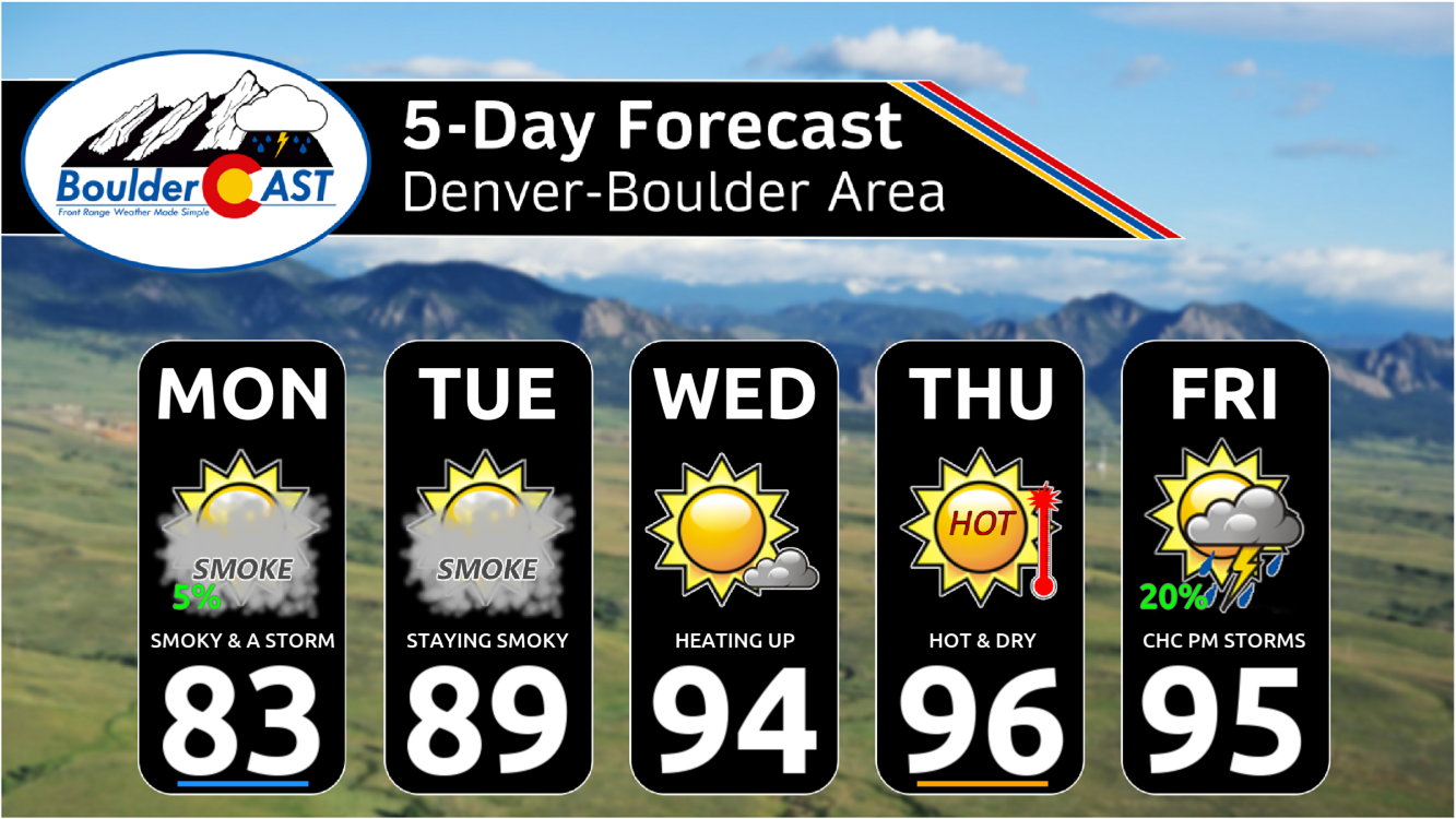
Our extended forecast graphic below summarizes things nicely. We expect gradually improving smoke conditions for the area but temperatures will be heating up at the same time towards toasty levels. Try to stay cool this week and keep your home’s windows closed if possible to limit exposure to the smoke. Let’s just hope we continue to have minimal fires in Colorado. Much of the state is well-primed for ignition right now…
Forecast Specifics:
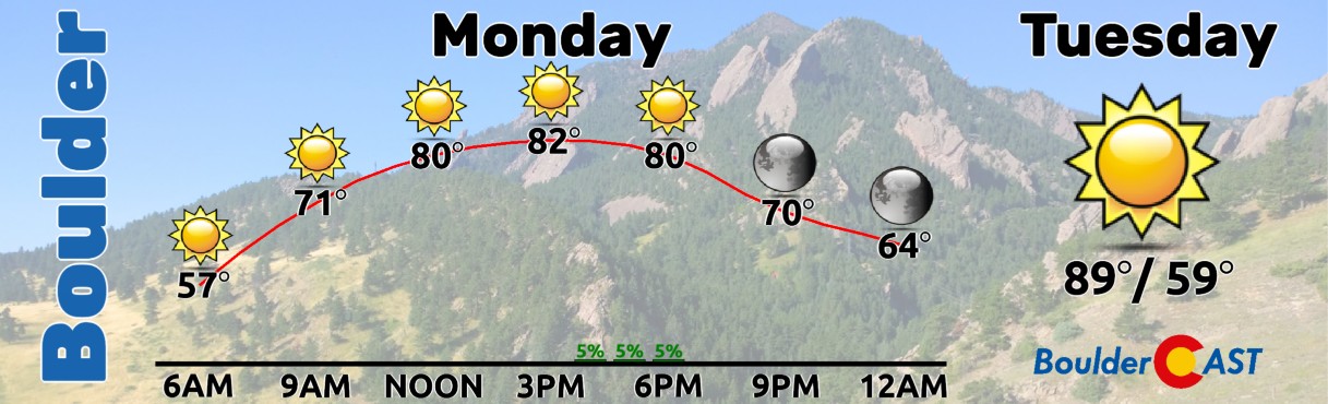
Monday: Turning warmer with a slight chance of some late-day storms, mainly in the Foothills. Thick smoke will cloud the skies and bring degraded air quality reaching Unhealthy for Sensitive Groups levels. Highs in the low to middle 80s for the Plains and low to mid 70s in the Foothills.
Tuesday: Turning hot with highs in the upper 80s to near 90 degrees for the Plains and upper 70s in the Foothills. Thick smoke will linger with air quality remaining Unhealthy for Sensitive Groups.
Wednesday: Hot and dry with low to mid 90s for the Plains and low 80s in the Foothills. Thick smoke will linger with air quality remaining Unhealthy for Sensitive Groups.
Thursday, Friday, and the weekend: Hot with mid to upper 90s to near 100 for the Plains and middle 80s in the Foothills. There is also a chance of storms on the Plains late Friday, as well as the upcoming weekend. With flow shifting towards southwesterly, smoke levels should gradually decline somewhat, especially by Friday or Saturday.
Get BoulderCAST updates delivered to your inbox:
DISCLAIMER: This weekly outlook forecast is created Monday morning and covers the entire upcoming week. Accuracy will decrease as the week progresses as this post is NOT updated. To receive daily updated forecasts from our team, among many other perks, subscribe to BoulderCAST Premium.
Go Premium, get all the perks.
Daily Forecast Updates
Get our daily forecast discussion every morning delivered to your inbox.
All Our Model Data
Access to all our Colorado-centric high-resolution weather model graphics. Seriously — every one!
Ski & Hiking Forecasts
6-day forecasts for all the Colorado ski resorts, plus more than 120 hiking trails, including every 14er.
Smoke Forecasts
Wildfire smoke concentration predictions up to 72 hours into the future.
Exclusive Content
Weekend outlooks every Thursday, bonus storm updates, historical data and much more!
No Advertisements
Enjoy ad-free viewing on the entire site.
Enjoy our content? Give it a share!


You must be logged in to post a comment.