Persistent orographic Mountain snowfall is the main story this week with many ranges and ski resorts poised to see more than a foot of powder by midweek. Unfortunately the snow chances are much lower east of the Continental Divide with mostly dry weather expected in and around Denver, that is with one or two exceptions. Read on for all the details.
This week’s highlights include:
- Persistent light snow will occur in the Mountains Monday through Wednesday as a weak storm system slowly approaches from the west
- Long duration light snowfall will lead to totals of 8-16+” in the High Country
- Extreme avalanche danger will exist across much of the state — avoid backcountry adventures!
- The lower elevations will remain mostly dry throughout the week, but slight chances for snow Monday night and Wednesday night
- Temperatures will be warmest on Monday in the 50s, but stay seasonal the rest of the week in the 40s
- Drier weather takes over statewide Thursday and beyond as the storm system exits to the east
DISCLAIMER: This weekly outlook forecast is created Monday morning and covers the entire upcoming week. Accuracy will decrease as the week progresses as this post is NOT updated. To receive daily updated forecasts from our team, among many other perks, subscribe to BoulderCAST Premium.
Mountain snow, but nearly nothing down low
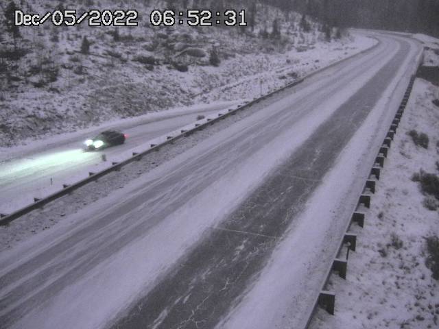
Light snow in ongoing across the northern Mountains as of early Monday morning. The view below is from near Keystone. A persistent light snow such as this will be the story over the next several days in the higher elevations.
The cause of the snowy weather in the Mountains traces back to northern California this morning — a weak storm system is drifting ashore in the Pacific Northwest. It will make slow progress eastward through the week leading to continued snowfall in the High Country.
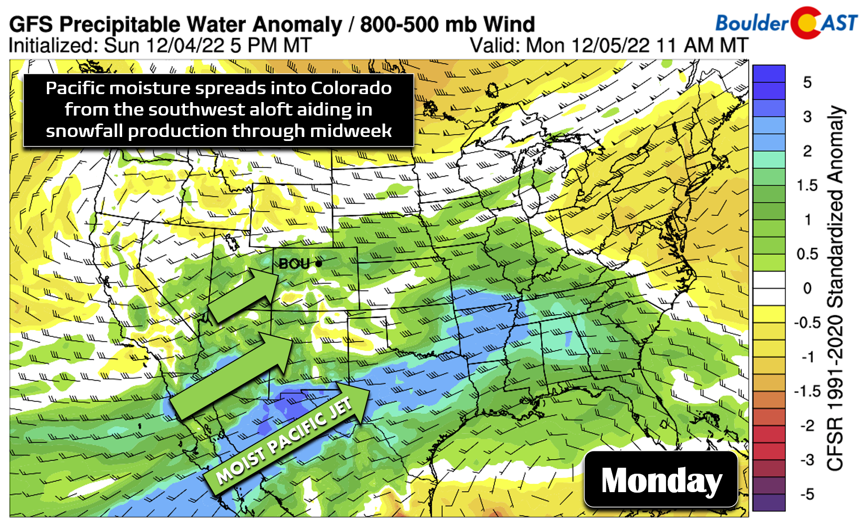
Out ahead of this system, a decent fetch of moist southwesterly flow is spreading into Colorado from the Pacific Ocean and subsequently interacting with the terrain to produce orographic snow across the state. Moisture is highest Monday and Tuesday but will remain elevated through Wednesday evening to keep the light snow going.
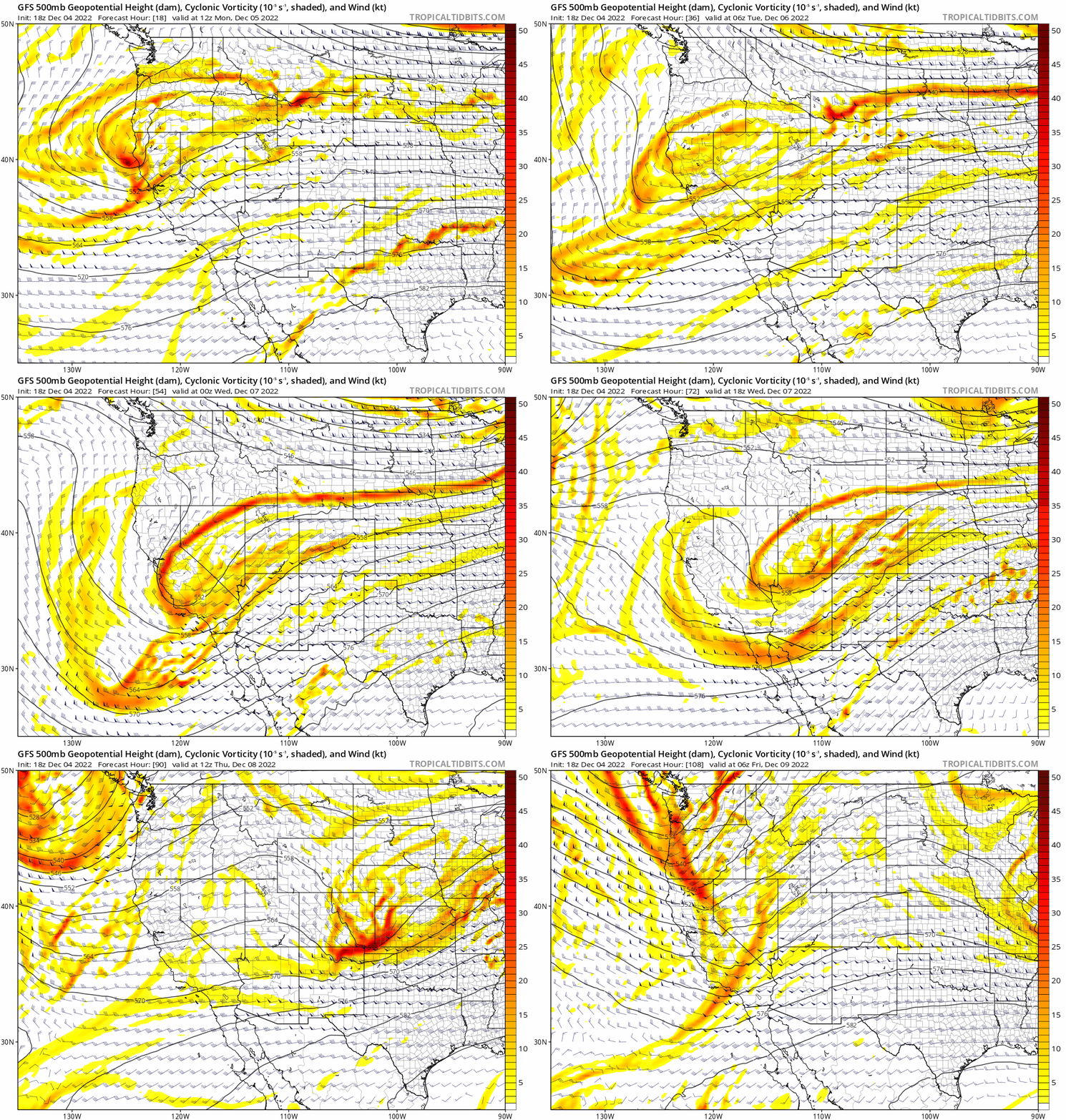
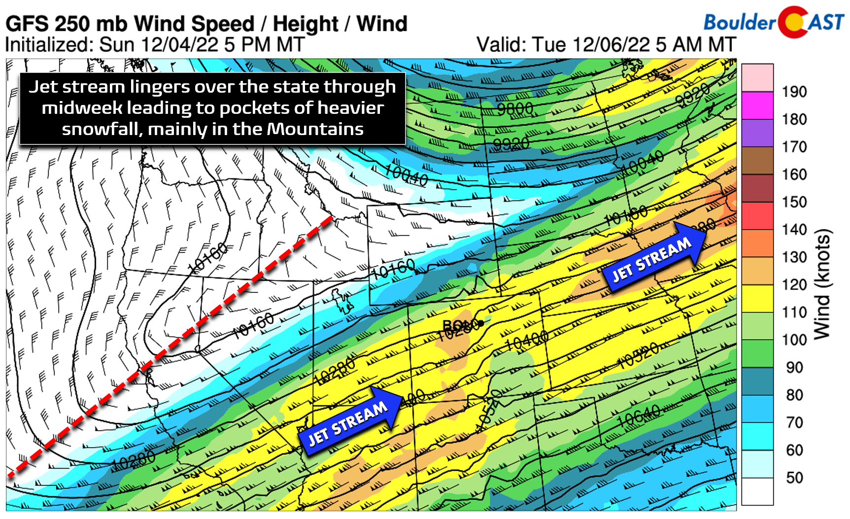
Embedded in this flow there is also a strong polar jet streak which will stall out and linger for the next few days, at times producing some localized heavier snow bands.
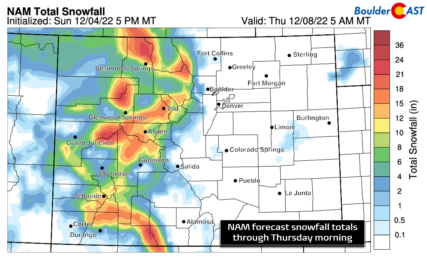
Until this weak trough passes early Thursday, the large-scale pattern will remain largely unchanged, with light snow falling across most of the mountain ranges statewide. Though the snowfall will mostly be light, the extended duration of 72+ hours will allow for sizable accumulations this week in the Mountains. Many peaks and ski resorts will see 8-16″, with favored locations likely to see 1-2 feet.
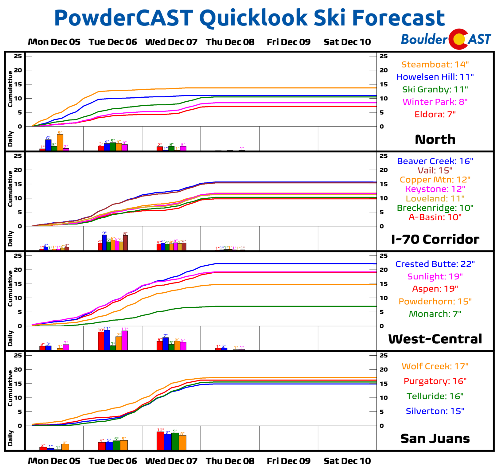
PowderCAST is currently highlighting Crested Butte to see the most snow this week at 22″, though many ski resorts are not far behind!
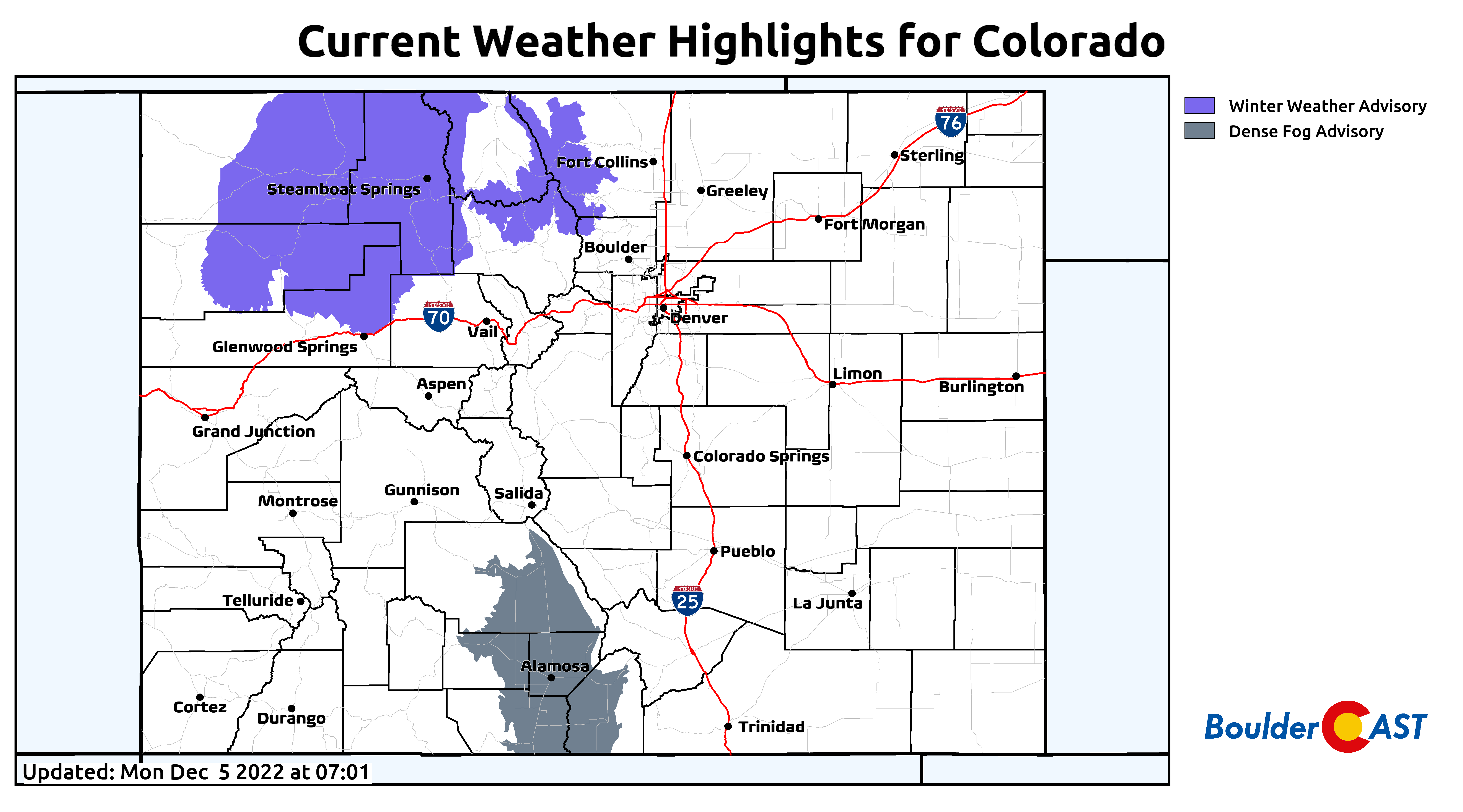
Winter Weather Advisories currently encompass a large portion of northern Colorado. As the jet sags southward Monday night into Tuesday, we do look for advisories to expand to cover most of the state’s higher terrain to highlight the impacts on travel. Expect snowy travel conditions if you are headed anywhere in the Mountains through Thursday morning!
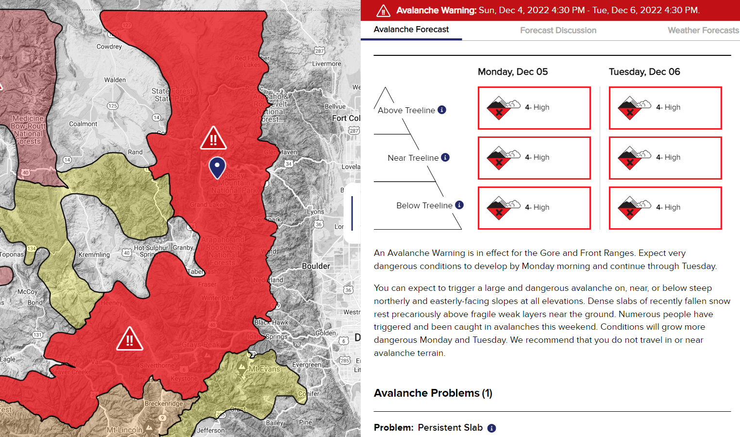
In addition to the falling snow causing travel issues, snow on the ground will be at high risk for avalanches this week across much of the state. Please use extreme caution or avoid backcountry adventures altogether. See the Colorado Avalanche Information Center website for up-to-date avalanche information as the snow and weather evolve in the coming days.
Across the lower elevations, it will be an entirely different world this week with largely downslope flow dominating our weather pattern. The persistent light snowfall in the Mountains will not make it more than a couple miles beyond the Continental Divide, with generally quiet weather expected in the Denver Metro area throughout the week alongside seasonable temperatures.
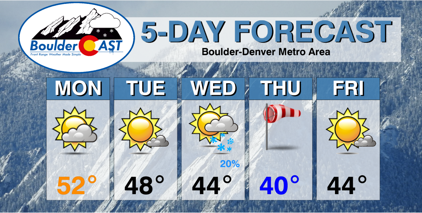
Monday will see temperatures rise into the 50s with partly cloudy skies — the warmest day of the week. Tuesday will be slightly cooler but still pleasant and with a little more sunshine behind a weak cold front.
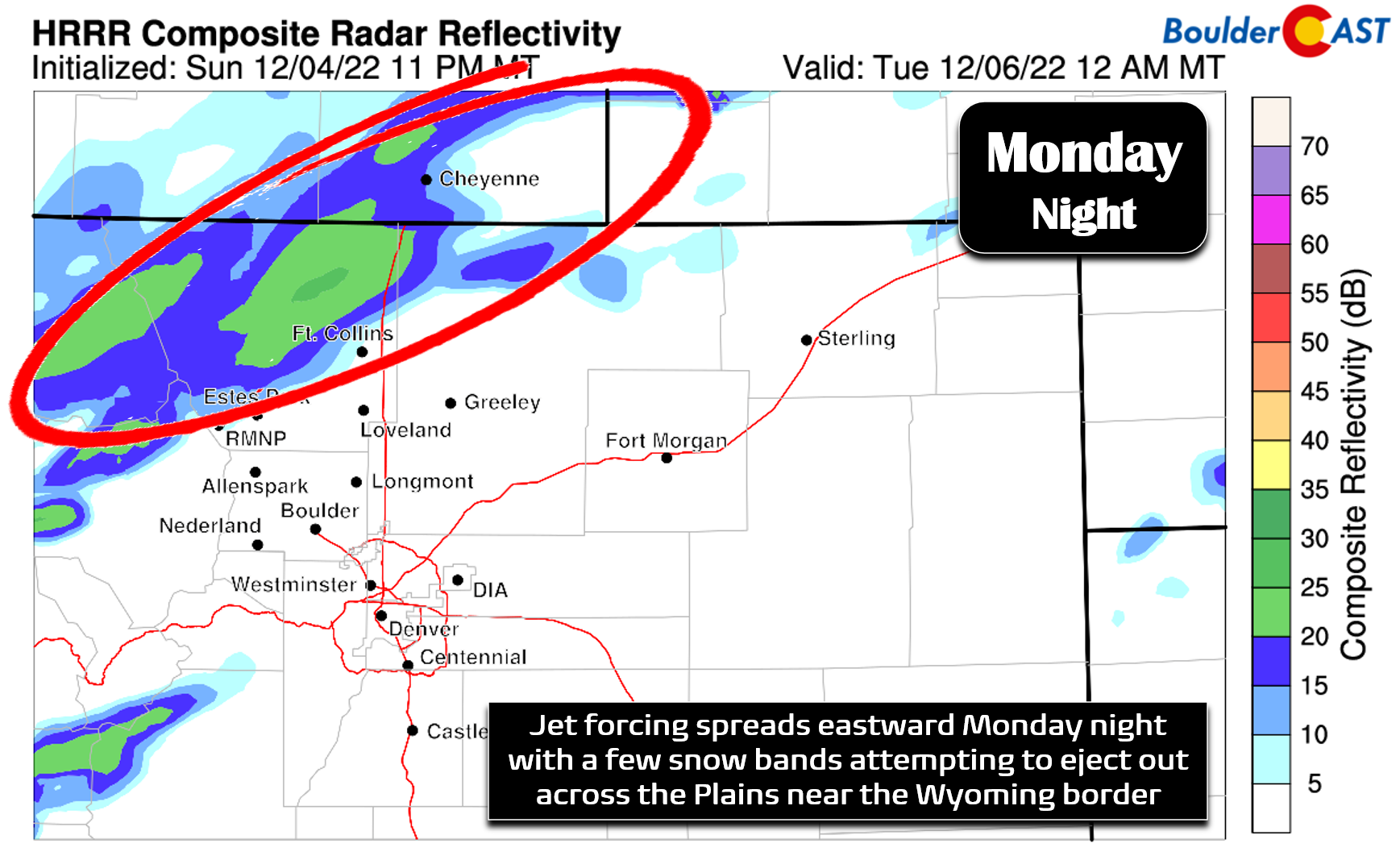
One thing to watch: late Monday night we are expecting some snow to spread out across the Plains near and north of Fort Collins as the overhead jet stream briefly aligns so that this area is in the favorable left-exit region. However, the jet energy will be battling downslope and low-level dry air in this region. Thus, we’re not expecting much accumulation at all — generally just a dusting or less overnight. All of the action Monday night should be well north of Boulder and Denver with no impacts expected locally outside of a few flurries.
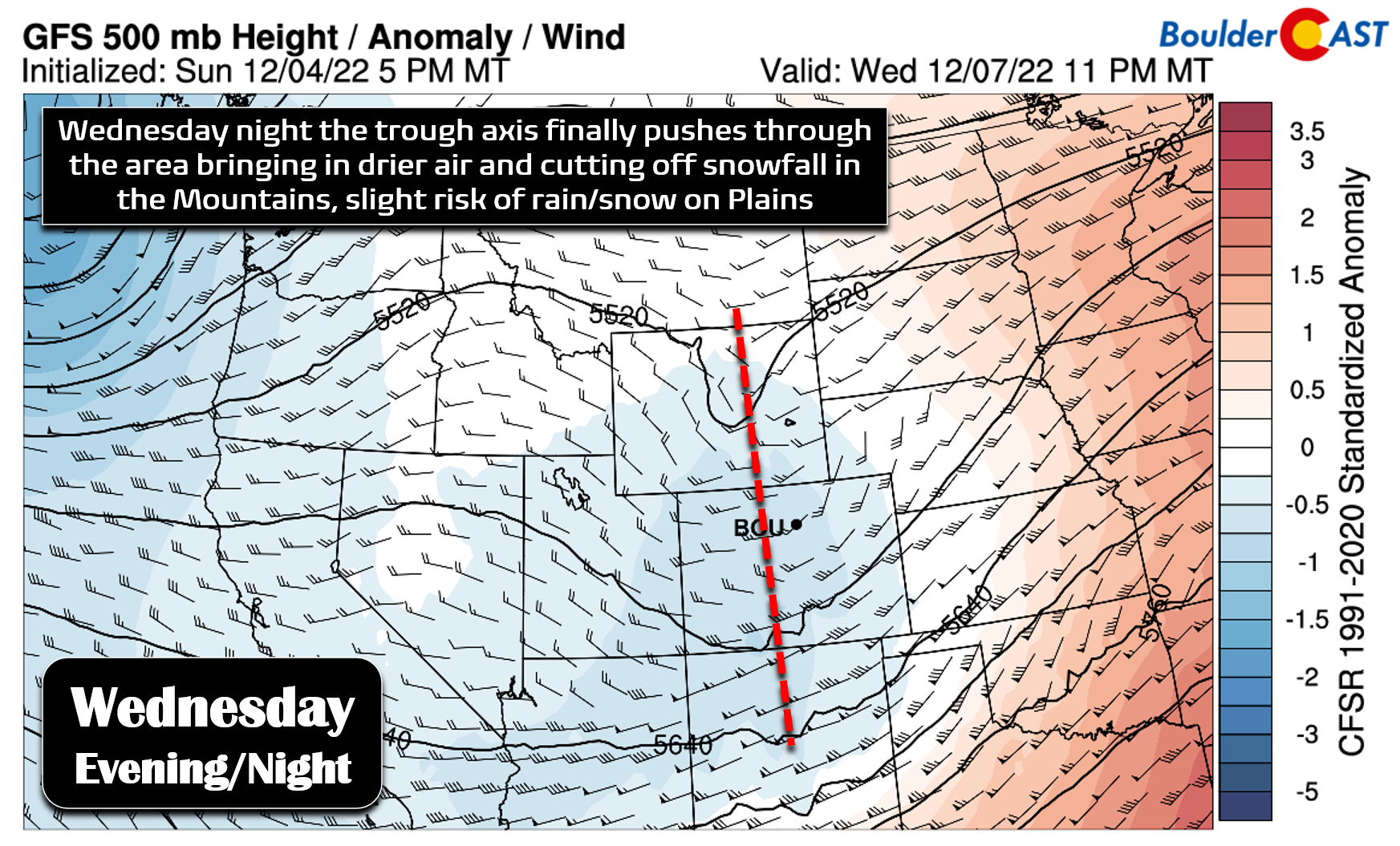
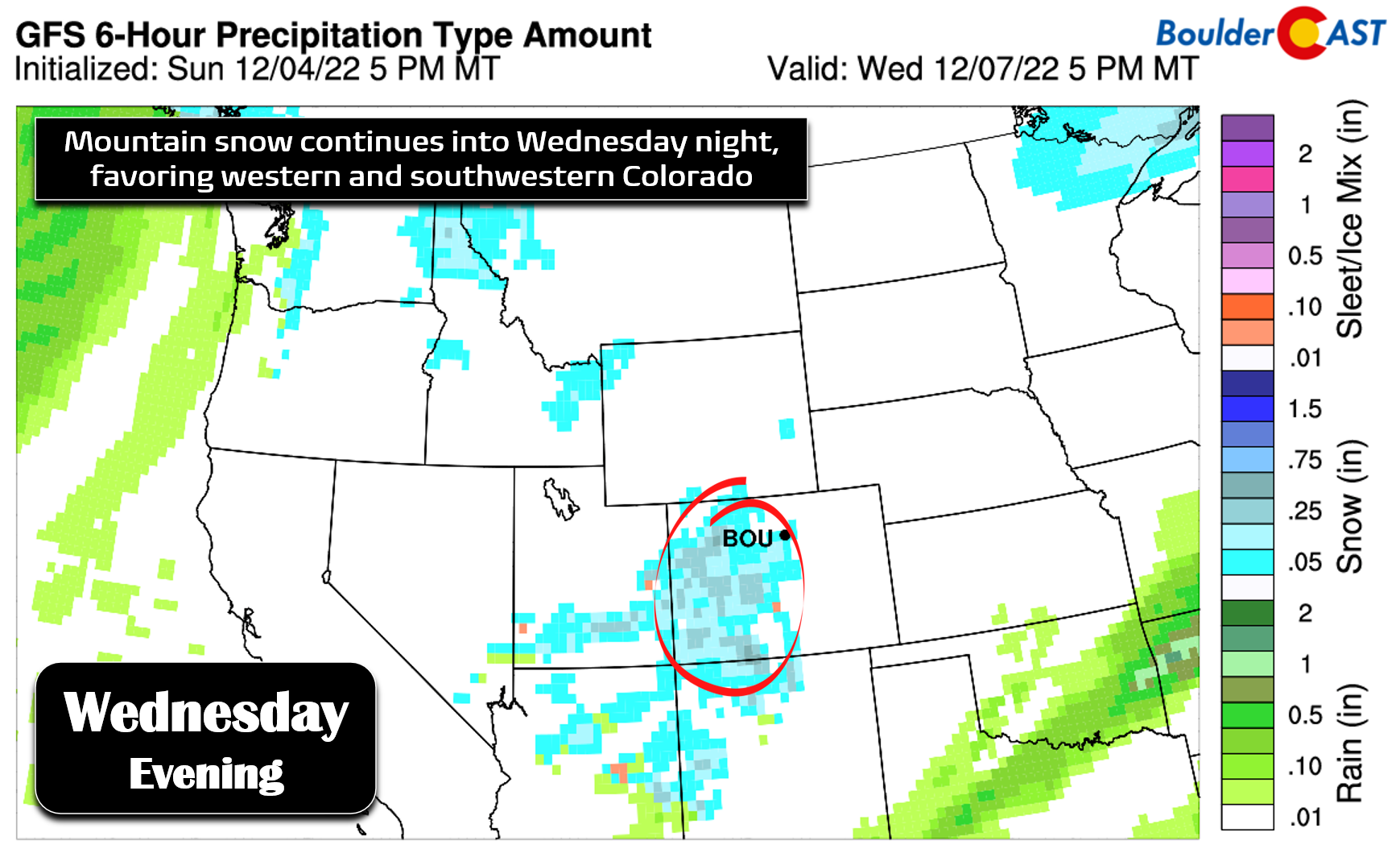
By Wednesday the main trough axis will finally make its was across Colorado with the best lift passing through during the evening and overnight period.
Mountain snow will be ongoing still at this point, with Wednesday’s sharp southwest flow and moisture plume favoring the central and southern ranges.
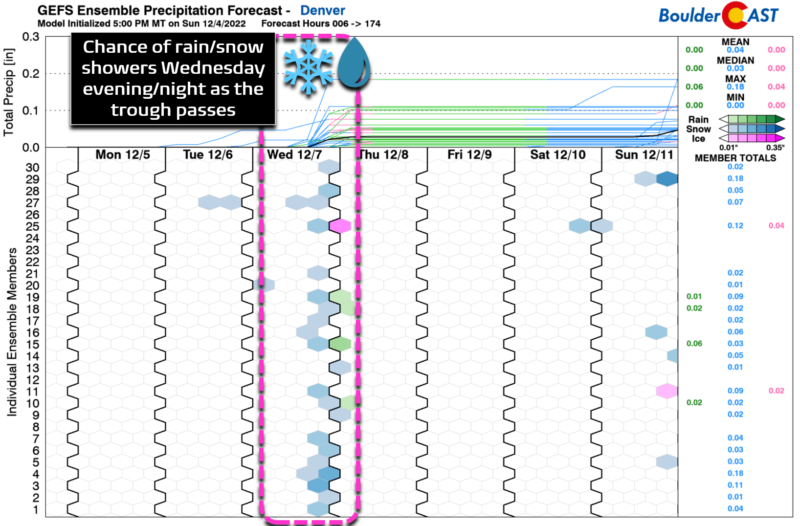
As the trough passes through, there could be enough energy and frontal forcing to produce some snow showers across the Boulder-Denver area Wednesday evening and night. Models have been showing this precipitation chance in some form for a few days now, but it still does not look all that favorable in our opinion. Worst case scenario is probably a dusting to 1″ of snow in parts of the Front Range Wednesday night. The “no accumulation” outcome is currently favored, though. We’ll continue to watch this situation and keep you updated if things change. For now expect a cooler day Wednesday with highs in the middle 40s and just a slight chance of light snow after sunset.
As the trough kicks east on Thursday, drier air and subsidence will filter in on the backside. Thursday will be mostly sunny and breezy with temperatures topping out in the lower 40s. Friday will warm up a bit into the middle 40s with continued sunshine.
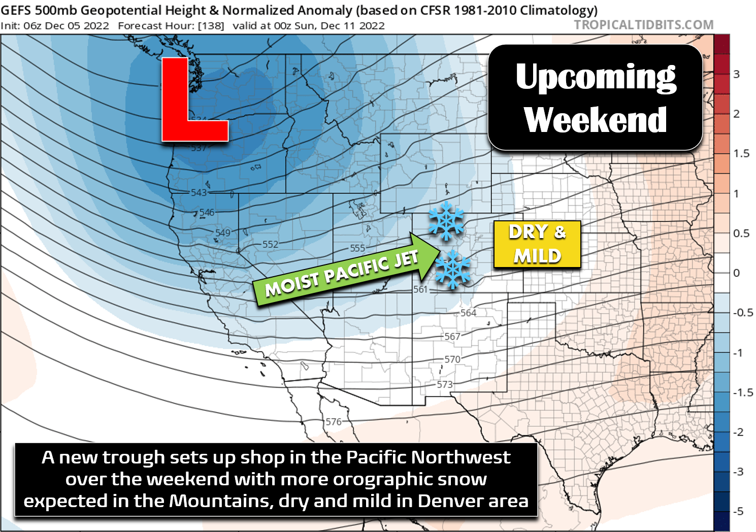
A similar troughy pattern will develop in the Pacific Northwest again during the upcoming weekend, leading once again to moist southwest flow surging into Colorado. A return of Mountain snowfall is expected under this setup with continued mild and dry weather likely across the lowlands. Unfortunately we’re stuck in this dry, downslopey pattern for the time being. At least the Mountains will be piling up snow!
Forecast Specifics:
Monday: Partly to mostly cloudy and mild. Highs reach the lower 50s on the Plains with upper 30s in the Foothills.
Tuesday: A mix of clouds and sun and slightly cooler. Temperatures top out in the upper 40s on the Plains with middle 30s in the Foothills.
Wednesday: Lots of sunshine during the day but clouds increase in the evening with a slight chance of light snow in the evening and overnight. A dusting or less of accumulation is expected. High temperatures in the middle 40s across the Plains with lower 30s in the Foothills.
Thursday: Some morning clouds, then mostly sunny, dry and breezy. Highs in the lower 40s across the Plains with near 30 degrees in the Foothills.
Friday: Mostly sunny and seasonal with temperatures in the middle 40s on the Plains and lower 30s in the Foothills.
High Country: Light but persistent snowfall will be ongoing Monday through Wednesday in the Mountains statewide alongside gusty west and southwest winds. Though snowfall rates will generally be light most of the time, the duration of this event will produce decent snowfall totals, generally 8-16″ at most ski resorts. Snow comes to an end early Thursday morning with dry and seasonal weather expected heading into the weekend.
Help support our team of Front Range weather forecasters by joining BoulderCAST Premium. We talk Boulder and Denver weather every single day. Sign up now to get access to our daily forecast discussion email each morning, complete six-day skiing and hiking forecasts powered by machine learning, first-class access to all our Colorado-centric high-resolution weather graphics, bonus storm updates and much more! Or not, we just appreciate your readership!
Spread the word, share the BoulderCAST forecast!





You must be logged in to post a comment.