⦁❶⦁ Remnant tropical moisture from once-Hurricane Kay is fully-entrenched across the state today
⦁❷⦁ Widely scattered afternoon and evening showers and storms expected with highs around 80 degrees
⦁❸⦁ The moisture lingers through Friday and so too will the (slight) rainfall chances
⦁❹⦁ A deep trough develops along the West Coast this weekend but it may never reach Colorado
Do you want the latest BoulderCAST Daily forecast discussion delivered to your inbox every single morning? If so, join BoulderCAST Premium where we talk Boulder and Denver weather every single day.
M
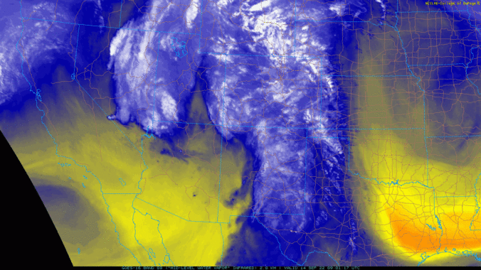
oisture from the remnants of once-Hurricane Kay is now fully encompassing the Front Range and the entire state of Colorado, as seen in the GOES-East water vapor animation below.

GOES-East water vapor animation from Wednesday morning showing plentiful moisture surging across Colorado
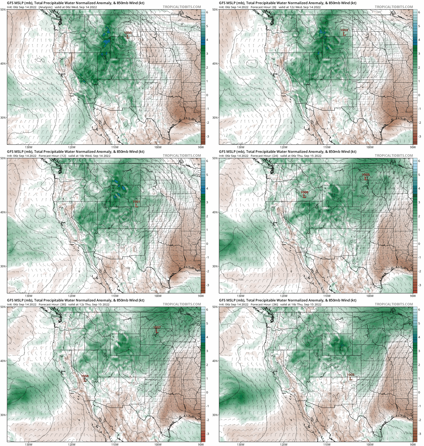
This surge in moisture, while not extraordinary, is a significant uptick compared to the dry air we’ve seen the last few days and this will lead to a return of rainfall chances statewide. The GFS moisture anomaly forecast animation below indicates ~2 standard anomalies above normal moisture today through tonight, with lesser amounts lingering through at least tomorrow.
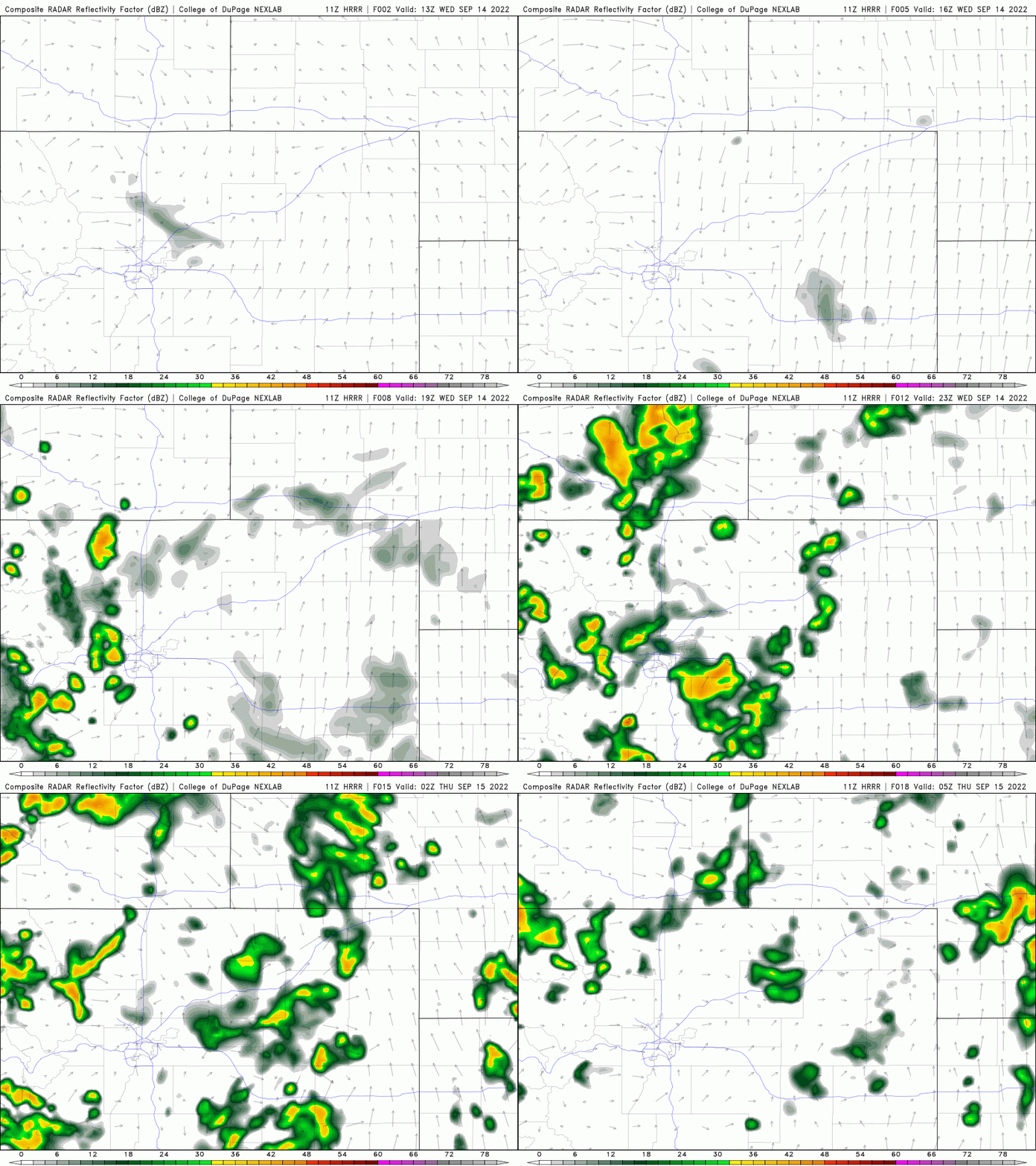
The catch is that most of the moisture is higher up in the atmosphere, with dry low-level air lingering across the Denver Metro area. Because of this, we expect more widespread storm coverage this afternoon/evening across the Mountains, with some mild flash flooding potential possible over the burn scars. On the lower elevations, storm chances will be reduced and it will be more of a wind threat. The HRRR is predicting rather spotty storm activity this afternoon and evening around Boulder and Denver.
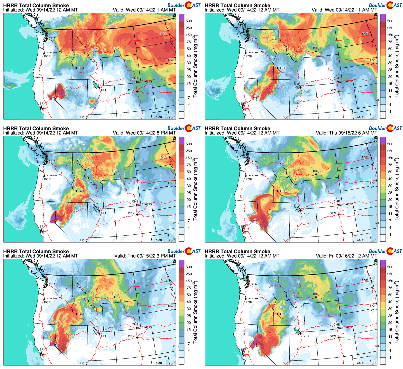
As promised, the southwest flow taking hold will scour out the smoke across the region through the day today and dare we say Thursday could very well be completely smoke free!
All in all, expect a cooler and mostly cloudy day with about a 20-30% chance of afternoon and evening storms, mainly between 1PM and 8PM. High temperatures top out in the upper 70s to around 80 degrees.
The next couple days will be unsettled with the moisture lingering across the area. Both Thursday and Friday will retain the slight risk of rain and somewhat cooler temperatures in the middle 70s to lower 80s.
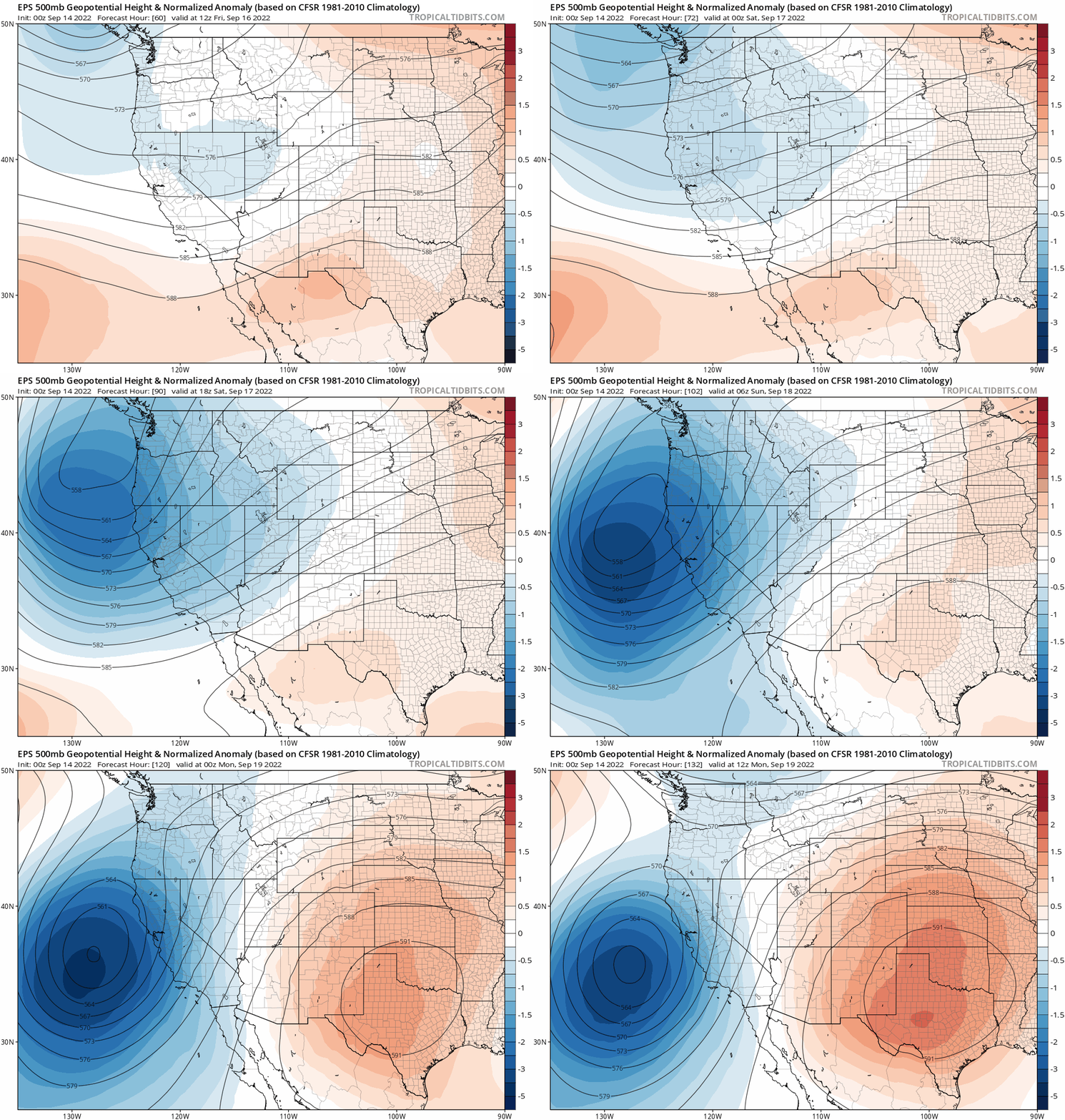
Further out, during the upcoming weekend, a deep trough is projected to sink into the Pacific Northwest and intensify just off the West Coast. Ordinarily this would be a foreboding sign for Colorado, but model ensembles are insistent that this trough will never see the light of day in the Front Range. For example, the European ensemble 500mb height forecast animation below actually develops a strong ridge over Texas which ultimately will shields our state from the effects of the potent trough. This should lead to a big warm-up for us and potentially increasing fire danger as southwest flow strengthens between the two opposing weather systems.
Remember, our daily forecasts are Premium content. Periodically, we open this forecast up to all of our readers. Today is one of those days!
Help support our team of Front Range weather bloggers by joining BoulderCAST Premium. We talk Boulder and Denver weather every single day. Sign up now to get access to our daily forecast discussions each morning, complete six-day skiing and hiking forecasts powered by machine learning, first-class access to all our Colorado-centric high-resolution weather graphics, bonus storm updates and much more! Or not, we just appreciate your readership!





You must be logged in to post a comment.